

Adina Sommer
Antique and Contemporary Art
Winzerer Str. 154
80797 München
telephone
+49 89 304714
business hours:
by appointment
Email
![]()


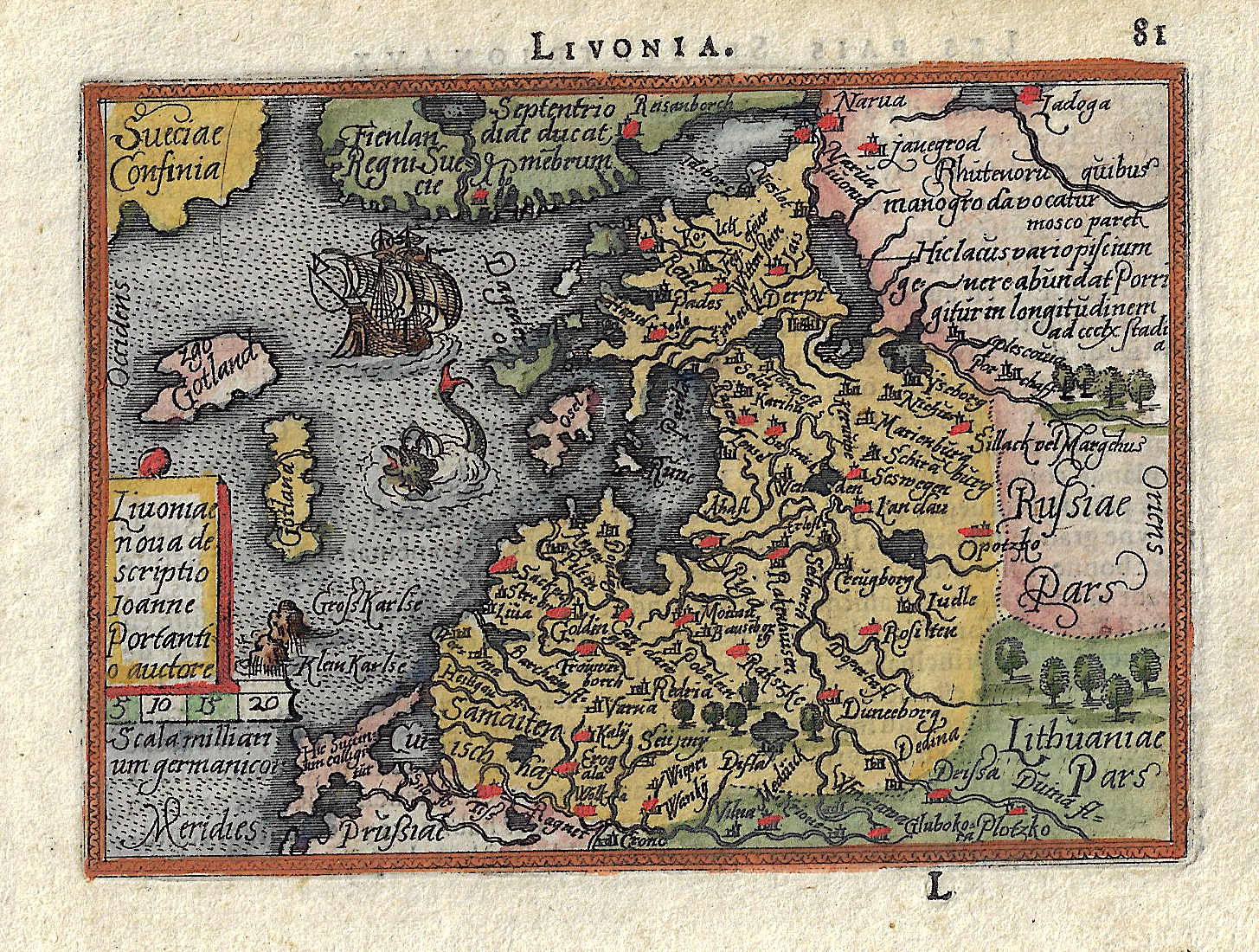
Livonia.

| Article ID | EUL4322 |
Title | Livonia. |
Description | Map shows the whole of Latvia and Estonia with a shipsstafage and a sea monster. |
| Year | ca. 1620 |
Artist | Bertius (1565-1629) |
Petrus Bertius (1565 -1629) was a Flemish theologian, historian, geographer and cartographer, He grew up in Beveren (Flanders). In 1593 he was appointed mathematics professor and librarian of the University of Leyden. His main cartographic work includes a miniature world atlas of 1600, a pocket atlas of the German Empire of 1616 with 26 engraved maps and 101 city views, a version of the Geographia of Ptolemy with 28 maps by Mercator and 14 maps from the Parergon of Ortelius of 1618, but he is known today as a cartographer with his edition of the Geographia of Ptolemy (based on Mercator's edition of 1578) and for his atlas. | |
Historical Description | The Baltic States (Latin Balticum) is an area in Europe, which today includes the countries of Estonia, Latvia and Lithuania. The Baltic is named after the Central Latin name for the Baltic Sea as mare balticum, the "Baltic Sea". This term had been in use since the 11th century and first appeared with Adam von Bremen. The use of „mare balticum“ can be traced back to the name of a large island with rich amber deposits in northern Europe, which the ancient Roman scholar Pliny the Elder mentioned as Baltia or Balcia, actually probably Abalcia, and which was identified with the Prussian coast in the Middle Ages . The commercial cities were able to secure far-reaching freedoms within the order and achieved great wealth, especially in the 15th century, when they dominated the Baltic Sea trade as members of the Hanseatic League. The Baltic port cities were therefore culturally strongly influenced by Germany, Denmark and Sweden and have preserved this legacy in many aspects to this day. The reign of the Order over the territory of what is now Estonia and Latvia (Old Livonia) ended in the mid-16th century during the Reformation. In the Livonian War, Russia failed to conquer Livonia, but the contested territory came under the rule of its opponents, whom Livonia called for help. Livonia and Courland came under Polish sovereignty, Estonia became Swedish and the island of Saaremaa / Øsel Danish. Lithuania remained independent as it established a first alliance and treaty union with Poland, the Union of Krewo, in 1385, the others followed, and in 1569 led to the establishment of the noble republic of the Kingdom of Poland and the Grand Duchy of Lithuania. |
| Place of Publication | Amsterdam |
| Dimensions (cm) | 8 x 11 cm, |
| Condition | Perfect condition |
| Coloring | original colored |
| Technique | Copper print |