

Adina Sommer
Antique and Contemporary Art
Winzerer Str. 154
80797 München
telephone
+49 89 304714
business hours:
by appointment
Email
![]()


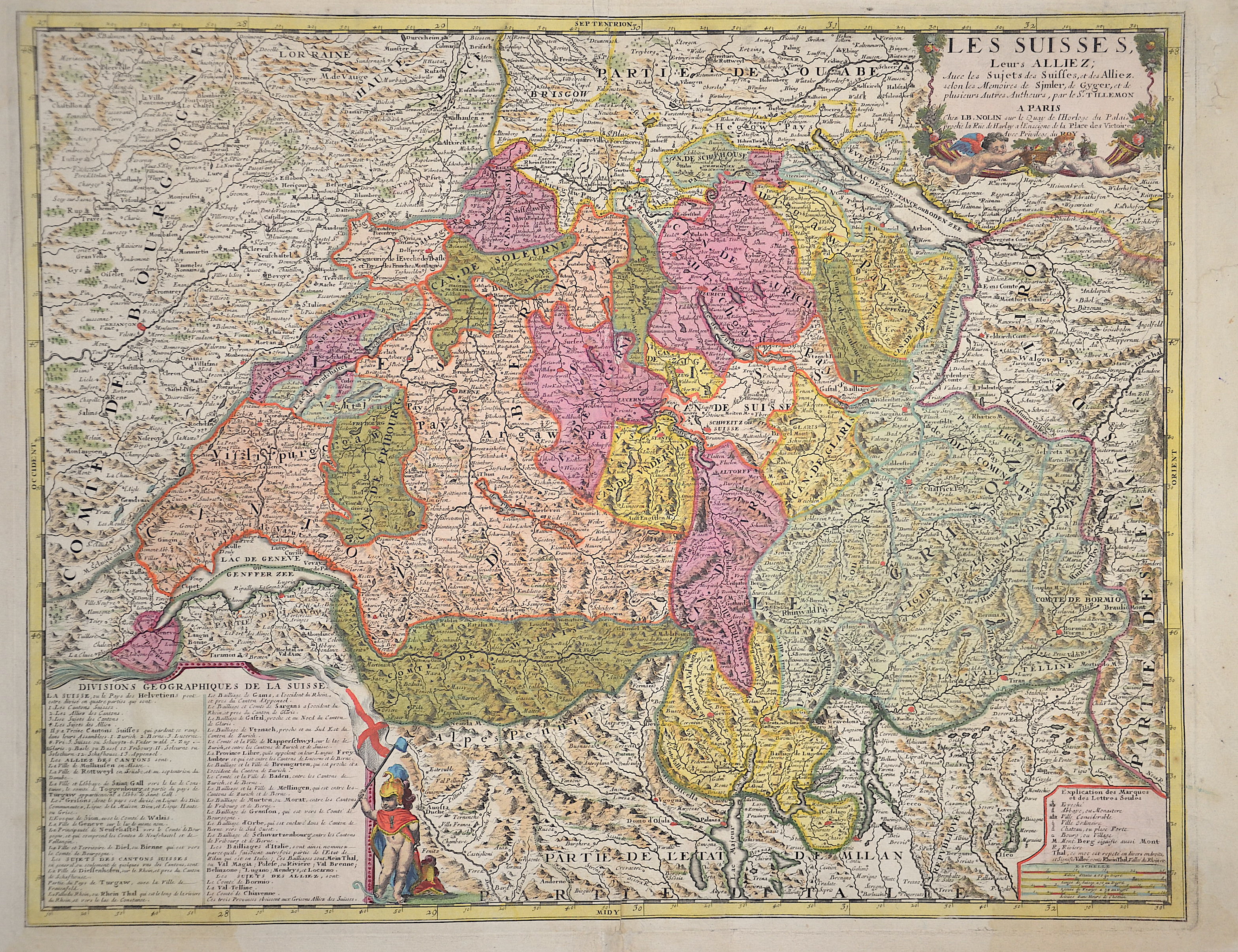
Les Suisses, Leurs Alliez,..

| Article ID | EUC4760 |
Title | Les Suisses, Leurs Alliez,.. |
Description | Very nice old coloured map of Switzerland divided into its cantons. It contains the information from the maps of Hans Conrad Gyger and Josias Simmler. Three cartouches including a title cartouche, an index and a description explaining the geographical division of Switzerland. |
| Year | ca. 1689 |
Artist | Nolin (1657-1725) |
Jean-Baptiste Nolin (ca. 1657-1708) set up the family publishing business in Paris. Many of his maps were based on the work of Vincenzo Coronelli and Sieur de Tillemon. His son (1686-1762), continued the business for many years and prepared an Atlas General which was published posthumously in 1783. | |
Historical Description | Since 1848, the Swiss Confederation has been a federal state of relatively autonomous cantons, some of which have a history of confederacy that goes back more than 700 years, putting them among the world's oldest surviving republics. The early history of the region is tied to that of Alpine culture. Switzerland was inhabited by Gauls and Raetians, and it came under Roman rule in the 1st century BC. Gallo-Roman culture was amalgamated with Germanic influence during Late Antiquity, with the eastern part of Switzerland becoming Alemannic territory. The area of Switzerland was incorporated into the Frankish Empire in the 6th century. In the high medieval period, the eastern part became part of the Duchy of Swabia within the Holy Roman Empire while the western part was part of Burgundy |
| Dimensions (cm) | 46 x 58,5 cm |
| Condition | Restoration at centerfold |
| Coloring | original colored |
| Technique | Copper print |