

Adina Sommer
Antique and Contemporary Art
Winzerer Str. 154
80797 München
telephone
+49 89 304714
business hours:
by appointment
Email
![]()


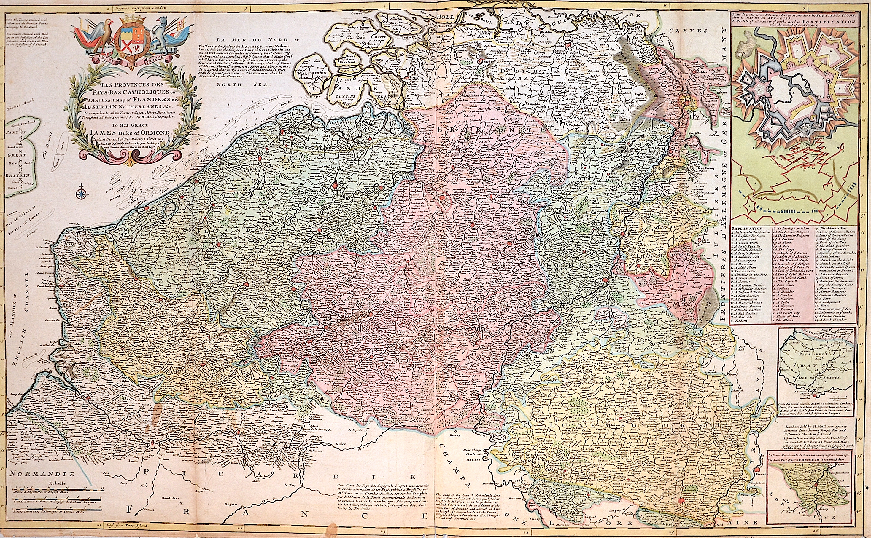
Les Provinces des Pays-Bas Catholiques ou, a most exaxt map of Flanders or Austrian Netherlands und Co.

| Article ID | EUN590 |
Title | Les Provinces des Pays-Bas Catholiques ou, a most exaxt map of Flanders or Austrian Netherlands und Co. |
Description | Map of the Netherlands with splendid title cartouche, coat of arms and three partial maps with a plan of all types of fortifications with the method of attack; A map of the roads from Paris to Valenciennes; The southern part of Luxembourg. The map refers to the Austrian Netherlands. Austria received the Netherlands in the Treaty of Utrecht (signed in 1712). The map is based on the 21-sheet map of the region by Henri Fricx. |
| Year | ca. 1720 |
Artist | Moll (1654-1732) |
Hermann Moll (1654–1732) was a London-based engraver, cartographer, and publisher known for his detailed maps of Europe and the Americas. He also created maps for Defoe’s Robinson Crusoe and Swift’s Gulliver’s Travels. His major works include the Atlas Geographus (1711–1717) and Atlas Minor (1719), both published in multiple editions. Moll collaborated with explorer William Dampier, whose travel reports provided valuable geographic data for Moll’s maps. Dampier’s popularity and the public’s growing interest in travel literature helped boost Moll’s success, leading other authors like Defoe and Swift to use his illustrations. | |
Historical Description | The area, which later includes the Benelux area, is called de Lage Landen in Dutch, Low Countries in English, consisting of Belgium, the Netherlands (Nederland) and Luxembourg. In the 19th century, three countries were united under the crown of the Dutch king from 1815 to 1830, until Belgium became independent. The forerunners of the Benelux Treaty were the economic union concluded between Luxembourg and Belgium on July 25, 1921. |
| Place of Publication | London |
| Dimensions (cm) | 61 x 100 cm |
| Condition | Some folds partly restored |
| Coloring | original colored |
| Technique | Copper print |