

Adina Sommer
Antique and Contemporary Art
Winzerer Str. 154
80797 München
telephone
+49 89 304714
business hours:
by appointment
Email
![]()


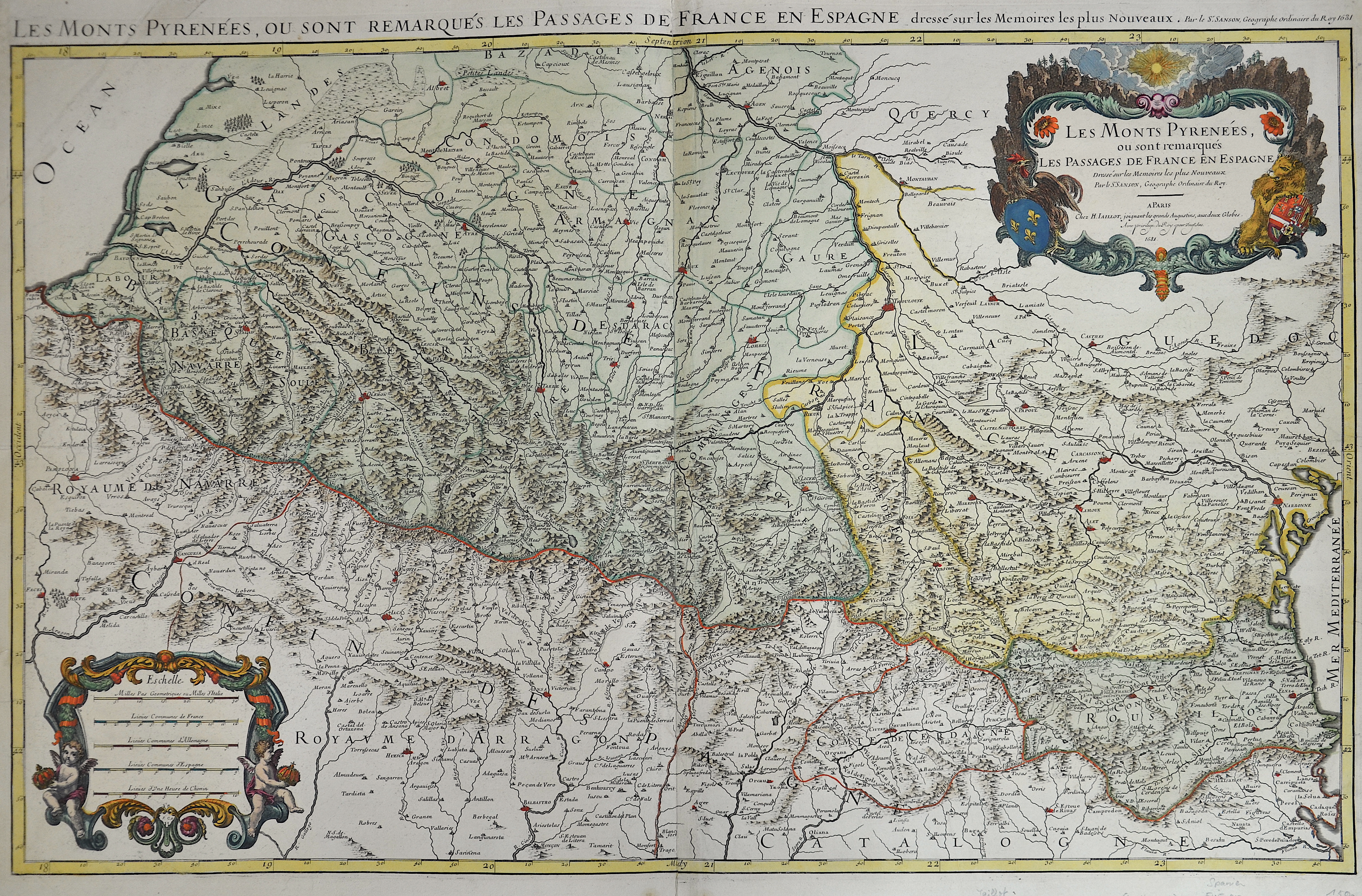
Les Monts Pyrenées. Ou sont remarques les Passages de France et Espagne

| Article ID | EUE1431 |
Title | Les Monts Pyrenées. Ou sont remarques les Passages de France et Espagne |
Description | Map shows the Pyrenees from the Biscay to the Mediterranean with two magnificent cartouches and two coats of arms. |
| Year | dated 1691 |
Artist | Jaillot (1632-1712) |
Alexis Hubert Jaillot (1632-1712) was an important French cartographer and publisher. In 1665 Jaillot married into the Berey family of map publishers. After the death of his brother-in-law Nicolas II Berey (1640–1667) he bought the Berey card collection from his sister-in-law. This gave him a valuable foundation that he could market straight away without ever having made a map himself. Jaillot entered the card business at an opportune moment. In early 1668, Louis XIV won the first of his Reunion Wars, and a period began when France was constantly expanding its territory. There was a great demand for maps depicting the French triumphs and the new frontiers, as well as upcoming expansion plans. Jaillot's map collection also included printing plates that Pierre Duval (1619–1683) (nephew of Nicolas Sanson) had created and originally sold to Nicolas Berey. But Duval, who also mislaid his cards himself, resisted the re-edition of his old cards. At the height of the dispute with Duval, Jaillot won Nicolas Sanson's sons Guillaume and Adrien in late 1670 as card makers and business partners. With them he was able to market new cards with the prestigious name Sansons. His first atlas of 1681, Atlas Nouveau, became such a great commercial success that other publishers began selling plagiarism. | |
Historical Description | Before the colonization by Cro-Magnon people (Homo sapiens), the Spanish foothills of the Pyrenees were already inhabited by Neanderthals, as is shown by finds in the Cova Gran de Santa Linya cave. The political border between France and Spain runs through the Pyrenees. The small principality of Andorra is located in the eastern Pyrenees. Like the Alpine region, the Pyrenees also have a culturally connecting function between the three neighboring countries, which can be seen, for example, through the use of the same languages. |
| Place of Publication | Paris |
| Dimensions (cm) | 56 x 87 cm |
| Condition | Little tear on lower part |
| Coloring | original colored |
| Technique | Copper print |