

Adina Sommer
Antique and Contemporary Art
Winzerer Str. 154
80797 München
telephone
+49 89 304714
business hours:
by appointment
Email
![]()


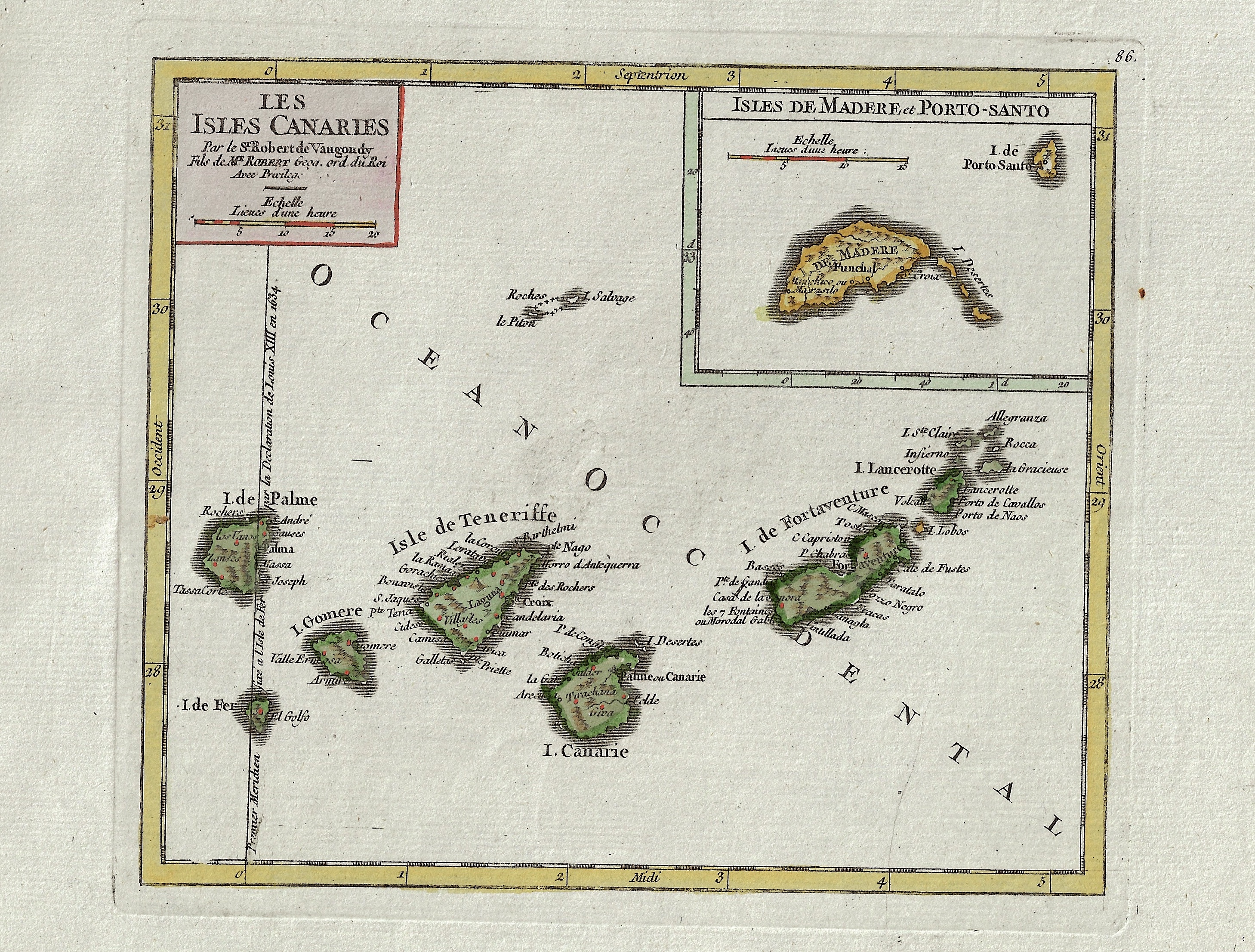
Les Isles Canaries / Isles de Madere et Porto-Santo

| Article ID | EUE4287 |
Title | Les Isles Canaries / Isles de Madere et Porto-Santo |
Description | Map shows the Canary islands with Teneriffa, Fuerteventura, Gran Canaria, Lanzarote, La Palma, La Gomera und El Hierro. Furthermore, the Portuguese archipelago of Madeira on a partial map. |
| Year | ca. 1700 |
Artist | Vaugondy,de (1723-1786) |
Didier Robert de Vaugondy (1723 -1786) also known as Le Sieur or Monsieur Robert, and his son, were leading cartographers in France during the 18th century. In 1757, Gilles and Didier Robert De Vaugondy published The Atlas Universel, one of the most important atlases of the 18th century. To produce the atlas, the Vaugondys integrated older sources with more modern surveyed maps. They verified and corrected the latitude and longitude of many regional maps in the atlas with astronomical observations. The older material was revised with the addition of many new place names. In 1760, Didier Robert de Vaugondy was appointed geographer to Louis XV. Gilles and Didier Robert De Vaugondy produced their maps and terrestrial globes working together as father and son. Globes of a variety of sizes were made by gluing copperplate-printed gores on a plaster-finished papier-mache core, a complicated and expensive manufacturing process, employing several specialists. In some cases it is uncertain whether Gilles or Didier made a given map. Gilles often signed maps as M.Robert, while Didier commonly signed his maps as ""Robert de Vaugondy"", or added ""fils"" or ""filio"" after his name. The Robert de Vaugondys were descended from the Nicolas Sanson family through Sanson's grandson, Pierre Moulard-Sanson. From him, they inherited much of Sanson's cartographic material, which they combined with maps and plates acquired after Hubert Jaillot's death in 1712 to form the basis the Atlas Universel. | |
Historical Description | Canary islands with Teneriffa, Fuerteventura, Gran Canaria, Lanzarote, La Palma, La Gomera und El Hierro. The archipelago also includes a number of islands and islets: La Graciosa, Alegranza, Isla de Lobos, Montaña Clara, Roque del Oeste and Roque del Este. In ancient times, the island chain was often referred to as "the Fortunate Isles". The Canary Islands are the most southerly region of Spain and the largest and most populated archipelago of the Macaronesia region. From the 4th century until the rediscovery of the Canary Islands by the Europeans in the 14th century, different cultures developed independently on the individual islands. These were based on the same principles but had so many special features that one cannot speak of a "culture of the Guanches of the Canary Islands". There was the culture of the Majos in Lanzarote, that of the Majoreros in Fuerteventura, that of the Bimbaches in El Hierro, that of the Gomeros in La Gomera, that of the Canarios in Gran Canaria, that of the Benahoaritas in La Palma and that of the Guanches in Tenerife. The naming of the indigenous people of all islands with the designation of the indigenous people of the island of Tenerife as Guanche, which was common for a long time, ignores the differentiated cultural developments on the different islands. |
| Place of Publication | Paris |
| Dimensions (cm) | 16,5 x 19 cm |
| Condition | Perfect condition |
| Coloring | original colored |
| Technique | Copper print |