

Adina Sommer
Antique and Contemporary Art
Winzerer Str. 154
80797 München
telephone
+49 89 304714
business hours:
by appointment
Email
![]()


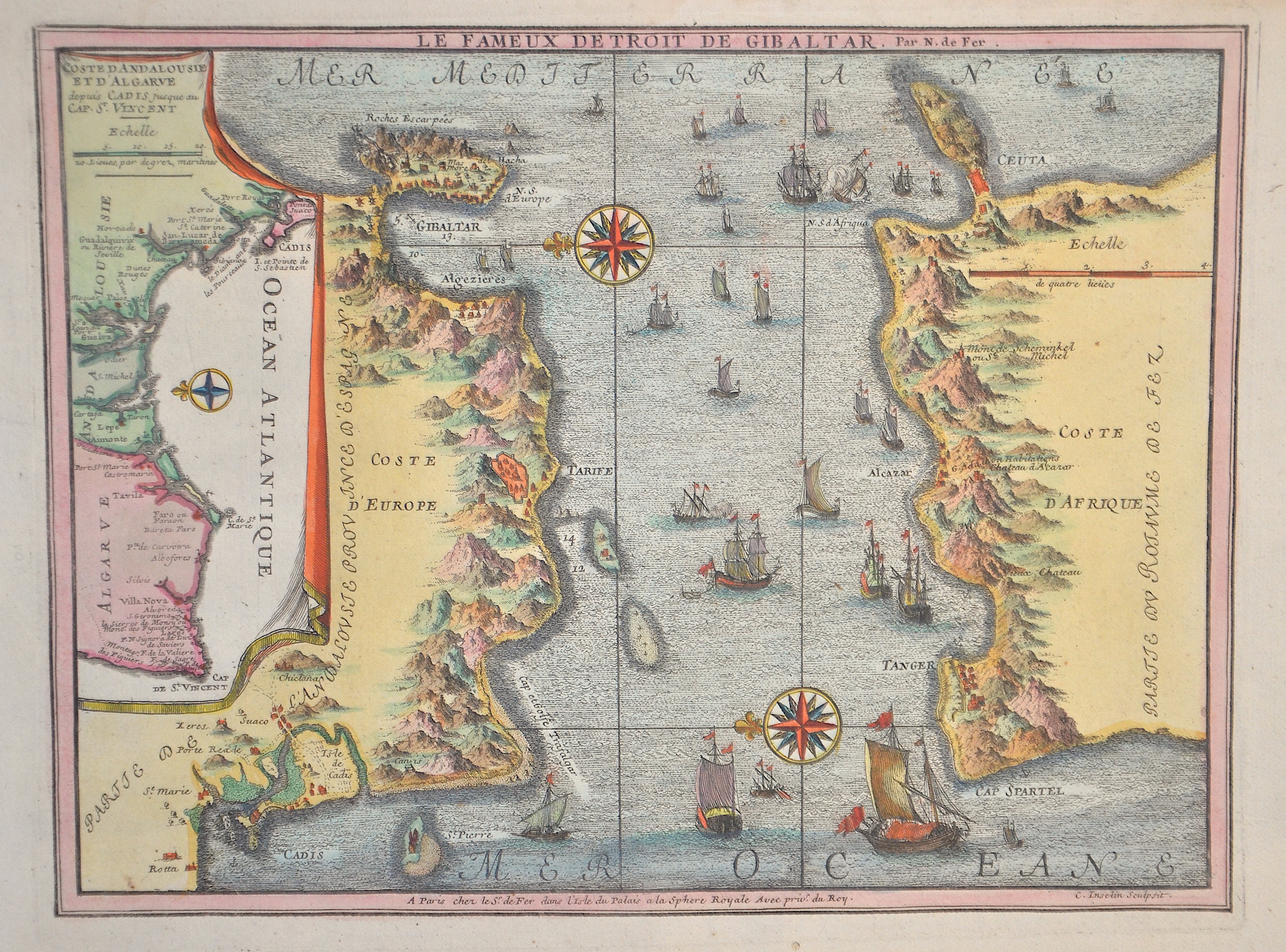
Les fameux de triot de Gibaltar

| Article ID | EUE1042 |
Title | Les fameux de triot de Gibaltar |
Description | Map shows Gibraltar with beautyfull ship representations, on seperate map Portugal Algarve and Andalusia. |
| Year | ca. 1720 |
Artist | Fer, de (1646-1720) |
Nicolas de Fer ( 1646 - 1720 in Paris) was a French cartographer and geographer. He also was an engraver and publisher. De Fer was the youngest of three sons of Antoine de Fer, who was also a cartographer. When he was 12, he became the apprentice of Parisian engraver Louis Spirinx, and made his first map, of the Canal du Midi, at the age of 23. After the death of his father in June 1673, de Fer was so successful at improving the firm that, in 1690, he became the official geographer to Louis, Dauphin of France. With support from the Spanish and French Royal Families, de Fer also became official geographer for Philip V and Louis XIV, the kings of Spain and France, respectively. Because of this, his maps became Bourbon propaganda, endorsing French King Louis XIV. His business flourished, producing town plans, atlases, wall maps, and more than 600 sheet maps.He made maps of places in Europe and North America, including New Spain, places fortified by Vauban, the Low Countries, and the War of the Spanish Succession. In 1698, de Fer published a map of North America, which included a depiction of beavers building dams near Niagara Falls. Seventeen years later, Herman Moll published an identical map as his own, known as the -Beaver map-. De Fer became the official geographer for His Catholic Majesty in 1720.Two of his sons-in-law, Guillaume Danet and Jaques-François Bénard, continued the company after de Fer's death on 25 October of that year until around 1760. | |
Historical Description | Gibraltar is a British Overseas Territory located on the southern end of the Iberian Peninsula. In 1704, during the War of the Spanish Succession, a combined Anglo-Dutch fleet, representing the Grand Alliance, captured the town of Gibraltar on behalf of the Archduke Charles of Austria in his campaign to become King of Spain. The occupation of the town by Alliance forces caused the exodus of the population to the surrounding area of the Campo de Gibraltar.As the Alliance's campaign faltered, the 1713 Treaty of Utrecht was negotiated and ceded control of Gibraltar to Britain to secure Britain's withdrawal from the war. Unsuccessful attempts by Spanish monarchs to regain Gibraltar were made with the siege of 1727 and again with the Great Siege of Gibraltar (1779 to 1783), during the American War of Independence. Gibraltar became a key base for the Royal Navy and played an important role prior to the Battle of Trafalgar. |
| Place of Publication | Paris |
| Dimensions (cm) | 23,5 x 31,5 cm |
| Condition | Very good |
| Coloring | original colored |
| Technique | Copper print |