

Adina Sommer
Antique and Contemporary Art
Winzerer Str. 154
80797 München
telephone
+49 89 304714
business hours:
by appointment
Email
![]()


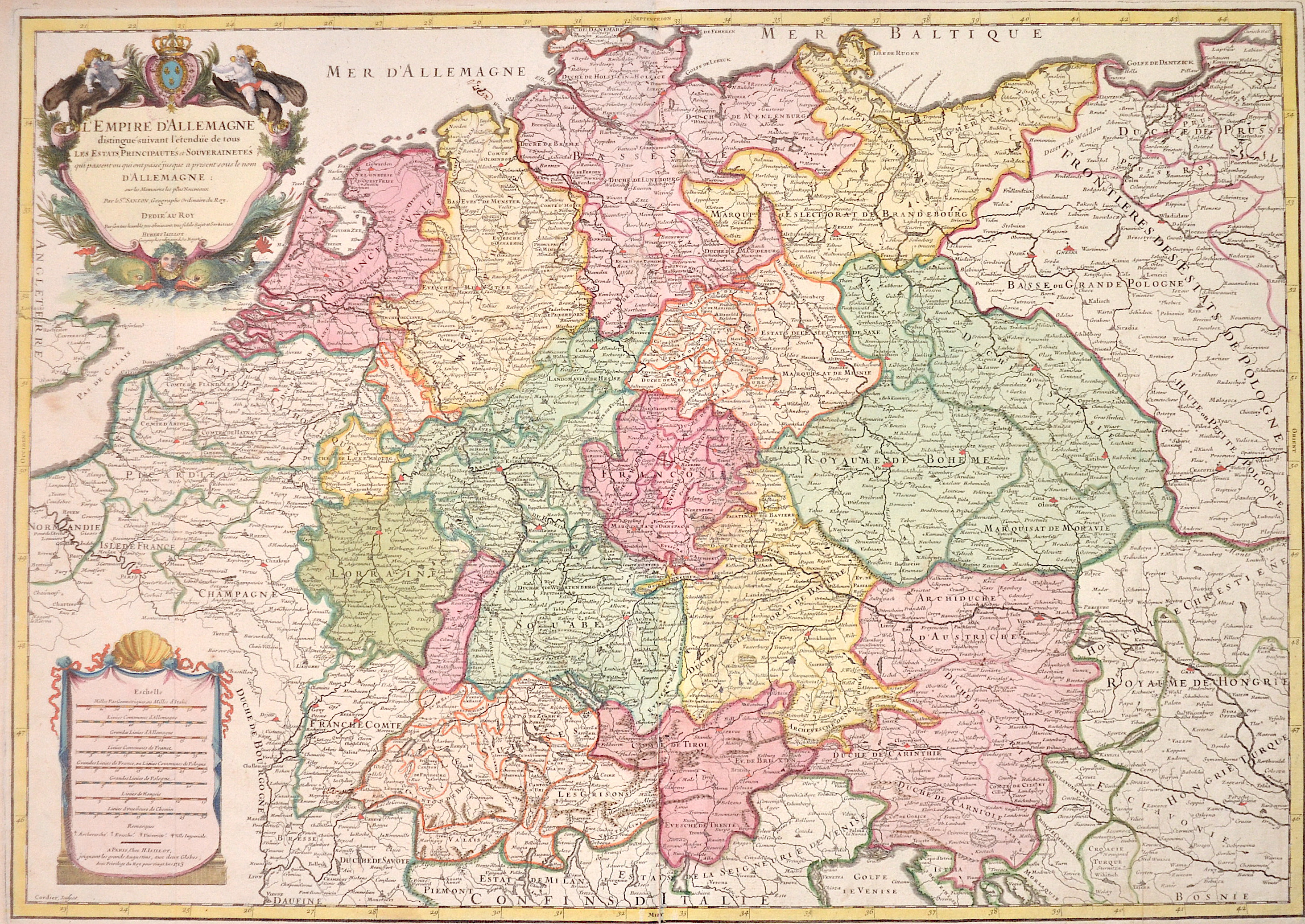
L´Empire d´Allemagne distingue suivant l´etenedu de tous les estates principautes et souverainites

| Article ID | EUD0510 |
Title | L´Empire d´Allemagne distingue suivant l´etenedu de tous les estates principautes et souverainites |
Description | Map shows all of Germany with Silesia, Bohemia, the Netherlands, Belgium, Alsace, Switzerland, Tyrol, Austria and a magnificent title cartouche as well as a mileage scale cartouche. |
| Year | dated 1713 |
Artist | Jaillot (1632-1712) |
Alexis Hubert Jaillot (1632-1712) was an important French cartographer and publisher. In 1665 Jaillot married into the Berey family of map publishers. After the death of his brother-in-law Nicolas II Berey (1640–1667) he bought the Berey card collection from his sister-in-law. This gave him a valuable foundation that he could market straight away without ever having made a map himself. Jaillot entered the card business at an opportune moment. In early 1668, Louis XIV won the first of his Reunion Wars, and a period began when France was constantly expanding its territory. There was a great demand for maps depicting the French triumphs and the new frontiers, as well as upcoming expansion plans. Jaillot's map collection also included printing plates that Pierre Duval (1619–1683) (nephew of Nicolas Sanson) had created and originally sold to Nicolas Berey. But Duval, who also mislaid his cards himself, resisted the re-edition of his old cards. At the height of the dispute with Duval, Jaillot won Nicolas Sanson's sons Guillaume and Adrien in late 1670 as card makers and business partners. With them he was able to market new cards with the prestigious name Sansons. His first atlas of 1681, Atlas Nouveau, became such a great commercial success that other publishers began selling plagiarism. | |
Historical Description | The concept of Germany as a distinct region in central Europe can be traced to Roman commander Julius Caesar, who referred to the unconquered area east of the Rhine as Germania, thus distinguishing it from Gaul (France), which he had conquered. In the High Middle Ages, the regional dukes, princes and bishops gained power at the expense of the emperors. Martin Luther led the Protestant Reformationagainst the Catholic Church after 1517, as the northern states became Protestant, while the southern states remained Catholic. The two parts of the Holy Roman Empire clashed in the Thirty Years' War (1618–1648). 1648 marked the effective end of the Holy Roman Empire and the beginning of the modern nation-state system, with Germany divided into numerous independent states, such as Prussia, Bavaria and Saxony. |
| Place of Publication | Paris |
| Dimensions (cm) | 46 x 64 cm |
| Condition | Lower centerfold restored |
| Coloring | original colored |
| Technique | Copper print |