

Adina Sommer
Antique and Contemporary Art
Winzerer Str. 154
80797 München
telephone
+49 89 304714
business hours:
by appointment
Email
![]()


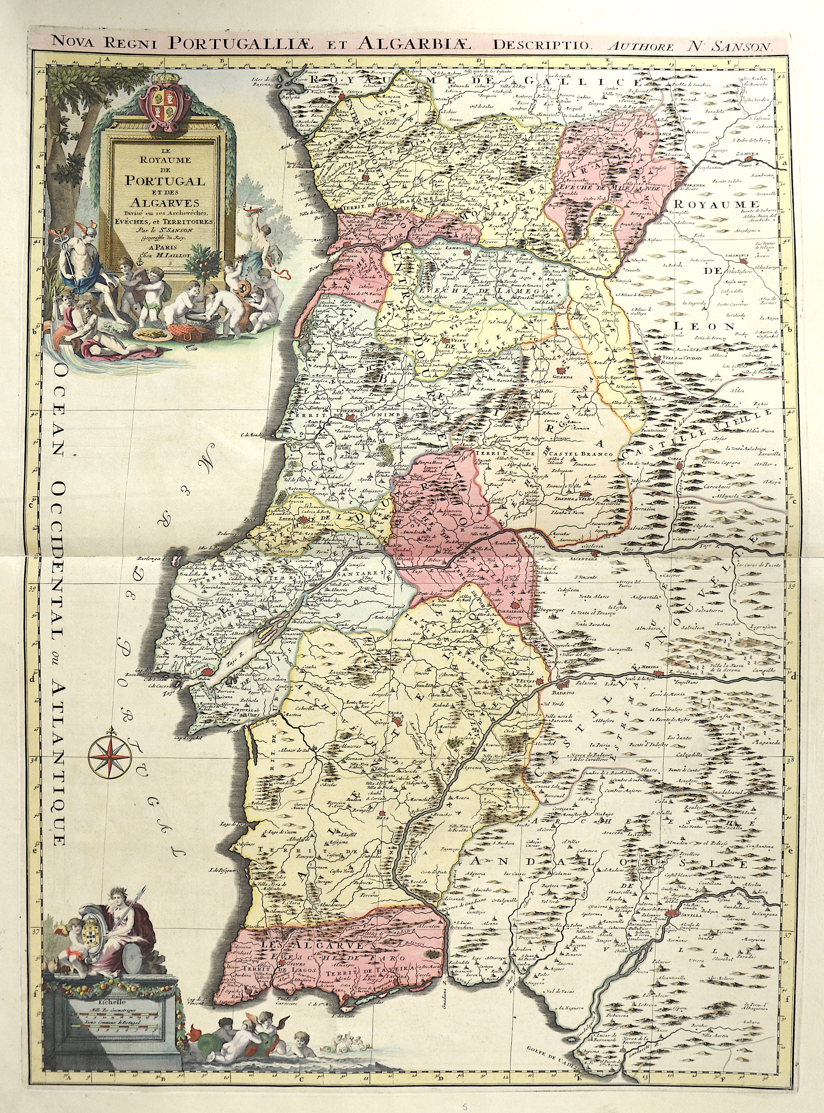
Le Royaume de Portugal et des Algarves…

| Article ID | EUE1497 |
Title | Le Royaume de Portugal et des Algarves… |
Description | Map shows total Portugal with 2 beautiful cartouches. |
| Year | ca. 1695 |
Artist | Jaillot/ Sanson (1632-1712) |
Alexis Hubert Jaillot (1632–1712) was a prominent French cartographer and publisher. In 1665, he married into the Berey family of map publishers. After the death of his brother-in-law Nicolas II Berey in 1667, Jaillot bought the Berey map collection from his sister-in-law, acquiring a valuable stock without having ever created a map himself. Jaillot entered the map business at a favorable time—after Louis XIV’s early victories in the Reunions Wars in 1668, France’s territory expanded rapidly, creating high demand for maps showing French triumphs, new borders, and expansion plans. His collection included plates originally made by Pierre Duval, who resisted Jaillot’s reissues. At the height of this conflict, Jaillot gained the support of Guillaume and Adrien Sanson, sons of Nicolas Sanson, as mapmakers and partners, enabling him to publish new maps under the prestigious Sanson name. His first atlas, Atlas Nouveau (1681), was a commercial success, leading to widespread piracy by other publishers. | |
Historical Description | Portugal is the oldest state on the Iberian Peninsula and one of the oldest in Europe, its territory having been continuously settled, invaded and fought over since prehistoric times. The pre-Celtic people, Celts, Carthaginians and Romans were followed by the invasions of the Visigoths and Suebi Germanic peoples. In the 15th and 16th centuries, Portugal established the first global empire, becoming one of the world's major economic, political and military powers. During this period, today referred to as the Age of Discovery, Portuguese explorers pioneered maritime exploration, notably under royal patronage of Prince Henry the Navigator and King John II, with such notable voyages as Bartolomeu Dias' sailing beyond the Cape of Good Hope (1488), Vasco da Gama's discovery of the sea route to India (1497–98) and the European discovery of Brazil (1500). During this time Portugal monopolized the spice trade, divided the world into hemispheres of dominion with Castille, and the empire expanded with military campaigns in Asia. However, events such as the 1755 Lisbon earthquake, the country's occupation during the Napoleonic Wars, the independence of Brazil (1822), and a late industrialization compared to other European powers, erased to a great extent Portugal's prior opulence. |
| Place of Publication | Paris |
| Dimensions (cm) | 76 x 55 |
| Condition | Very good |
| Coloring | original colored |
| Technique | Copper print |