

Adina Sommer
Antique and Contemporary Art
Winzerer Str. 154
80797 München
telephone
+49 89 304714
business hours:
by appointment
Email
![]()


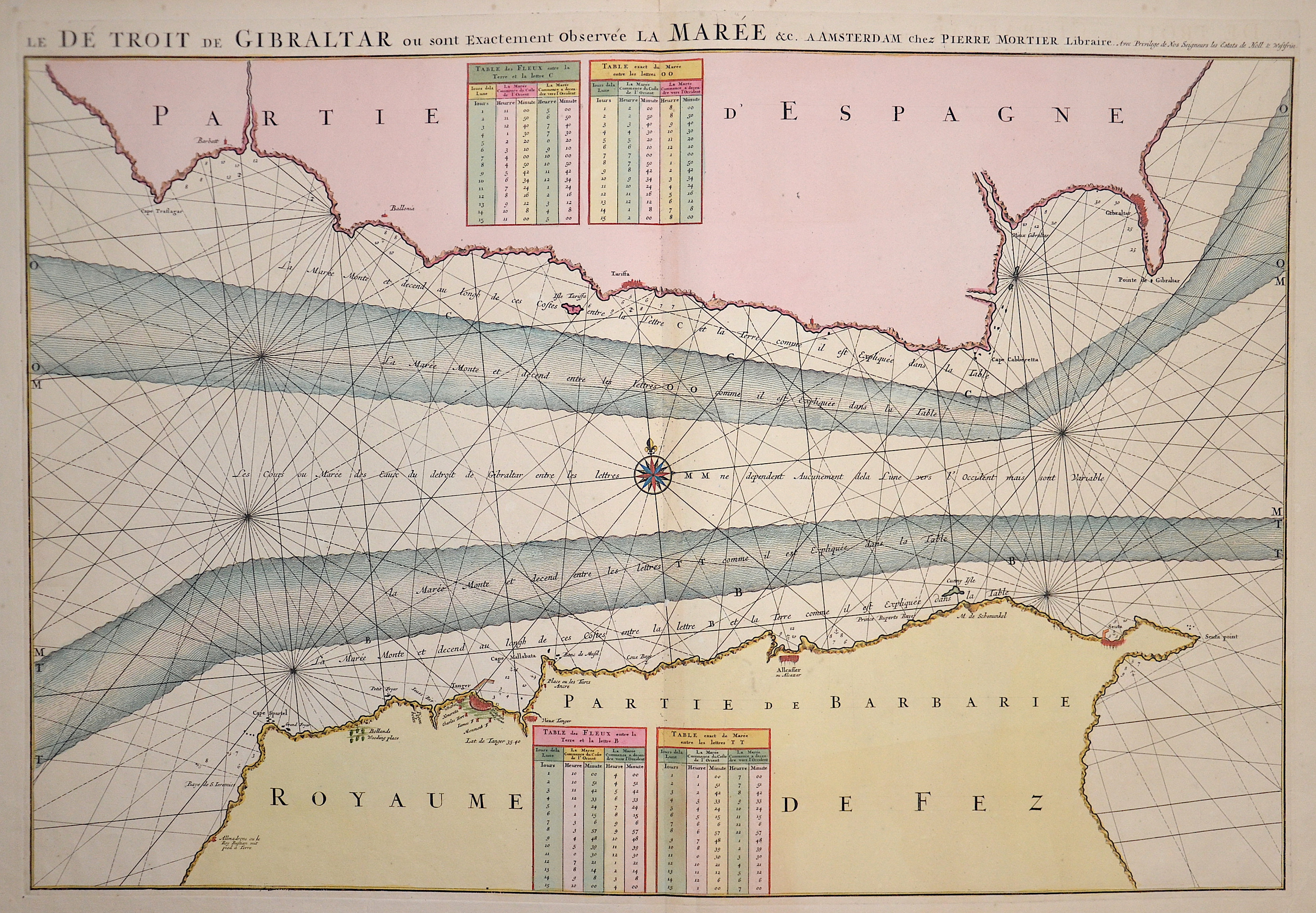
Le Detroit de Gibraltar ou sont exactement observee la Maree……

| Article ID | SE0274 |
Title | Le Detroit de Gibraltar ou sont exactement observee la Maree…… |
Description | Map shows the strait of Gibraltar with its sea current |
| Year | ca. 1695 |
Artist | Mortier (1661-1711) |
Pieter Mortier (1661–1711) was an 18th-century mapmaker and engraver from the Northern Netherlands. Mortier had a partnership with Johannes Covens I (1697-1774) and founded the map publishing company Covens & Mortier (1721-1866). Mortier, being French himself, had easy access to French cartographers such as De L'Isle, Sanson, Jaillot, de Fer and De Wit. Consequently, much of Mortier's business was built upon leveraging the sophisticated Dutch printing establishment to issue embellished high quality editions of previously contemporary French maps. In the greater context of global cartography, this was a significant advantage as most Dutch map publishes had, at this point, fallen into the miasma of reprinting their own outdated works. By contrast, the cartographers of France were producing the most accurate and up to date charts anywhere. Mortier's cartographic work culminated in the magnificent nautical atlas, Le Neptune Francois. Upon Pierre's death in 1711 this business was inherited by his widow. In 1721 his son Cornelius Mortier took over the day to day operation of the firm. Cornelius partnered with his brother-in-law Jean Covens to form one of history's great cartographic partnerships - Covens and Mortier - which continued to publish maps and atlases until about 1866. | |
Historical Description | In the 17th century, the Mediterranean was an important area for trade, naval power, and conflicts. It connected Europe, North Africa, and the Near East and was strategically highly significant. The western Mediterranean was increasingly dominated by European naval powers such as Spain, France, and later Venice. The Ottoman Empire controlled large parts of the eastern and southern Mediterranean. Naval supremacy was fiercely contested, especially between the Ottoman Empire and Christian states (e.g., the Habsburgs, Venice). Barbary corsairs (pirates from North Africa) attacked merchant ships and European coastal towns—often on behalf of local rulers—and thousands of people were captured and enslaved. Despite the conflicts, the Mediterranean remained an important trade area, dealing in goods such as spices, fabrics, metals, and grain. It was also a place of cultural exchange between Christianity and Islam, East and West. |
| Place of Publication | Amsterdam |
| Dimensions (cm) | 56 x 82 |
| Condition | Very good |
| Coloring | original colored |
| Technique | Copper print |