

Adina Sommer
Antique and Contemporary Art
Winzerer Str. 154
80797 München
telephone
+49 89 304714
business hours:
by appointment
Email
![]()


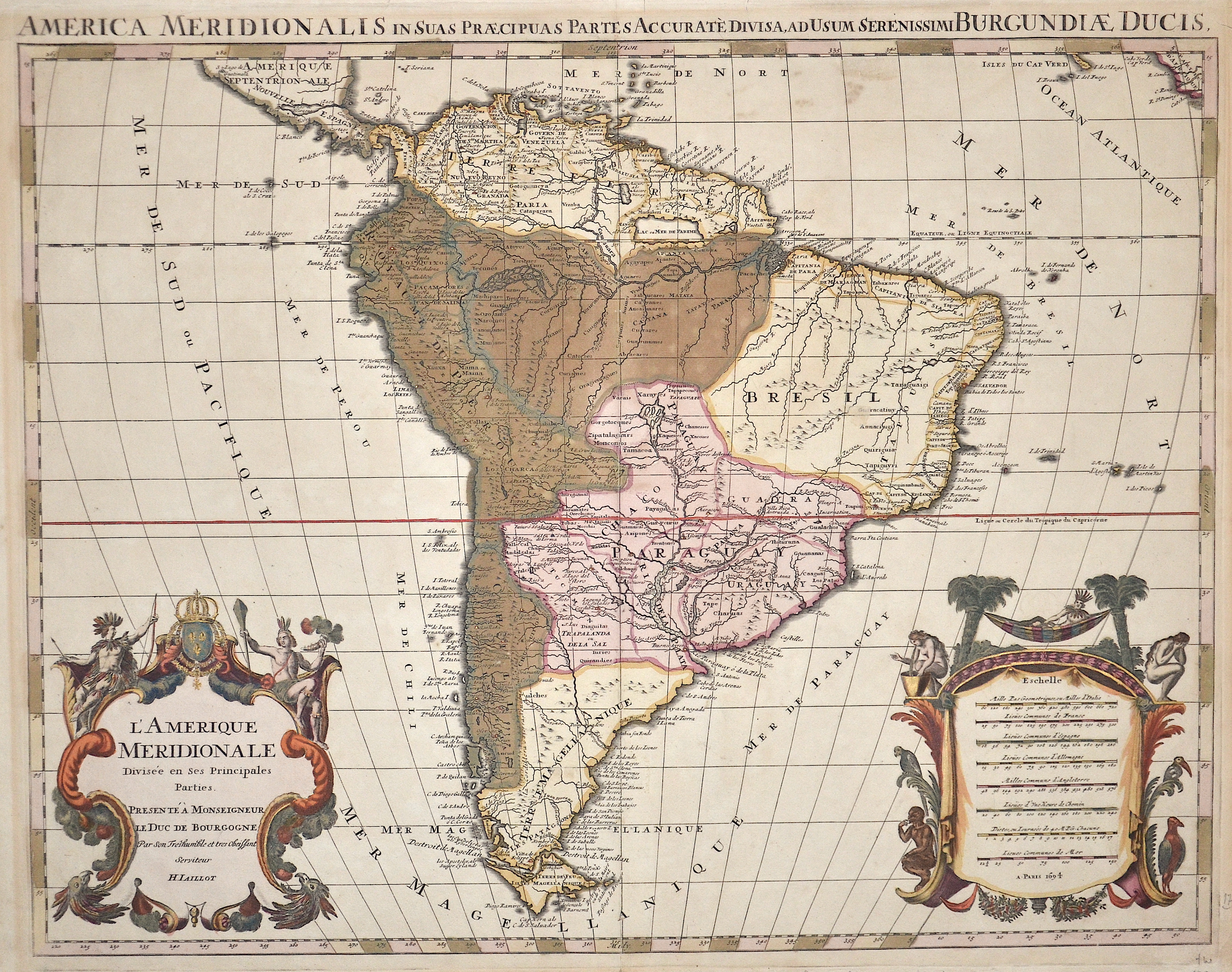
L’Amerique Meridionale
| Article ID | AMS1379 |
Title | L’Amerique Meridionale |
Map shows the whole of South America with two magnificent cartouches. | |
| Year | c. 1694 |
Artist | Jaillot |
| Place of Publication | Paris |
| Dimensions (cm) | 48 x 60,5 cm |
| Condition | Some restorations along the orig. outline colours |
| Coloring | original colored |
| Technique | Copper print |
:
189.00 €
( A reproduction can be ordered individually on request. )