

Adina Sommer
Antique and Contemporary Art
Winzerer Str. 154
80797 München
telephone
+49 89 304714
business hours:
by appointment
Email
![]()


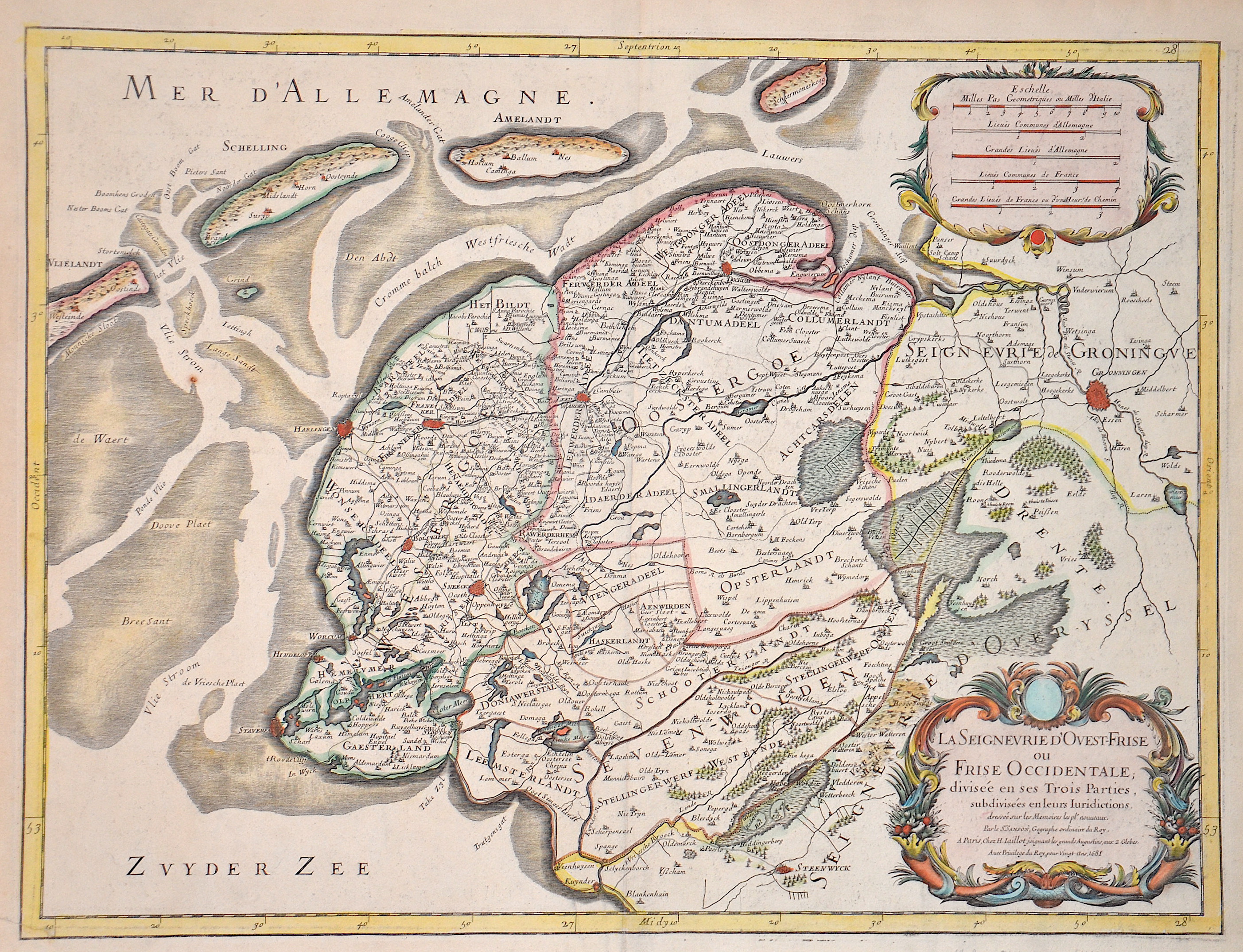
La Seignevrie d’Ovest-Frise ou Frise Occidentale, divisee en ses Trois Parties,

| Article ID | EUN5275 |
Title | La Seignevrie d’Ovest-Frise ou Frise Occidentale, divisee en ses Trois Parties, |
Description | Map shows the province of Friesland in the Netherlands with two cartouches. |
| Year | c. 1681 |
Artist | Jaillot/ Sanson (1632-1712) |
Alexis Hubert Jaillot (1632–1712) was a prominent French cartographer and publisher. In 1665, he married into the Berey family of map publishers. After the death of his brother-in-law Nicolas II Berey in 1667, Jaillot bought the Berey map collection from his sister-in-law, acquiring a valuable stock without having ever created a map himself. Jaillot entered the map business at a favorable time—after Louis XIV’s early victories in the Reunions Wars in 1668, France’s territory expanded rapidly, creating high demand for maps showing French triumphs, new borders, and expansion plans. His collection included plates originally made by Pierre Duval, who resisted Jaillot’s reissues. At the height of this conflict, Jaillot gained the support of Guillaume and Adrien Sanson, sons of Nicolas Sanson, as mapmakers and partners, enabling him to publish new maps under the prestigious Sanson name. His first atlas, Atlas Nouveau (1681), was a commercial success, leading to widespread piracy by other publishers. | |
Historical Description | Friesland or Greater Friesland has long been the name given to the Frisian settlement areas that stretch along the Dutch and German North Sea coasts. The Inter-Frisian Council, which represents all Frisian interests, speaks of the Three Frieslands. This refers to Westerlauwers' Friesland, which essentially comprises the Dutch province of Friesland, eastern Friesland with the Frisian settlement areas from the Ems to the Weser estuary and the Schleswig-Holstein region of North Friesland including the island of Helgoland. The province of Friesland, Westlauwers'sche Friesland, belongs to the Netherlands. An early culture with settlements on terps (terps) developed in Friesland around 400 to 200 BC. The Romans called the inhabitants Frisii. In the 8th century, Friesland became part of the Frankish Empire and was Christianized. During the Middle Ages, Friesland was incorporated piece by piece by the Counts of Holland. After a period of independence in the 15th century, Friesland returned to Holland and came under Habsburg rule. From 1581, it had a relatively independent status within the Republic of the Seven United Provinces. It was one of the few provinces by the sea to have its own Admiralty of Friesland. Friesland became part of the Batavian Republic in 1795, the Napoleonic Kingdom of Holland in 1806 and the French Empire in 1810. Since 1815, Friesland has been a province of the newly established Kingdom of the Netherlands. |
| Place of Publication | Paris |
| Dimensions (cm) | 43 x 57 cm |
| Condition | Perfect condition |
| Coloring | colored |
| Technique | Copper print |