

Adina Sommer
Antique and Contemporary Art
Winzerer Str. 154
80797 München
telephone
+49 89 304714
business hours:
by appointment
Email
![]()


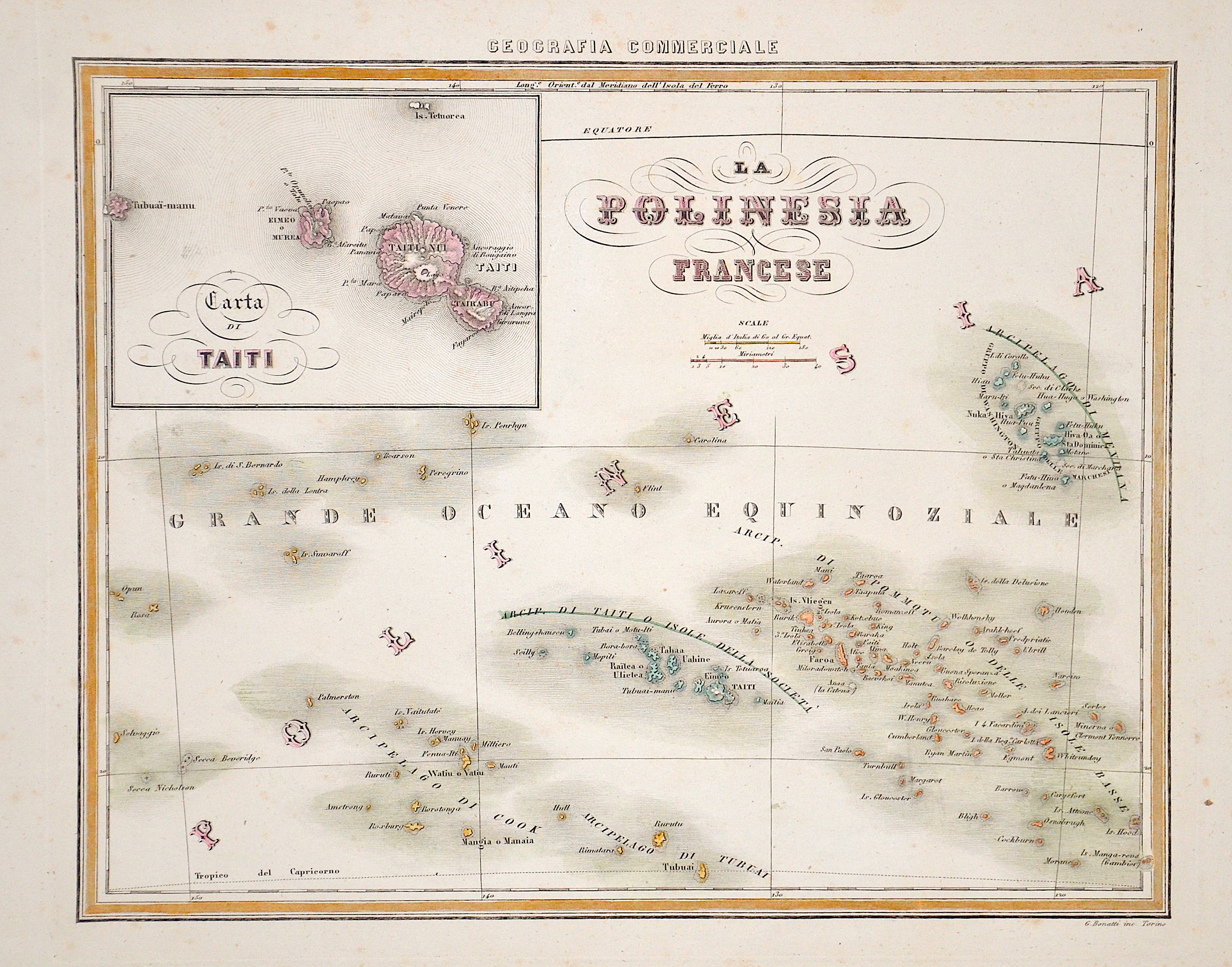
La Polinesia Francese

| Article ID | OZ0461 |
Title | La Polinesia Francese |
Description | Map shows French Pacific in the South Pacific and a partial map of Tahiti. |
| Year | ca. 1800 |
Artist | Bonatti |
Historical Description | The Society Islands in French Polonesia. The archipelago is suspected to have been named by Captain James Cook during his first voyage in 1769, supposedly in honour of the Royal Society, the sponsor of the first British scientific survey of the islands. However, Cook himself stated in his journal that he called the islands Society as they lay contiguous to one another. |
| Place of Publication | Turin |
| Dimensions (cm) | 27 x 33,5 cm |
| Condition | Little stains |
| Coloring | original colored |
| Technique | Steel engraving |