

Adina Sommer
Antique and Contemporary Art
Winzerer Str. 154
80797 München
telephone
+49 89 304714
business hours:
by appointment
Email
![]()


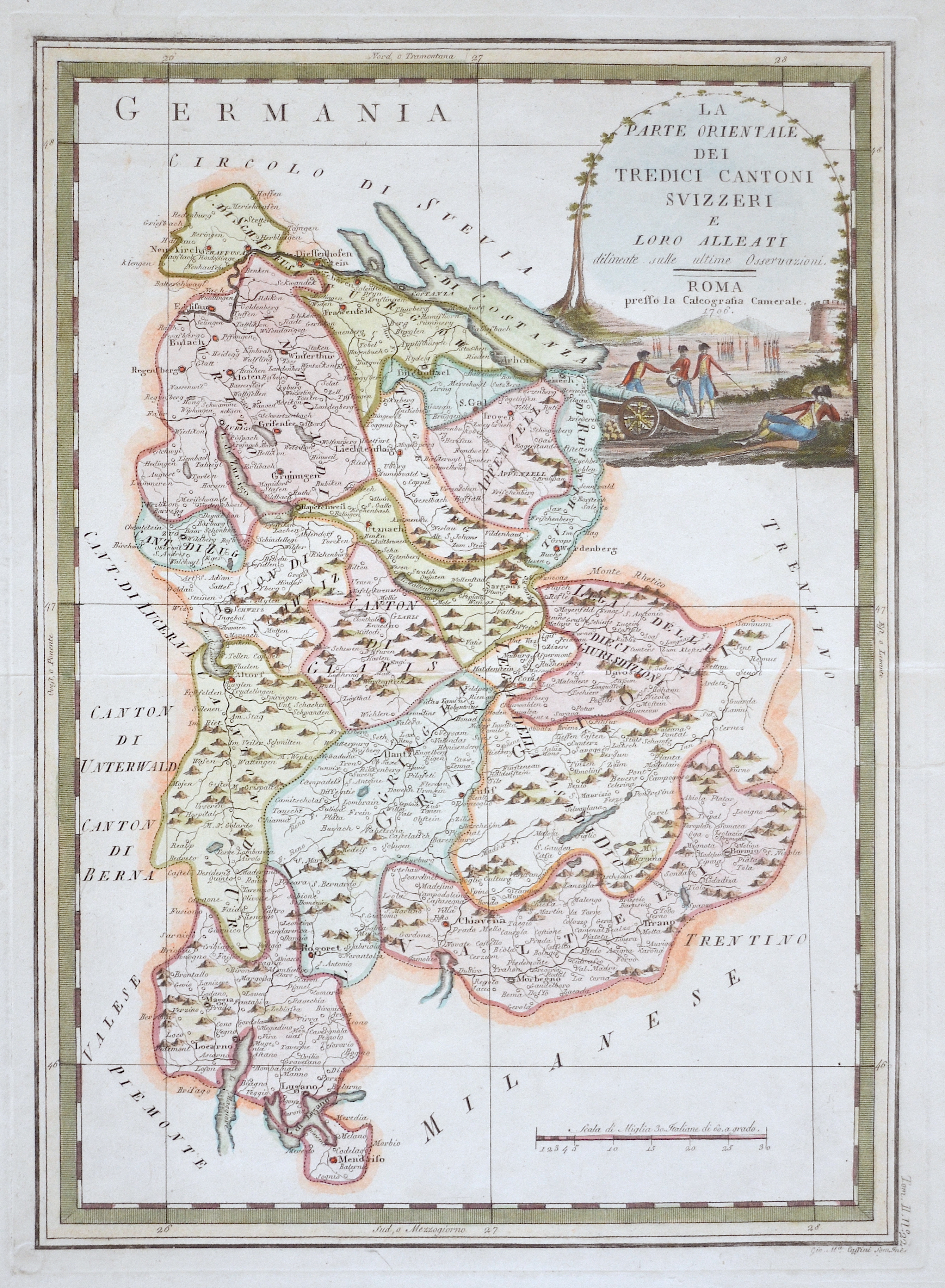
La Parte orientale die Tredici Cantoni Svizzeri e Loro Alleati

| Article ID | EUC4296 |
Title | La Parte orientale die Tredici Cantoni Svizzeri e Loro Alleati |
Description | Map shows the cantons of Thurgau and St. Gallen with a title cartouche |
| Year | ca. 1706 |
Artist | Cassini (1745-1824) |
Giovanni Maria Cassini (1745 - ca. 1824) Rom, was a noted geographer, engraver, and publisher in Rome. He was one of the last of the fine Italian globe makers active at the end of the 18th century. Cassini made Terrestrial and Celestial Globes in 1790 and 1792. He also published the twelve terrestrial and twelve celestial globe gores that formed these globes in his atlas "Nuovo Atlante Geografico Universale" along with rules for the construction of globes and globe gores. | |
Historical Description | Since 1848, the Swiss Confederation has been a federal state of relatively autonomous cantons, some of which have a history of confederacy that goes back more than 700 years, putting them among the world's oldest surviving republics. The early history of the region is tied to that of Alpine culture. Switzerland was inhabited by Gauls and Raetians, and it came under Roman rule in the 1st century BC. Gallo-Roman culture was amalgamated with Germanic influence during Late Antiquity, with the eastern part of Switzerland becoming Alemannic territory. The area of Switzerland was incorporated into the Frankish Empire in the 6th century. In the high medieval period, the eastern part became part of the Duchy of Swabia within the Holy Roman Empire while the western part was part of Burgundy |
| Place of Publication | Rome |
| Dimensions (cm) | 47,5 x 34 cm |
| Condition | Perfect condition |
| Coloring | colored |
| Technique | Copper print |