

Adina Sommer
Antique and Contemporary Art
Winzerer Str. 154
80797 München
telephone
+49 89 304714
business hours:
by appointment
Email
![]()


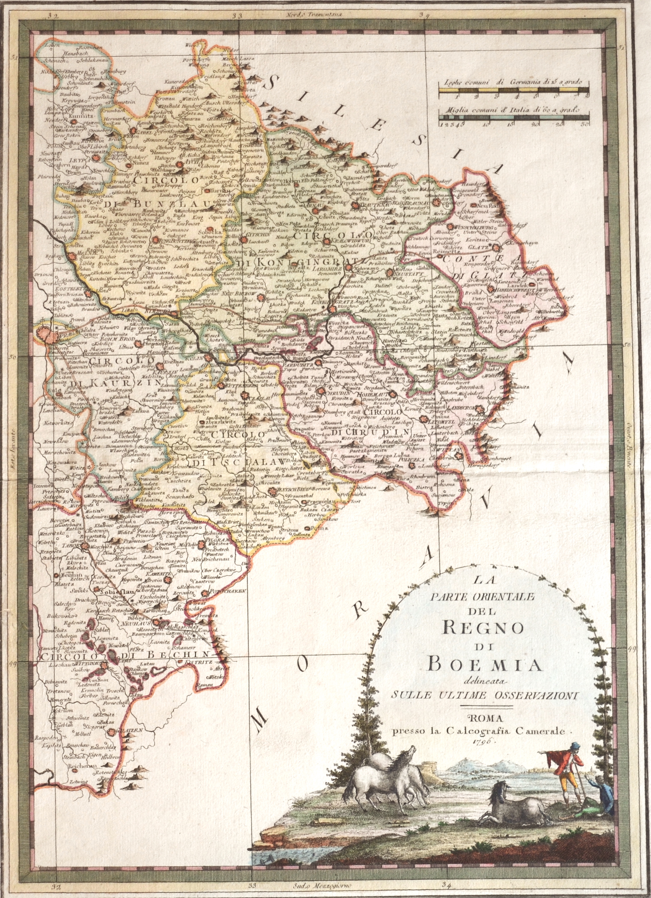
La Parte Orientale del Regno die Boemia

| Article ID | EUT4098 |
Title | La Parte Orientale del Regno die Boemia |
Description | Detailed map of the eastern part of Behemia in Czech with the cities of Prag, Jungbunzlau, Kolin, Pardubice, Chrudium etc. |
| Year | ca. 1796 |
Artist | Cassini (1745-1824) |
Giovanni Maria Cassini (1745 - ca. 1824) Rom, was a noted geographer, engraver, and publisher in Rome. He was one of the last of the fine Italian globe makers active at the end of the 18th century. Cassini made Terrestrial and Celestial Globes in 1790 and 1792. He also published the twelve terrestrial and twelve celestial globe gores that formed these globes in his atlas "Nuovo Atlante Geografico Universale" along with rules for the construction of globes and globe gores. | |
Historical Description | Bohemia is the westernmost and largest historical region of the Czech lands in the present-day Czech Republic. In a broader meaning, Bohemia sometimes refers to the entire Czech territory, including Moravia and Czech Silesia, especially in a historical context, such as the Lands of the Bohemian Crown ruled by Bohemian kings. Bohemia was a duchy of Great Moravia, later an independent principality, a kingdom in the Holy Roman Empire, and subsequently a part of the Habsburg Monarchy and the Austrian Empire. After World War I and the establishment of an independent Czechoslovak state, Bohemia became a part of Czechoslovakia. Between 1938 and 1945, border regions with sizeable German-speaking minorities of all three Czech lands were joined to Nazi Germany as the Sudetenland. |
| Place of Publication | Rome |
| Dimensions (cm) | 47,5 x 34 cm |
| Condition | Perfect condition |
| Coloring | original colored |
| Technique | Copper print |