

Adina Sommer
Antique and Contemporary Art
Winzerer Str. 154
80797 München
telephone
+49 89 304714
business hours:
by appointment
Email
![]()


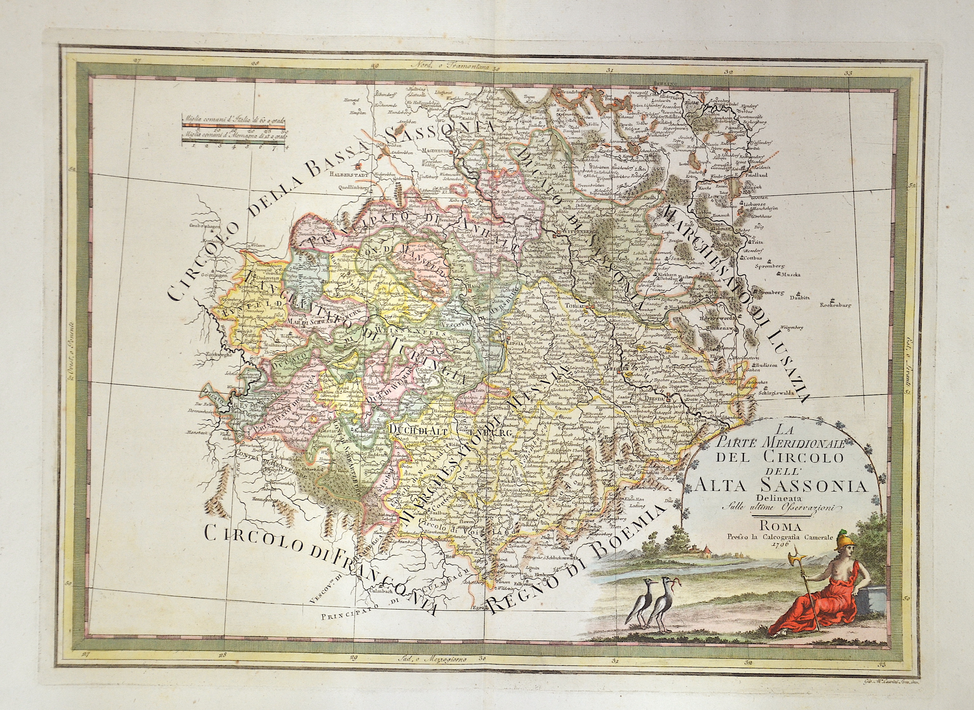
La Parte Meridionale del Circolo dell Alta Sassonia

| Article ID | EUD4678 |
Title | La Parte Meridionale del Circolo dell Alta Sassonia |
Description | Map shows Saxony and Thuringia with a title cartouche. |
| Year | c. 1706 |
Artist | Cassini (1745-1824) |
Giovanni Maria Cassini (1745 - ca. 1824) Rom, was a noted geographer, engraver, and publisher in Rome. He was one of the last of the fine Italian globe makers active at the end of the 18th century. Cassini made Terrestrial and Celestial Globes in 1790 and 1792. He also published the twelve terrestrial and twelve celestial globe gores that formed these globes in his atlas "Nuovo Atlante Geografico Universale" along with rules for the construction of globes and globe gores. | |
Historical Description | Saxony-Wittenberg, in modern Saxony-Anhalt, became subject to the margravate of Meissen, ruled by the Wettin dynasty in 1423. This established a new and powerful state, occupying large portions of the present Free State of Saxony, Thuringia, Saxony-Anhalt and Bavaria (Coburg and its environs). Although the centre of this state was far to the southeast of the former Saxony, it came to be referred to as Upper Saxony and then simply Saxony, while the former Saxon territories were now known as Lower Saxony. In 1485, Saxony was split. A collateral line of the Wettin princes received what later became Thuringia and founded several small states there (see Ernestine duchies). The remaining Saxon state became still more powerful and was known in the 18th century for its cultural achievements, although it was politically weaker than Prussia and Austria, states which oppressed Saxony from the north and south, respectively. |
| Place of Publication | Rome |
| Dimensions (cm) | 34 x 47,5 cm |
| Condition | Perfect condition |
| Coloring | original colored |
| Technique | Copper print |