

Adina Sommer
Antique and Contemporary Art
Winzerer Str. 154
80797 München
telephone
+49 89 304714
business hours:
by appointment
Email
![]()


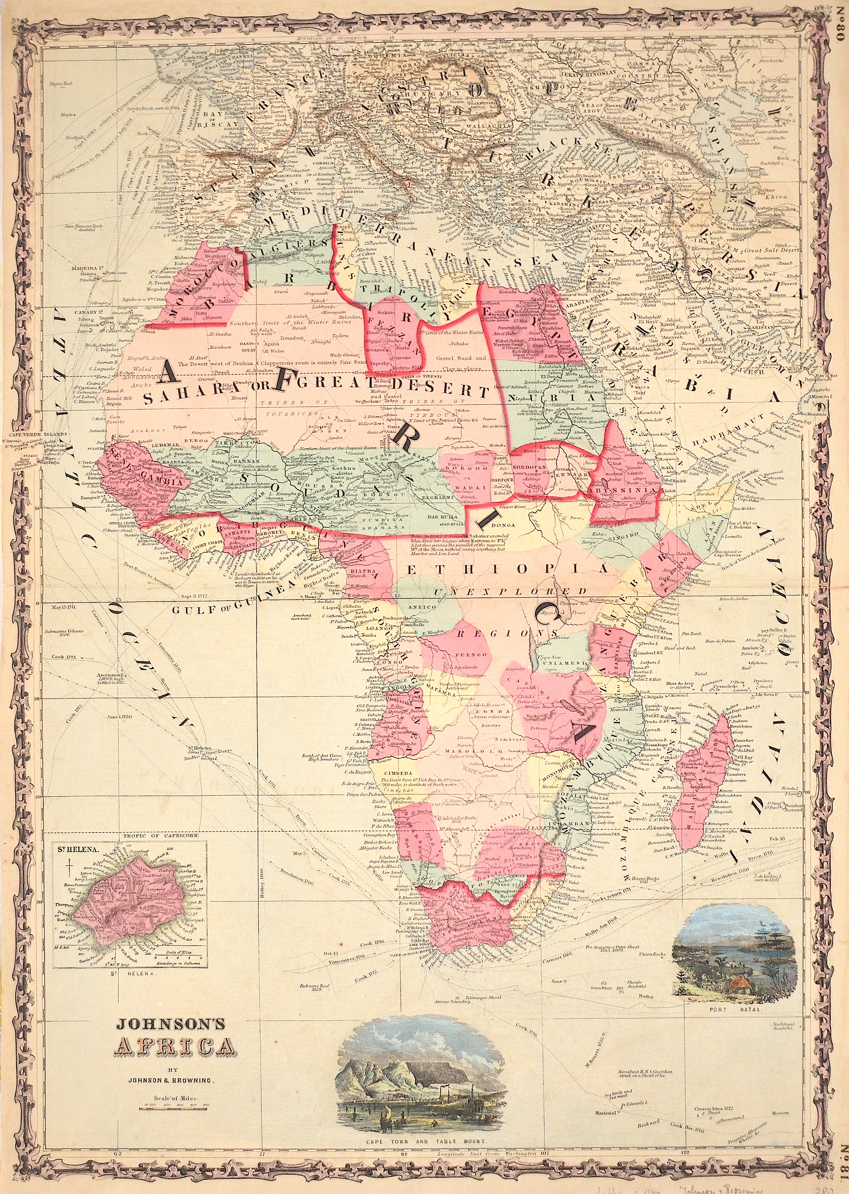
Johnson’s Africa by Johnson & Browning.

| Article ID | AF0446 |
Title | Johnson’s Africa by Johnson & Browning. |
Description | Map shows all of Africa with Madagascar, Arabia, Turkey, Persia and partly Europe. With a partial map of St. Helena and two views: Cape Town and Table Mount and Port Natal |
| Year | ca. 1860 |
Artist | Johnson & Browning (1827-1884) |
Alvin Jewett Johnson (1827 - 1884). Alvin J. Johnson entered into the business of publishing atlases in 1860. Having previously been a book canvasser who sold maps and atlases for the well-known map and atlas publisher, J.H. Colton, Johnson was introduced to the profitability of atlases as a reference book. Whether he originally planned to start his book publishing business with atlases or not is unknown. It does appear that, when he came to New York City in 1857, he began to support Colton in the publishing of his atlases and maps. In 1859, Colton’s General Atlas was published by the firm of Johnson & Browning, and the next year he published the first edition of his own atlas, titled, Johnson’s New Illustrated (Steel Plate) Family Atlas, With Descriptions Geographical, Statistical and Historical. The early editions of the Family Atlas, as it is most commonly referred to, was comprised of maps developed by the Colton firm, and the title page announces that the publishers, Johnson & Browning, are “formerly (successors to J.H. Colton and Company…”. Browning was an agent who worked in Johnson's book canvassing business. | |
Historical Description | According to the "Out-of-Africa theory", Africa is considered the "cradle of mankind", where homo development led to the development of the anatomically modern human Homo sapiens. One of the earliest advanced civilizations in mankind was formed in ancient Egypt. Over the millennia, various "great empires" such as the Empire of Abyssinia emerged on the continent. There were other kingdoms in West Africa, such as the Ashanti and Haussa, but they emerged much later. There were also some important cultures in East and South Africa, as in the area of today's Sudan, then called Nubia or Kush. Nubian pharaohs ruled all of Egypt for a dynasty. For example, the inhabitants of Greater Zimbabwe were important cultures in southern Africa. This stone castle was architecturally a masterpiece at that time and important for trade between the peoples of the south and east. The Swahili were known in East Africa. North Africa was connected to Europe and the Near East by the Mediterranean rather than separated. Carthage, a foundation of the Phoenicians in what is now Tunisia, was around the middle of the 1st millennium BC. The dominant power in the western Mediterranean until it was replaced by Rome in the Punic Wars. This prevailed from 30 BC. BC (conquest of Egypt) over all of North Africa. Even the ancient Egyptians (Queen Hatshepsut) made trips to Punt, probably in what is now Somalia. The kingdom of the Queen of Sheba, which probably had its center in southern Arabia, is said to have spanned parts of the Horn from Africa to the north of Ethiopia. |
| Place of Publication | New York |
| Dimensions (cm) | 61,5 x 44 cm |
| Condition | Perfect condition |
| Coloring | original colored |
| Technique | Lithography |