

Adina Sommer
Antique and Contemporary Art
Winzerer Str. 154
80797 München
telephone
+49 89 304714
business hours:
by appointment
Email
![]()


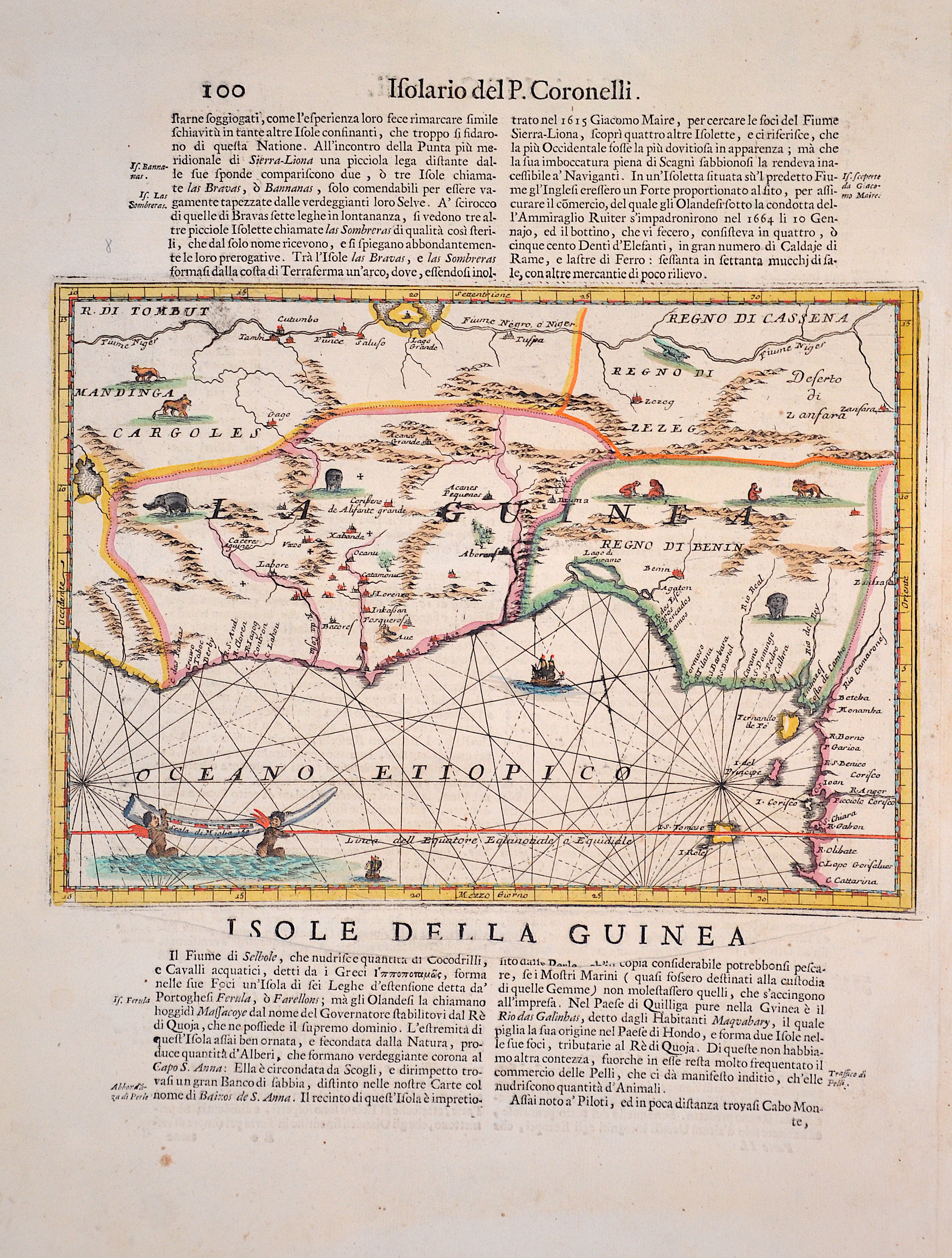
Isole della Guinea / 100 Isolario del P. Coronelli
| Article ID | AF0241 |
Title | Isole della Guinea / 100 Isolario del P. Coronelli |
Map shows the Gulf of Guinea with the countries Sierra Leone, Liberia, Ivory Coast, Ghana, Togo, Benin and Nigeria in Africa. Furthermore, many animal staffages in the country, two sailing ships and a mileage indicator cartouche. The reverse shows Isola Goree, an island off the coast of Senegal. Italian edition. | |
| Year | ca. 1695 |
Artist | Coronelli |
| Place of Publication | Venice |
| Dimensions (cm) | 23,5 x 30 cm |
| Condition | Perfect condition |
| Coloring | original colored |
| Technique | Copper print |
:
55.50 €
( A reproduction can be ordered individually on request. )