

Adina Sommer
Antique and Contemporary Art
Winzerer Str. 154
80797 München
telephone
+49 89 304714
business hours:
by appointment
Email
![]()


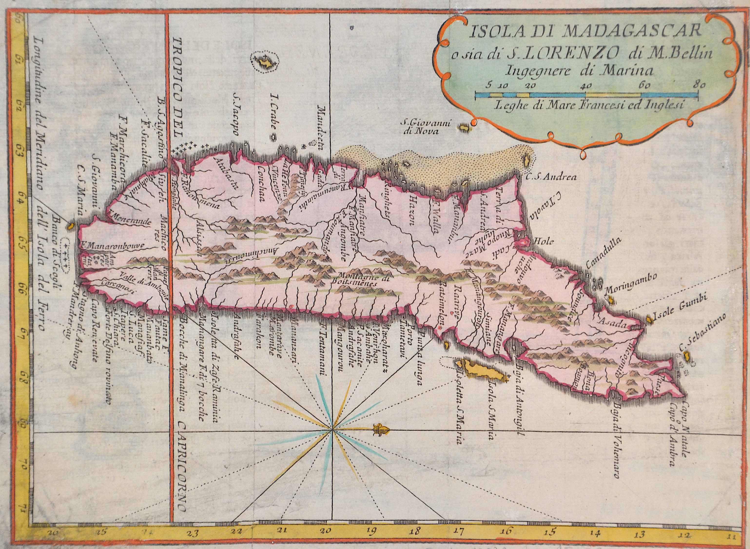
Isola di Madagascar

| Article ID | AF073 |
Title | Isola di Madagascar |
Description | Map shows the island Madagascar. |
| Year | ca. 1758 |
Artist | Bellin (1703-1772) |
Jacques-Nicolas Bellin (1703 Paris -1772 Versailles) was a French cartographer, engineer-geographer, marine hydrographer. As a contributor to the Encyclopédie, he wrote more than a thousand articles on maritime topics. As a cartographer, Bellin distinguished himself primarily in the field of sea cartography. From 1721 he worked for the Dépot des Cartes et Plans de la Marine, from 1741 until his death as an engineer-hydrograph of the Navy. In 1753 his atlas Neptune français, which covered all the coasts of France, was published, and in 1756 the hydrography françoise covering all seas of the earth. In 1764 the five-volume Petit Atlas maritime was published, which Bellin prepared on the orders of the Minister of the Navy, Choiseul. In addition, he wrote a number of geographical works and with Nouvelle méthode pour apprendre la geographie (1769) a geographic textbook for teaching. His maps illustrated, among other things, Bougainville's work Voyage autour du monde, published in 1771. As a co-author of the Encyclopédie edited by Diderot and d'Alembert, Bellin wrote more than a thousand articles in the field of shipping and navy. | |
Historical Description | Madagascar- officially the Republic of Madagascar , and previously known as the Malagasy Republic, is an island country in the Indian Ocean, off the coast of East Africa. Madagascar was an important transoceanic trading hub connecting ports of the Indian Ocean in the early centuries following human settlement. The written history of Madagascar began with the Arabs, who established trading posts along the northwest coast by at least the 10th century. From about 1774 to 1824, Madagascar gained prominence among pirates and European traders, particularly those involved in the trans-Atlantic slave trade. Many European sailors were shipwrecked on the coasts of the island, among them Robert Drury, whose journal is one of the few written depictions of life in southern Madagascar during the 18th century. The wealth generated by maritime trade spurred the rise of organized kingdoms on the island, some of which had grown quite powerful by the 17th century. Among these were the Betsimisaraka alliance of the eastern coast and the Sakalava chiefdoms of Menabe and Boina on the west coast. The Kingdom of Imerina, located in the central highlands with its capital at the royal palace of Antananarivo, emerged at around the same time under the leadership of King Andriamanelo. |
| Place of Publication | Paris |
| Dimensions (cm) | 17 x 23 |
| Condition | Right margin replaced |
| Coloring | colored |
| Technique | Copper print |