

Adina Sommer
Antique and Contemporary Art
Winzerer Str. 154
80797 München
telephone
+49 89 304714
business hours:
by appointment
Email
![]()


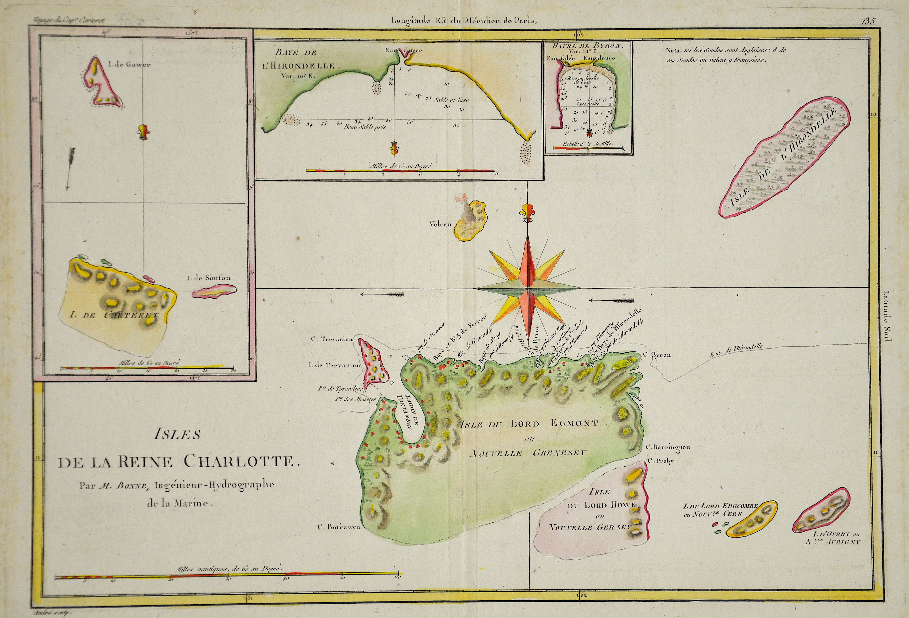
Isles de la Reine Charlotte

| Article ID | AMC0699 |
Title | Isles de la Reine Charlotte |
Description | Map shows the Queen Charlotte Islands, Haida Gwaii, at Brittish Columbia. |
| Year | ca. 1750 |
Artist | Bonne (1727-1795) |
Rigobert Bonne (1727–1795) was one of the most important cartographers of the late 18th century. In 1773 Bonne succeeded Jacques Nicolas Bellin as Royal Cartographer to France in the office of the Hydrographer at the Depôt de la Marine. Working in his official capacity, Bonne compiled some of the most detailed and accurate maps of the period. Bonne’s work represents an important step in the evolution of the cartographic ideology away from the decorative work of the 17th and early 18th century towards a more detail oriented and practical aesthetic. With regard to the rendering of terrain Bonne maps bear many stylistic similarities to those of his predecessor, Bellin. However, Bonne maps generally abandon such common 18th century decorative features such as hand coloring, elaborate decorative cartouches, and compass roses. While mostly focusing on coastal regions, the work of Bonne is highly regarded for its detail, historical importance, and overall aesthetic appeal. | |
Historical Description | The Spaniard Alvaro de Mendaña de Neyra discovered the archipelago for Europe in 1568. His expedition explored the southern part of the archipelago and named the islands of San Cristoval, Guadalcanal and Ysabel. With the death of Mendaña the position data of the islands was lost. Philipp Carteret landed on the east coast of Gower Island in the north in 1767, but without realizing that the island was part of the old Spanish discovery. The following year Louis Antoine de Bougainville explored the northern area of the Solomon Islands and named Bougainville, Buka and Choiseul. He also traveled the sea lanes between the islands. The French Jean François Marie de Surville was the first European to stay on the archipelago for a long time. Surville gave some islands the French name they still have today. When he returned to France, he reported on his stay in the “land of murderers” (Terre des Arsacides). In 1788 the Briton John Shortland anchored on the east coast of an archipelago island. Assuming he discovered a larger land mass, he named the island New Georgia. |
| Place of Publication | Paris |
| Dimensions (cm) | 24 x 34,5 |
| Condition | Very good |
| Coloring | colored |
| Technique | Copper print |