

Adina Sommer
Antique and Contemporary Art
Winzerer Str. 154
80797 München
telephone
+49 89 304714
business hours:
by appointment
Email
![]()


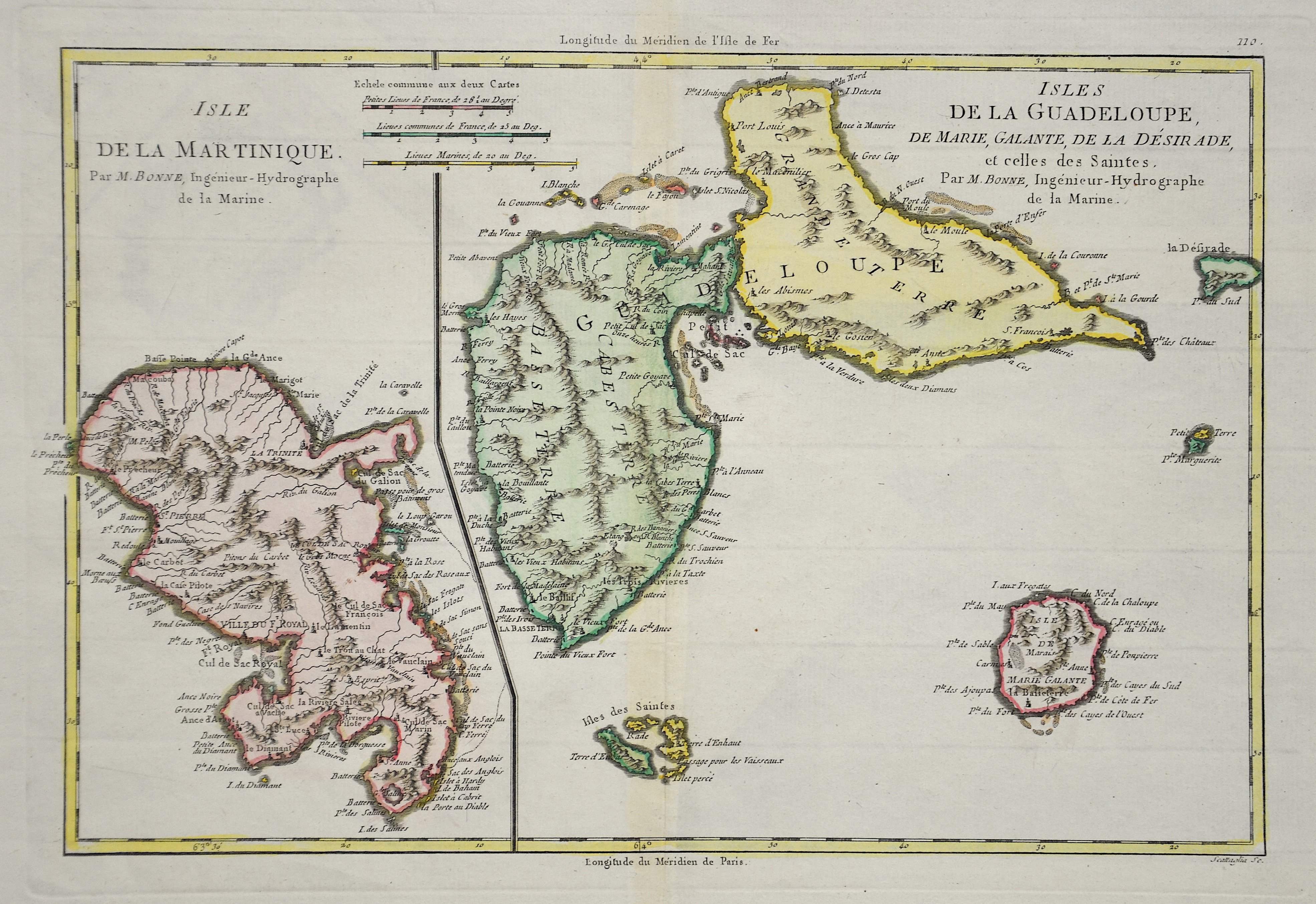
Isles de la Guadeloup/Isle de la Martinique

| Article ID | AMW428 |
Title | Isles de la Guadeloup/Isle de la Martinique |
Description | Map shows the Islands of Guadeloupe and Martinique |
| Year | ca. 1780 |
Artist | Bonne (1727-1795) |
Rigobert Bonne (1727–1795) was one of the most important cartographers of the late 18th century. In 1773 Bonne succeeded Jacques Nicolas Bellin as Royal Cartographer to France in the office of the Hydrographer at the Depôt de la Marine. Working in his official capacity, Bonne compiled some of the most detailed and accurate maps of the period. Bonne’s work represents an important step in the evolution of the cartographic ideology away from the decorative work of the 17th and early 18th century towards a more detail oriented and practical aesthetic. With regard to the rendering of terrain Bonne maps bear many stylistic similarities to those of his predecessor, Bellin. However, Bonne maps generally abandon such common 18th century decorative features such as hand coloring, elaborate decorative cartouches, and compass roses. While mostly focusing on coastal regions, the work of Bonne is highly regarded for its detail, historical importance, and overall aesthetic appeal. | |
Historical Description | Columbus was the first European to reach the island on the outward journey of his second voyage in 1493. He named it Guadalupe after the Spanish pilgrimage site Nuestra Señora de Guadalupe, as he had promised the monks there that he would name an island. The Caribs initially defended themselves successfully against the Spaniards. It was not until 1635 that the French succeeded in colonizing Guadeloupe. In 1664 the island was transferred to the French West India Company. After its dissolution in 1674, the French crown took over the administration of the colony. The French colonial rulers established a plantation economy. They mainly grew sugar cane and coffee. The new masters had people brought from Africa as workers, who were deported to the New World in the context of the transatlantic slave trade with slave ships. In the course of the French Revolution of 1789, slavery was abolished in the French colonies and thus also in Guadeloupe in February 1794. Great Britain took advantage of the new political situation and occupied the islands in April 1794. It was supported by the plantation owners who wanted to prevent the implementation of the declared abolition of slavery. The British occupation, however, was soon driven out by French troops led by the National Commissioner for Guadeloupe, Victor Hugues. This also relied on the support of the freed slaves. Hugues ruled the islands as commissioner from 1794 to 1798. In 1946 Guadeloupe became the overseas department (Département d'Outre Mer / DOM) of France. It has not been a colony since then; it is regarded in all areas as an integral part of the mother country and its inhabitants are state side as French. |
| Place of Publication | Paris |
| Dimensions (cm) | 23 x 34 |
| Condition | Very good |
| Coloring | gouache |
| Technique | Copper print |