

Adina Sommer
Antique and Contemporary Art
Winzerer Str. 154
80797 München
telephone
+49 89 304714
business hours:
by appointment
Email
![]()


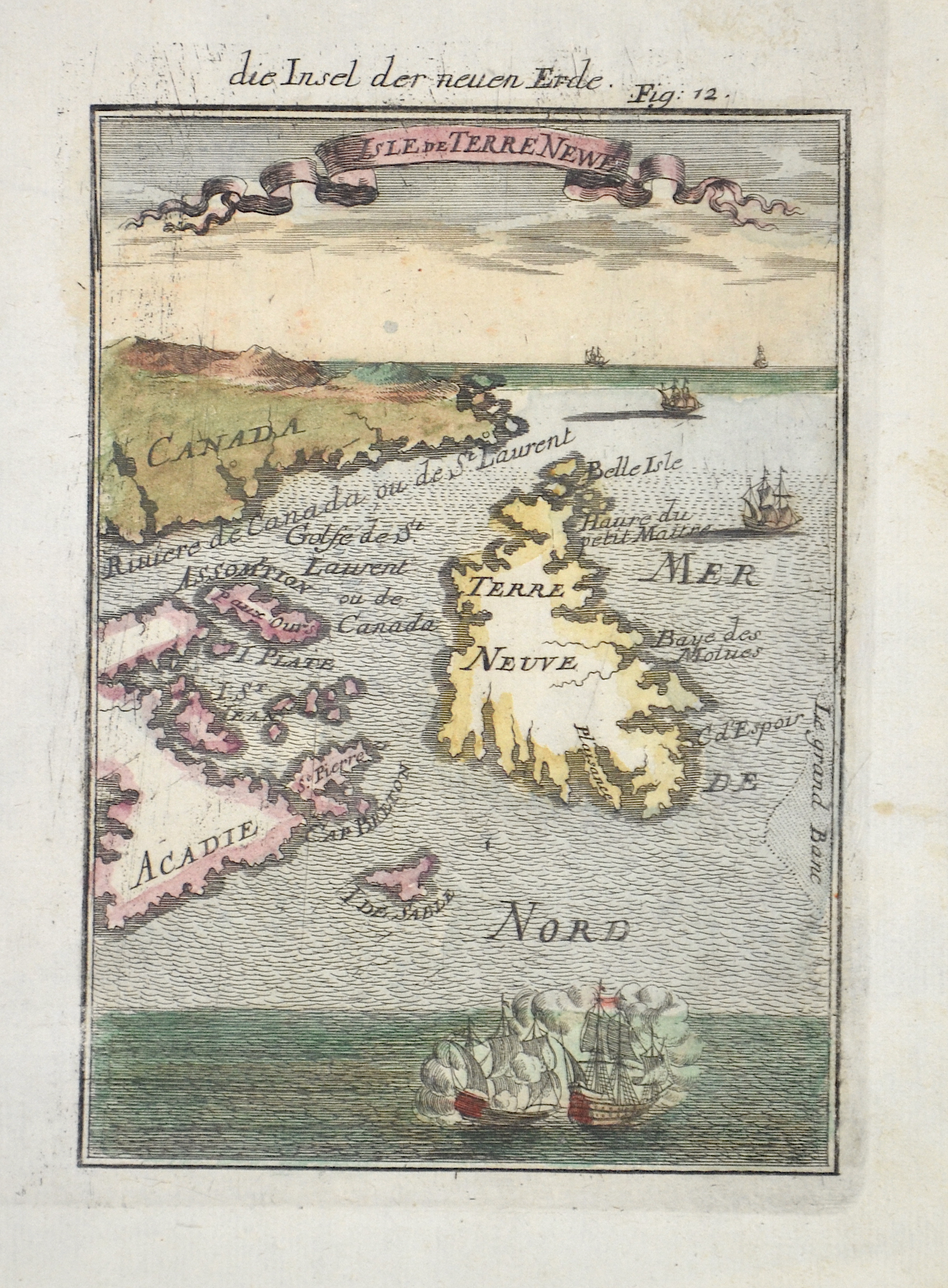
Isle de Terre Neuve

| Article ID | AMC0460 |
Title | Isle de Terre Neuve |
Description | Map shows the island Newfoundland and part of Laprador. |
| Year | ca. 1683 |
Artist | Mallet (1630-1706) |
Alain Manesson Mallet (1630- 1706 ) was a French cartographer and engineer. He started his career as a soldier in the army of Louis XIV, became a Sergeant-Major in the artillery and an Inspector of Fortifications. He also served under the King of Portugal, before returning to France, and his appointment to the court of Louis XIV. His military engineering and mathematical background led to his position teaching mathematics at court. His major publications were Description de L'Univers (1683) in 5 volumes, and Les Travaux de Mars ou l'Art de la Guerre (1684) in 3 volumes. His Description de L'Universe contains a wide variety of information, including star maps, maps of the ancient and modern world, and a synopsis of the customs, religion and government of the many nations included in his text. It has been suggested that his background as a teacher led to his being concerned with entertaining his readers. This concern manifested itself in the charming harbor scenes and rural landscapes that he included beneath his description of astronomical concepts and diagrams. Mallet himself drew most of the figures that were engraved for this book. | |
Historical Description | Various indigenous peoples have inhabited what is now Canada for thousands of years before European colonization. Beginning in the 16th century, British and French expeditions explored and later settled along the Atlantic coast. As a consequence of various armed conflicts, France ceded nearly all of its colonies in North America in 1763. In 1867, with the union of three British North American colonies through Confederation, Canada was formed as a federal dominion of four provinces. In 1583, Sir Humphrey Gilbert, by the royal prerogative of Queen Elizabeth I, founded St. John's, Newfoundland, as the first North American English colony. French explorer Samuel de Champlain arrived in 1603 and established the first permanent European settlements at Port Royal (in 1605) and Quebec City (in 1608). Among the colonists of New France, Canadiensextensively settled the Saint Lawrence River valley and Acadians settled the present-day Maritimes, while fur traders and Catholic missionaries explored the Great Lakes, Hudson Bay, and the Mississippi watershed to Louisiana. The Beaver Wars broke out in the mid-17th century over control of the North American fur trade. The Royal Proclamation of 1763 established First Nation treaty rights, created the Province of Quebec out of New France, and annexed Cape Breton Island to Nova Scotia. After the successful American War of Independence, The 1783 Treaty of Paris recognized the independence of the newly formed United States and set the terms of peace, ceding British North American territories south of the Great Lakes to the new country. the Constitutional Act of 1791 divided the province of Canada into French-speaking Lower Canada (later Quebec) and English-speaking Upper Canada (later Ontario), granting each its own elected legislative assembly. |
| Place of Publication | Paris |
| Dimensions (cm) | 16 x 10 |
| Condition | Very good |
| Coloring | original colored |
| Technique | Copper print |