

Adina Sommer
Antique and Contemporary Art
Winzerer Str. 154
80797 München
telephone
+49 89 304714
business hours:
by appointment
Email
![]()


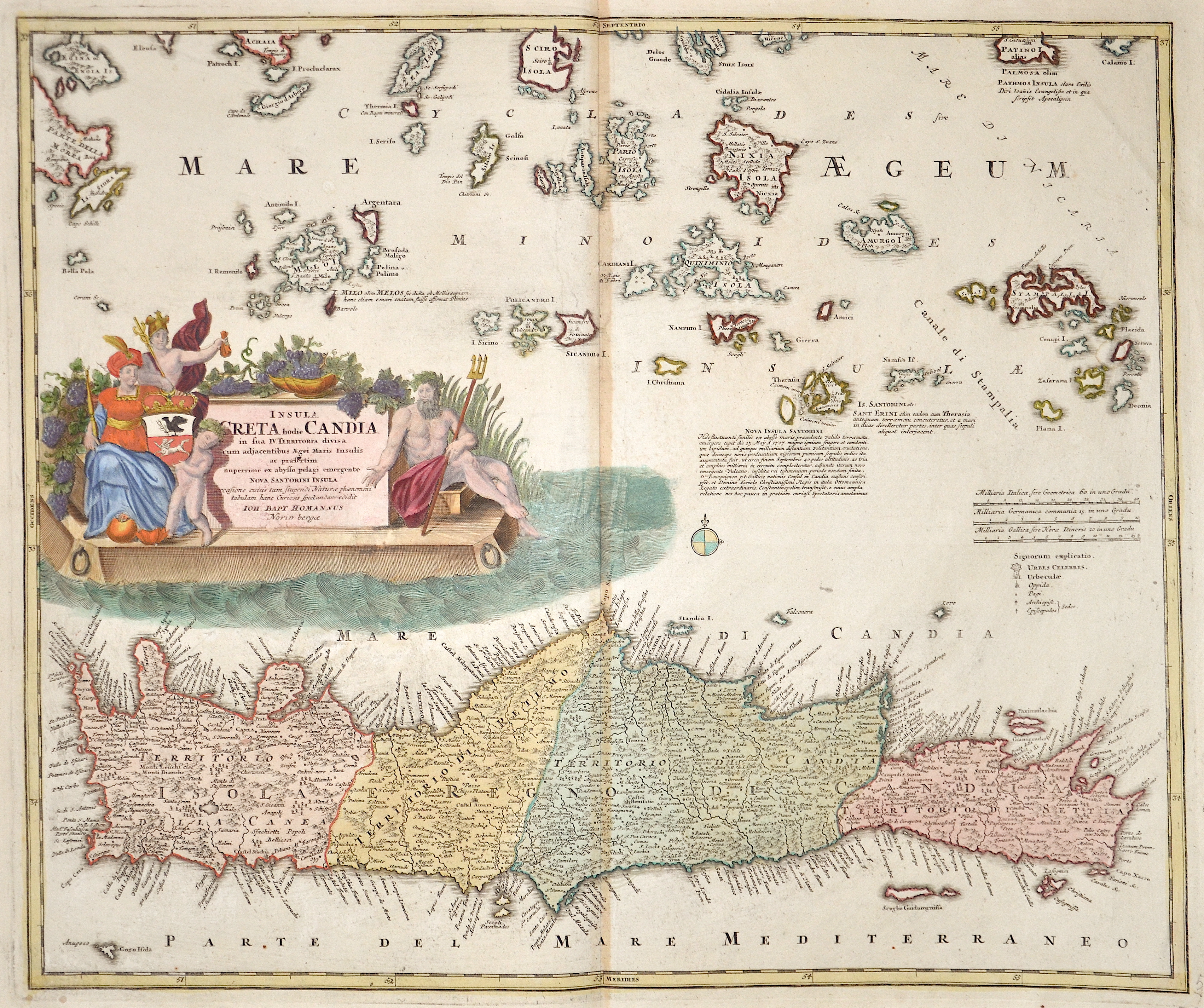
Insula Creta hodie Candia

| Article ID | EUK362 |
Title | Insula Creta hodie Candia |
Description | Map of Crete and the Small Cyclades with magnificent title cartouche and the coat of arms of the Kingdom of Kandia. |
| Year | ca. 1710 |
Artist | Homann (1664-1724) |
Johann Babtiste Homann (1664-1724), Nuremberg, was born in Oberkammlach, the Electorate of Bavaria. Although educated at a Jesuit school, and preparing for an ecclesiastical career, he eventually converted to Protestantism and from 1687 worked as a civil law notary in Nuremberg. He soon turned to engraving and cartography; in 1702 he founded his own publishing house. Homann acquired renown as a leading German cartographer, and in 1715 was appointed Imperial Geographer by Emperor Charles VI. Giving such privileges to individuals was an added right that the Holy Roman Emperor enjoyed. In the same year he was also named a member of the Prussian Academy of Sciences in Berlin. Of particular significance to cartography were the imperial printing privileges (Latin: privilegia impressoria). These protected for a time the authors in all scientific fields such as printers, copper engravers, map makers and publishers. They were also very important as a recommendation for potential customers. In 1716 Homann published his masterpiece Grosser Atlas ueber die ganze Welt (Grand Atlas of all the World). Numerous maps were drawn up in cooperation with the engraver Christoph Weigel the Elder, who also published Siebmachers Wappenbuch. Homann died in Nuremberg. He was succeeded by the Homann heirs company, which was in business until 1848. The company was known as Homann Erben, Homanniani Heredes, or Heritiers de Homann abroad. | |
Historical Description | The island of Crete is first referred to as Kaptara in texts from the Syrian city of Mari from the 18th century BC, which are later repeated in Neo-Assyrian records and in the Bible (Caphtor). It was also known in ancient Egypt as Keftiu, strongly suggesting that a similar form to both was the Minoan name for the island. In classical times, Crete lay on the edge of the Greek cultural area, it was regarded as the "island of 100 poleis" and was therefore divided into numerous small city-states. The stone-carved legal text of the then powerful polis of Gortyn is the only completely preserved codex of this type from Greek antiquity. From 1645 to 1648, the Turks conquered almost the entire island and incorporated it into the Ottoman Empire as Girit, with only Candia withstanding a siege until 1669. Numerous uprisings by the population in the 19th century against Ottoman sovereignty were bloodily suppressed. From 1830 to 1840, Crete was formally under the administration of the Vali of Egypt, Muhammad Ali Pasha. In 1898, the intervention of France, Russia and the United Kingdom forced Crete into almost complete autonomy under the sovereignty of the High Porte. The Treaty of London in 1913 finally made Crete part of the Greek state, and a comprehensive population exchange was agreed in the Treaty of Lausanne in 1923. |
| Place of Publication | Nuremberg |
| Dimensions (cm) | 50 x 58 cm |
| Condition | Very good |
| Coloring | colored |
| Technique | Copper print |