

Adina Sommer
Antique and Contemporary Art
Winzerer Str. 154
80797 München
telephone
+49 89 304714
business hours:
by appointment
Email
![]()


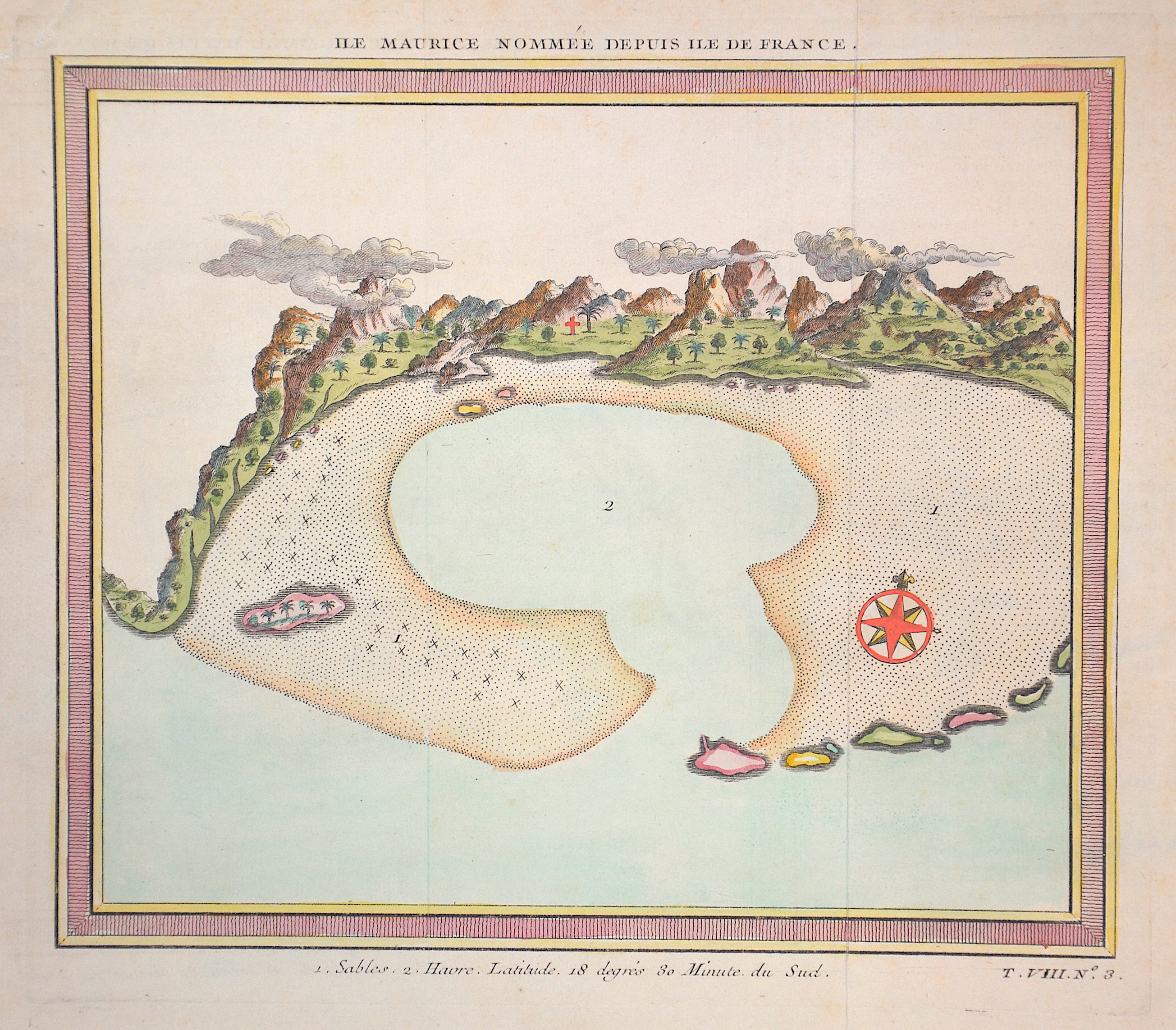
Ile Maurice nommee d puis ile de France

| Article ID | AF0225 |
Title | Ile Maurice nommee d puis ile de France |
Description | Map shows the islend of Mauritius |
| Year | ca. 1750 |
Artist | Bellin (1703-1772) |
Jacques-Nicolas Bellin (1703 Paris -1772 Versailles) was a French cartographer, engineer-geographer, marine hydrographer. As a contributor to the Encyclopédie, he wrote more than a thousand articles on maritime topics. As a cartographer, Bellin distinguished himself primarily in the field of sea cartography. From 1721 he worked for the Dépot des Cartes et Plans de la Marine, from 1741 until his death as an engineer-hydrograph of the Navy. In 1753 his atlas Neptune français, which covered all the coasts of France, was published, and in 1756 the hydrography françoise covering all seas of the earth. In 1764 the five-volume Petit Atlas maritime was published, which Bellin prepared on the orders of the Minister of the Navy, Choiseul. In addition, he wrote a number of geographical works and with Nouvelle méthode pour apprendre la geographie (1769) a geographic textbook for teaching. His maps illustrated, among other things, Bougainville's work Voyage autour du monde, published in 1771. As a co-author of the Encyclopédie edited by Diderot and d'Alembert, Bellin wrote more than a thousand articles in the field of shipping and navy. | |
Historical Description | The island was discovered by Europeans in 1505 (other sources mention 1507 or even 1510) by the Portuguese Pedro Mascarenhas. He is still remembered by the name of the archipelago of the Mascarenes (consisting of Mauritius, Rodrigues and Réunion). However, the Portuguese used the island only as a base and not as a colony. Admiral Wybrand van Warwijck took possession of the island for Holland in 1598 and named it after Prince Moritz of Orange. In 1715 the island was conquered by the French, who renamed it "Île de France". From 1767 the island was a French crown colony. In 1810, after a successful campaign - the so-called Mauritius Campaign - against France, the British under Commodore Josias Rowley occupied the island and renamed it Mauritius again. From 1958, Great Britain prepared Mauritius for its independence together with Rodrigues, became independent in 1968 and joined the Commonwealth. |
| Place of Publication | Paris |
| Dimensions (cm) | 19,5 x 22 |
| Condition | Very good |
| Coloring | colored |
| Technique | Copper print |
Reproduction:
27.00 €
( A reproduction can be ordered individually on request. )