

Adina Sommer
Antique and Contemporary Art
Winzerer Str. 154
80797 München
telephone
+49 89 304714
business hours:
by appointment
Email
![]()


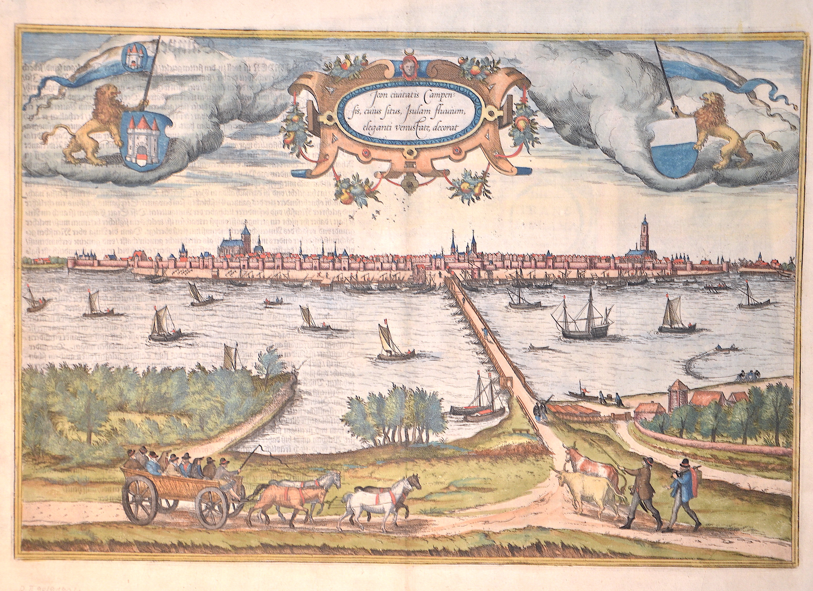
Icon Civitatis Campensis, cuius situs Isulam fluvium, eleganti venustate, decorat / Campen. 30

| Article ID | EUN1543 |
Title | Icon Civitatis Campensis, cuius situs Isulam fluvium, eleganti venustate, decorat / Campen. 30 |
Description | Magnificent map shows a bird's eye view of the Hanseatic town of Kampen on the Ijssel in the Netherlands. Also a title cartouche, two coats of arms each held by a lion, ship staffages on the Ijssel and a four-in-hand and several figures in the foreground. Reverse in German p. 30. |
| Year | ca. 1580 |
Artist | Braun/Hogenberg (1572-1618) |
Frans Hogenberg (1535 – 1590) was a Flemish and German painter, engraver, and mapmaker. Hogenberg was born in Mechelen as the son of Nicolaas Hogenberg In 1568 he was banned from Antwerp by the Duke of Alva. He travelled to London, where he stayed a few years before emigrating to Cologne. He is known for portraits and topographical views as well as historical allegories. He also produced scenes of contemporary historical events. George Braun (1541-1622), a cleric of Cologne, was the principal editor of the "Civitates Orbis Terrarum". The first volume of the Civitates Orbis Terrarum was published in Cologne in 1572. The sixth and the final volume appeared in 1617. This great city atlas, edited by Georg Braun and largely engraved by Franz Hogenberg, eventually contained 546 prospects, bird-eye views and map views of cities from all over the world. Braun (1541-1622), a cleric of Cologne, was the principal editor of the work, and was greatly assisted in his project by the close, and continued interest of Abraham Ortelius, whose Theatrum Orbis Terrarum of 1570 was, as a systematic and comprehensive collection of maps of uniform style, the first true atlas. | |
Historical Description | After the division of the Franconian Empire, the lower lands belonged to the East Franconian Kingdom (Regnum Teutonicum) and then to the Holy Roman Empire. Under Emperor Charles V, who was also King of Spain, the country was divided into seventeen provinces and also included what is now Belgium and parts of northern France and western Germany. The rift between Catholics loyal to Spain and radical Calvinists was torn too deep and led to the Calvinist provinces of Holland, Zeeland and Utrecht joining together in a defensive alliance in 1579, the Union of Utrecht. This treaty became the charter of a new state, the Republic of the United Netherlands. Only after an eighty-year war was the independence of the Netherlands from Spain recognized in the Peace of Westphalia in May 1648. This date is considered the birthday of today's Netherlands. As a result, as the republic of the Seven United Provinces, the Netherlands grew to become the greatest trading and economic power of the 17th century. This era is known as the Golden Age. However, this did not come from the state, but from the first two public companies in history, the Dutch East India Company (VOC) and the Dutch West India Company (WIC). The founding of New Amsterdam is well known (Nieuw Amsterdam), which was later renamed New York. In Asia, the Dutch created their colonial empire, the Dutch East Indies, what is now Indonesia. The Netherlands also gained colonies in northeastern South America. In Europe, the Netherlands was a great power in the 17th century, led by bourgeois politicians like Johan van Oldenbarnevelt and Johan de Witt. |
| Place of Publication | Cologne |
| Dimensions (cm) | 33 x 48 cm |
| Condition | Perfect condition |
| Coloring | original colored |
| Technique | Copper print |