

Adina Sommer
Antique and Contemporary Art
Winzerer Str. 154
80797 München
telephone
+49 89 304714
business hours:
by appointment
Email
![]()


I. Milo

| Article ID | EUK5475 |
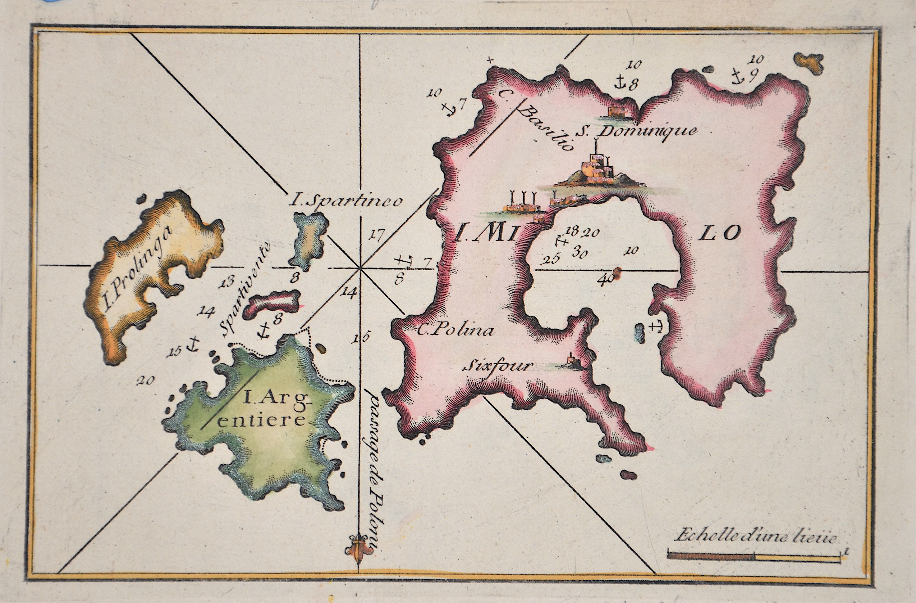
Title | I. Milo |
Description | Map showing the islands of Milos, Kimolos, and Poliegos in the Aegean Sea, Greece. The map also includes anchorages and sea depths. |
| Year | ca. 1754 |
Artist | Roux (1725-1793) |
Joseph Roux (1725–1793), from Marseille, came from a family of hydrographers and marine cartographers. He ran a workshop-boutique at the Vieux-Port of Marseille, which he had taken over from his father. His main focus was the creation of nautical charts and plans of harbors, bays, and coastlines — particularly in the Mediterranean region.bIn 1764, for example, he published a series of twelve large sheets under the title Carte de la Mer Méditerranée en douze feuilles ("Map of the Mediterranean Sea in twelve sheets"). He produced chart sheets with depth soundings (for navigation), anchorages, coastlines, and more — for example: maps like “Isle de Sicile. Mer Méditerranée” from around 1760. Around that time, nautical cartography was entering a phase in which detailed harbor and coastal plans were becoming increasingly important for trade, naval operations, and navigation. Although Roux’s maps were rooted in Marseille, they gained broader significance due to his status as Hydrographe du Roi (Hydrographer to the King) and the widespread distribution of his works. | |
Historical Description | The Aegean is considered the cradle of two great ancient civilizations, the Minoan culture and that of Ancient Greece. Later, the Aegean was ruled by the Persians, Romans, Byzantines, Genoese, Venetians and Ottomans. In ancient times, the Aegean islands, of which Crete and - by some distance - Lesbos are the largest, were a source of cultural development, with a particular focus on seafaring, trade and the transfer of knowledge. The combination of different cultures of the eastern Mediterranean region was favored by the geographical conditions.b |
| Place of Publication | Marselle |
| Dimensions (cm) | 12,7 x 19,5 cm |
| Condition | Perfect condition |
| Coloring | original colored |
| Technique | Copper print |