

Adina Sommer
Antique and Contemporary Art
Winzerer Str. 154
80797 München
telephone
+49 89 304714
business hours:
by appointment
Email
![]()


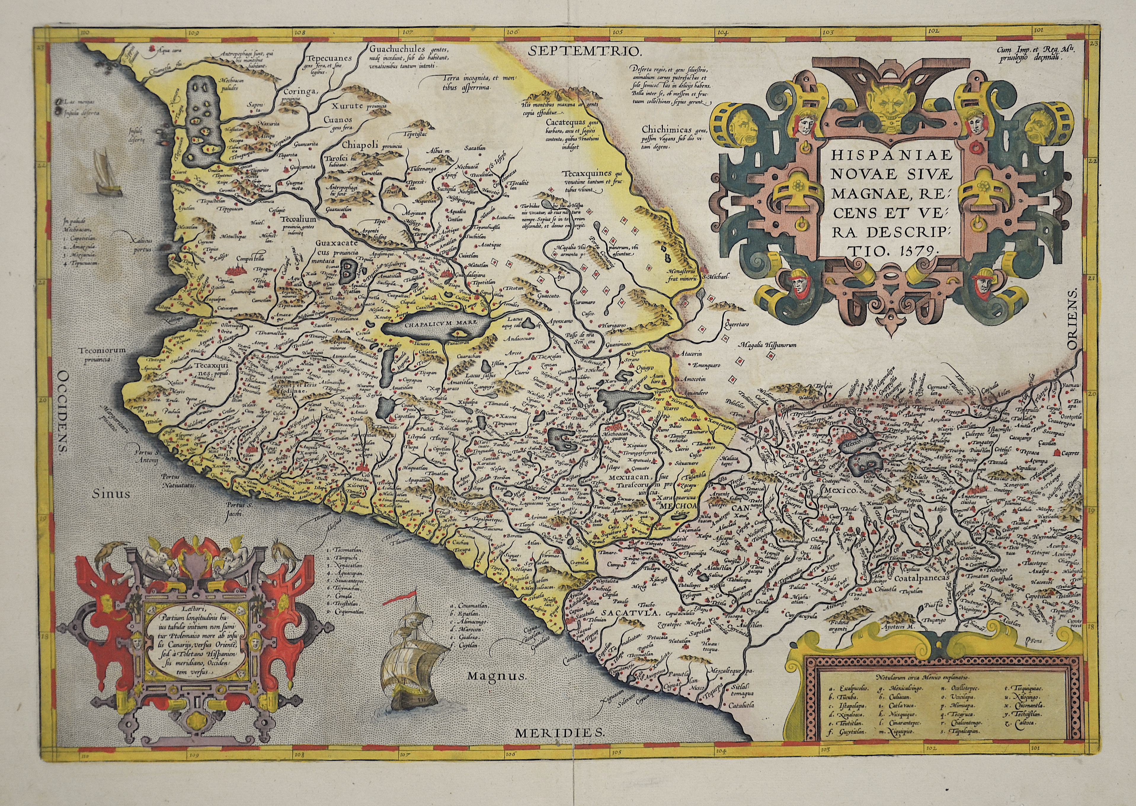
Hispaniae Novae sive Magnae recens descriptio

| Article ID | AMZ130 |
Title | Hispaniae Novae sive Magnae recens descriptio |
Description | Map shows Mexico and the southern west coast of the United States. With 2 decorative cartouches and a mile scale. |
| Year | dated 1579 |
Artist | Ortelius (1527-1598) |
Abraham Ortelius (1527–1598) was a Flemish cartographer and publisher from Antwerp. Originally a map colorist, he became a major figure in cartography through his Theatrum Orbis Terrarum (1570), considered the first modern atlas—a uniform collection of reliable maps in book form. Influenced by Gerardus Mercator, Ortelius published several maps before compiling the Theatrum, which clearly showed America as a separate continent. The work was published in 42 editions and 7 languages by 1612. Unlike many of his peers, Ortelius cited his sources, and his atlas became a milestone in mapmaking and geographic knowledge. | |
Historical Description | The Spanish first learned of Mexico during the Juan de Grijalva expedition of 1518. The Spanish conquest of the Aztec Empire began in February 1519 when Hernán Cortés arrived at the port in Veracruz with ca. 500 conquistadores. After taking control of that city, he moved on to the Aztec capital. In his search for gold and other riches, Cortés decided to invade and conquer the Aztec empire. When the Spaniards arrived, the ruler of the Aztec empire was Moctezuma II, who was later killed. His successor and brother Cuitláhuac took control of the Aztec empire, but was among the first to fall from the first smallpox epidemic in the area a short time later. The capture of Tenochtitlan and refounding of Mexico City in 1521 was the beginning of a 300-year-long colonial era during which Mexico was known as Nueva España (New Spain). The Kingdom of New Spain was created from the remnants of the Aztec hegemonic empire. Subsequent enlargements, such as the conquest of the Tarascan state, resulted in the creation of the Viceroyalty of New Spain in 1535. The Viceroyalty at its greatest extent included the territories of modern Mexico, Central America as far south as Costa Rica, and the western United States. The Viceregal capital Mexico City also administrated the Spanish West Indies (the Caribbean), the Spanish East Indies (the Philippines), and Spanish Florida. |
| Place of Publication | Antwerp |
| Dimensions (cm) | 35 x 50,5 |
| Condition | Very good |
| Coloring | colored |
| Technique | Copper print |