

Adina Sommer
Antique and Contemporary Art
Winzerer Str. 154
80797 München
telephone
+49 89 304714
business hours:
by appointment
Email
![]()


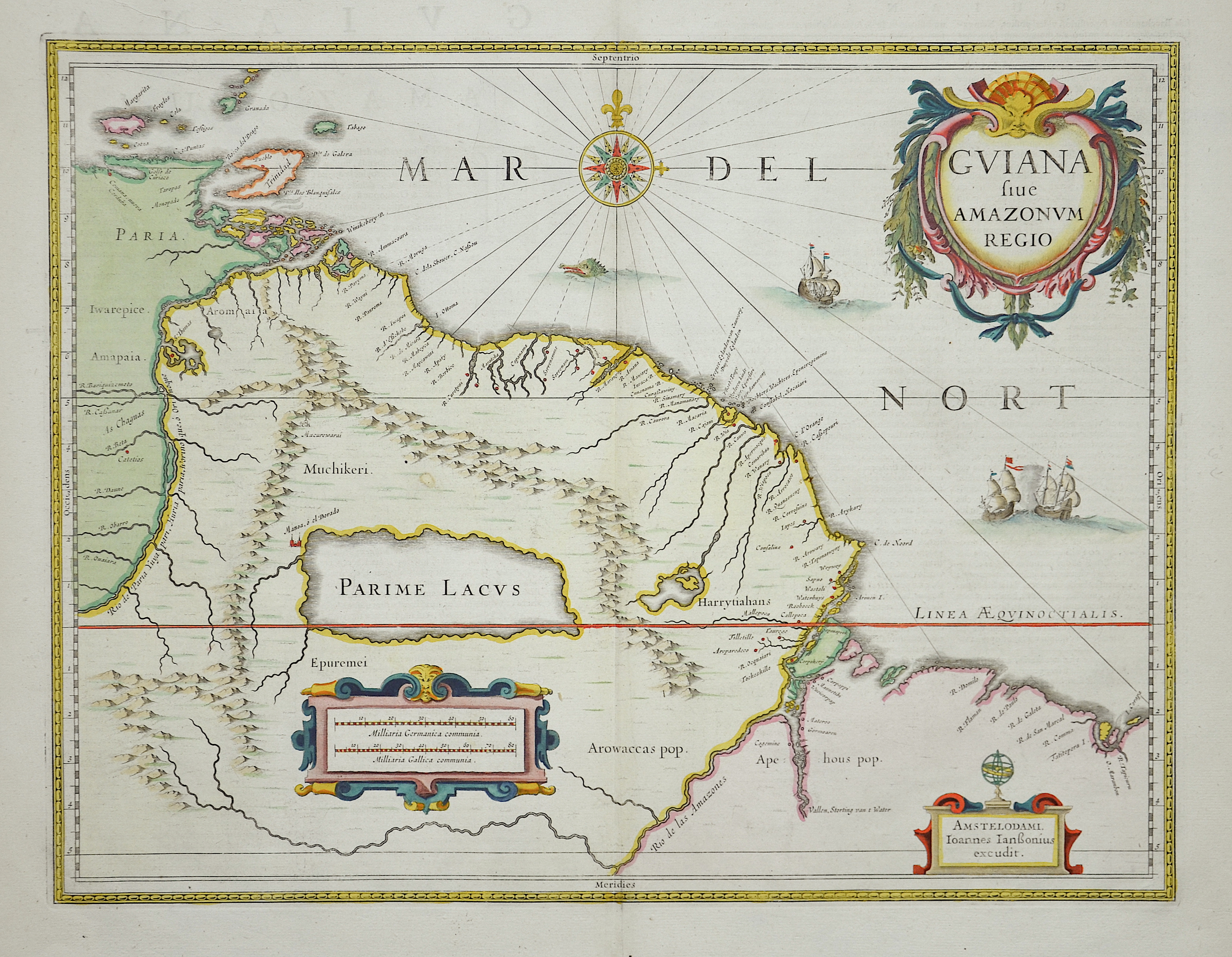
Guiana sive Amazonum Regio

| Article ID | AMS276 |
Title | Guiana sive Amazonum Regio |
Description | map of Guiana and Northeastern Venezuela with Trinidad. |
| Year | ca. 1666 |
Artist | Janssonius (1588-1664) |
Johannes Janssonius (Jansson)( 1588- 1664) Amsterdam, was born in Arnhem, the son of Jan Janszoon the Elder, a publisher and bookseller. In 1612 he married Elisabeth de Hondt, the daughter of Jodocus Hondius. He produced his first maps in 1616 of France and Italy. In 1623 Janssonius owned a bookstore in Frankfurt am Main, later also in Danzig, Stockholm, Copenhagen, Berlin, Königsberg, Geneva and Lyon. In the 1630s he formed a partnership with his brother in law Henricus Hondius, and together they published atlases as Mercator/Hondius/Janssonius. Under the leadership of Janssonius the Hondius Atlas was steadily enlarged. Renamed Atlas Novus, it had three volumes in 1638, one fully dedicated to Italy. 1646 a fourth volume came out with ""English County Maps"", a year after a similar issue by Willem Blaeu. Janssonius' maps are similar to those of Blaeu, and he is often accused of copying from his rival, but many of his maps predate those of Blaeu and/or covered different regions. By 1660, at which point the atlas bore the appropriate name ""Atlas Major"", there were 11 volumes, containing the work of about a hundred credited authors and engravers. It included a description of ""most of the cities of the world"" (Townatlas), of the waterworld (Atlas Maritimus in 33 maps), and of the Ancient World (60 maps). The eleventh volume was the Atlas of the Heavens by Andreas Cellarius. Editions were printed in Dutch, Latin, French, and a few times in German. | |
Historical Description | In pre-Columbian times, Indian groups, nomadic hunters and gatherers as well as fishermen and farmers lived in Venezuela. Christopher Columbus reached the eastern coast of Venezuela on his third voyage in 1498 and landed at the mouth of the Orinoco River. It was the first time that he and his team had entered mainland America. On August 24, 1499, an expedition by Alonso de Ojeda and Amerigo Vespucci followed, which supposedly gave the country the name Venezuela (Little Venice) because of the frequent use of stilt houses. The first permanent settlement of the Spaniards called Nueva Cadiz was founded in 1522. From 1528 to 1545, the province of Venezuela was pledged by Charles V to the Welser family, who ran the Little Venice colony during this period. The current capital, Caracas, was founded in 1567, and in 1577 the Spanish crown appointed a governor to administer it.The colony was rather neglected by the Spaniards in the 16th and 17th centuries, since they concentrated on gold from other parts of America. The cultivation of cocoa, sugar, tobacco, coffee and cotton resulted in a large number of slaves being brought to Venezuela, which, after much of the native culture had been largely destroyed, influenced the culture in Venezuela. From 1797 to 1821 there were repeated attempts to detach New Granada, whose sub-region was Venezuela, from Spanish rule. In 1821 Simón Bolívar managed to bring the wars of independence to a victorious end in Venezuela. |
| Place of Publication | Amsterdam |
| Dimensions (cm) | 37 x 48 |
| Condition | Very good |
| Coloring | colored |
| Technique | Copper print |