

Adina Sommer
Antique and Contemporary Art
Winzerer Str. 154
80797 München
telephone
+49 89 304714
business hours:
by appointment
Email
![]()


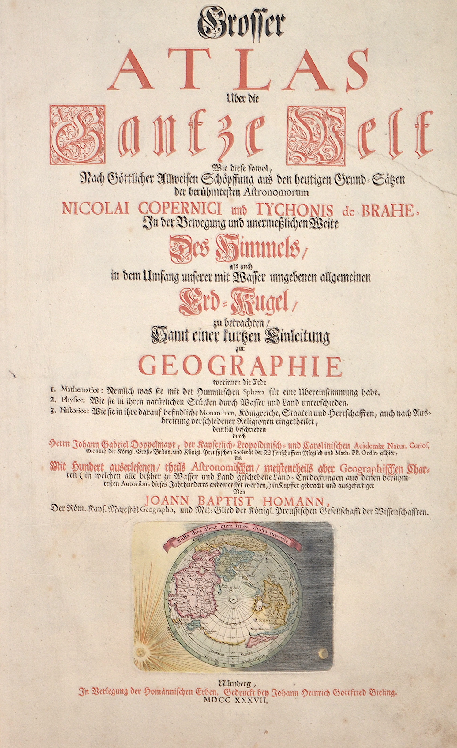
Grosser Atlas uber die gantze Welt.

| Article ID | T0161 |
Title | Grosser Atlas uber die gantze Welt. |
Description | Title page by Joann Baptist Homann "Grosser Atlas uber die gantze Welt. Wie diese sowol, Nach Göttlicher Allweisen Schöpffung aus den heutigen Grund-Sätzen der berühmtesten Astronomorum Nicolai Copernici und Tychonis de Brahe, In der Bewegung und unermeßlichen Weite Des Himmel,… ". Published by the homannic heirs, printed in black and red letters by Johann Heinrich Gottfried Bieling. Furthermore, an illustration of the world from the North Pole projection. |
| Year | c. 1737 |
Artist | Homann Erben |
Johann Babtiste Homann (1664-1724) was born in Oberkammlach, the Electorate of Bavaria. Although educated at a Jesuit school, and preparing for an ecclesiastical career, he eventually converted to Protestantism and from 1687 worked as a civil law notary in Nuremberg. He soon turned to engraving and cartography; in 1702 he founded his own publishing house. Homann acquired renown as a leading German cartographer, and in 1715 was appointed Imperial Geographer by Emperor Charles VI. Giving such privileges to individuals was an added right that the Holy Roman Emperor enjoyed. In the same year he was also named a member of the Prussian Academy of Sciences in Berlin. Of particular significance to cartography were the imperial printing privileges (Latin: privilegia impressoria). These protected for a time the authors in all scientific fields such as printers, copper engravers, map makers and publishers. They were also very important as a recommendation for potential customers. In 1716 Homann published his masterpiece Grosser Atlas ueber die ganze Welt (Grand Atlas of all the World). Numerous maps were drawn up in cooperation with the engraver Christoph Weigel the Elder, who also published Siebmachers Wappenbuch. Homann died in Nuremberg. He was succeeded by the Homann heirs company, which was in business until 1848. The company was known as Homann Erben, Homanniani Heredes, or Heritiers de Homann abroad. | |
Historical Description | The title page is one of the most important parts of an atlas or book. It appears at the beginning of the book and describes the actual title and the context or subject of the book or atlas. The title page often shows the title of the work, the person or institution responsible for its intellectual content, and the imprint, which includes the name and address of the publisher as well as the date of publication. Further information about the publication is often printed on the back of the title page.The first printed books or incunabula had no title pages: the text simply began on the first page, and the book was often identified by its opening words – the incipit. Maps were usually published in atlases, and atlases were books with titles. Even here, title pages were individual works of art. A publisher emphasized the importance of a book by introducing it with a spectacular entrée.Usually, the images on an atlas title page referred to the subject matter: measuring instruments, mythological, astronomical, religious, scientific, and allegorical references and facts were combined in a composition that represented the pride of scientific and intellectual progress. An atlas title page is often no more than an outstanding artistic and expressive cartouche. |
| Place of Publication | Nuremberg |
| Dimensions (cm) | 46,5 x 26 cm |
| Condition | Tear on the right side perfectly restored |
| Coloring | original colored |
| Technique | Copper print |