

Adina Sommer
Antique and Contemporary Art
Winzerer Str. 154
80797 München
telephone
+49 89 304714
business hours:
by appointment
Email
![]()


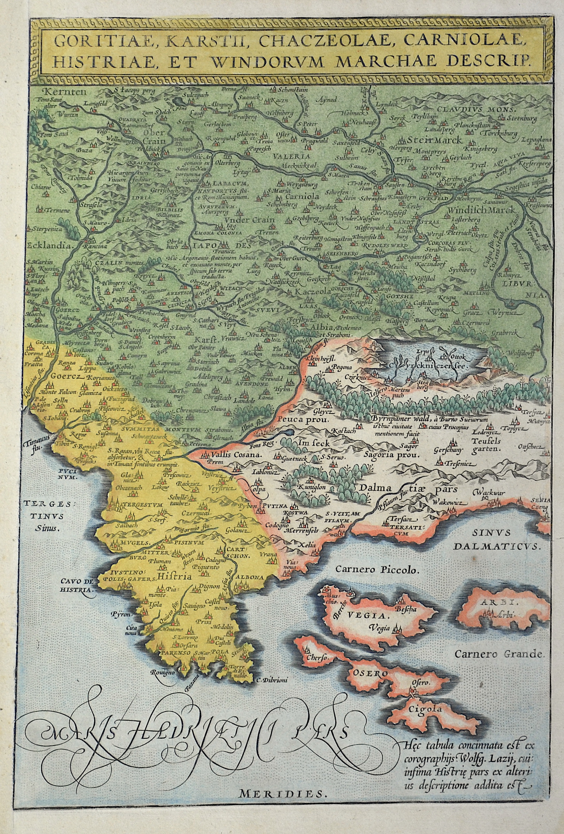
Goritiae, Karstii, Chaczeolae, Carniolae, Istriae, et Vindorum marchae descrip

| Article ID | EUY1793 |
Title | Goritiae, Karstii, Chaczeolae, Carniolae, Istriae, et Vindorum marchae descrip |
Description | Map shows Istria, Slovenia, northern Dalmatia and the southwest of Austria. |
| Year | ca. 1595 |
Artist | Ortelius (1527-1598) |
Abraham Ortelius (1527–1598) was a Flemish cartographer and publisher from Antwerp. Originally a map colorist, he became a major figure in cartography through his Theatrum Orbis Terrarum (1570), considered the first modern atlas—a uniform collection of reliable maps in book form. Influenced by Gerardus Mercator, Ortelius published several maps before compiling the Theatrum, which clearly showed America as a separate continent. The work was published in 42 editions and 7 languages by 1612. Unlike many of his peers, Ortelius cited his sources, and his atlas became a milestone in mapmaking and geographic knowledge. | |
Historical Description | In the historical sense, Eastern Europe refers to Ukraine, the European part of Russia, Belarus and the Republic of Moldova. Occasionally, the Caucasian countries of Georgia, Armenia and, conditionally, Azerbaijan are also seen as part of Eastern Europe. By Christian Giordano and other scholars, one of the six historical regions of Europe is called "Eastern Europe." The Eastern European countries are historically and culturally largely influenced by the Orthodox Church (Islamic Azerbaijan excepted) and were - in contrast to the Ottoman-dominated Balkans - under the rule of the Russian Empire. Like the Balkan countries, the countries of Eastern Europe were for a long time backward agricultural states (cf.: Intermediate Europe) and had no or only a limited share in the social developments of the Renaissance, Reformation and Enlightenment of the Western world. |
| Place of Publication | Antwerp |
| Dimensions (cm) | 34 x 23 cm |
| Condition | Very good |
| Coloring | original colored |
| Technique | Copper print |