

Adina Sommer
Antique and Contemporary Art
Winzerer Str. 154
80797 München
telephone
+49 89 304714
business hours:
by appointment
Email
![]()


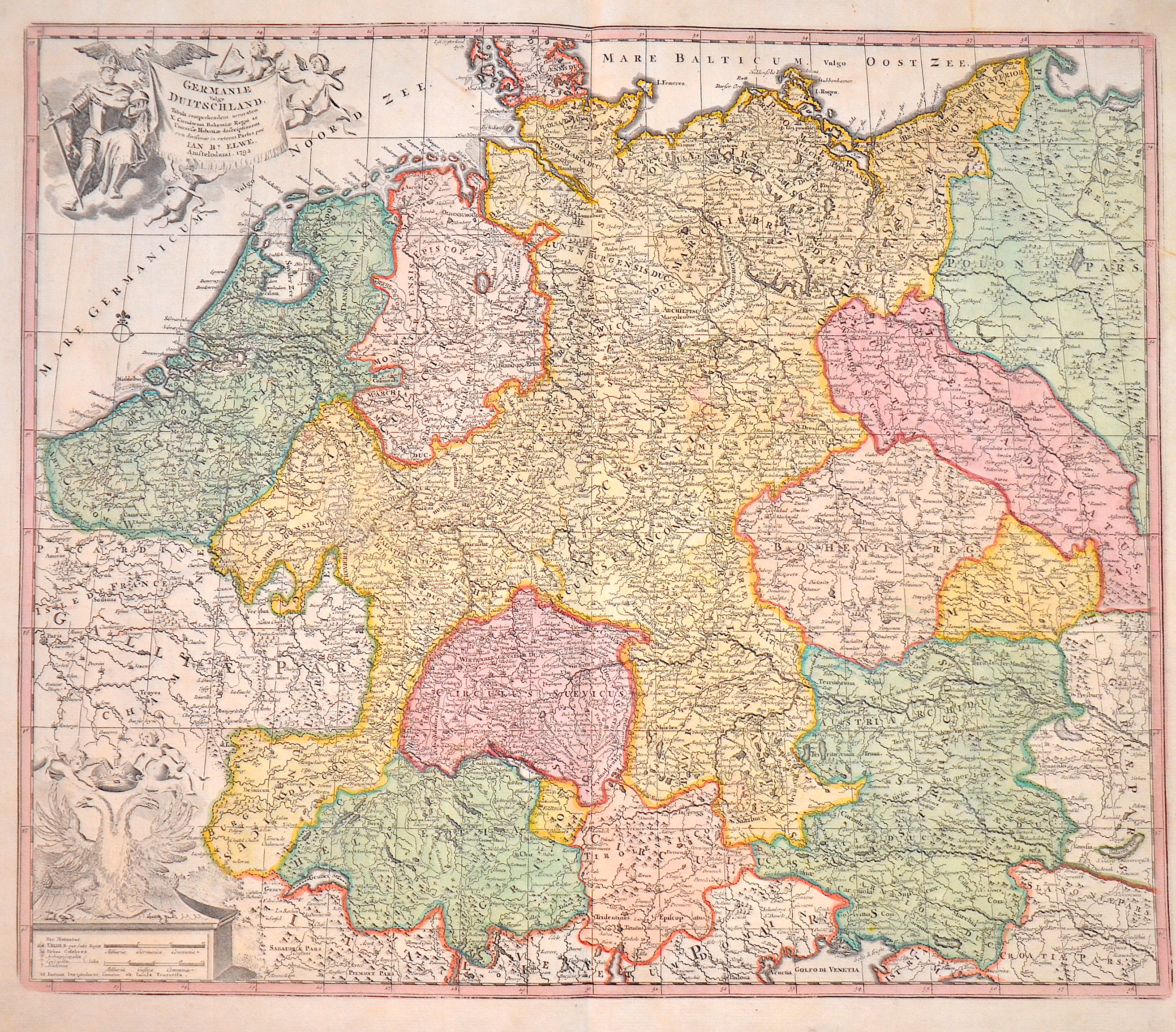
Germaniae Vulgo Duitschland,…

| Article ID | EUD3611 |
Title | Germaniae Vulgo Duitschland,… |
Description | Decorative map of Germany with Silesia, Bohemai, Netherlands, belgium, Elsass, Switzerland, Tyrol and Austria. With two cartouches, one with thegerman ; long necked double eagle;. |
| Year | dated 1792 |
Artist | Elwe (1777-1777) |
Jan Barend Elwe ( 177 - 1815), was a Dutch publisher and book seller who reissued maps by De L´Isle and Ottens and some other cartographers in the late 18th century. His famous map "Amerique Septentrionale Divisee en ses Principales Parties" was derived mainly from Sanson’s and Jaillot’s maps of 1656 and 1676. At this time, California was no longer shown as an island, but as a peninsular, and the Great Lakes to the north are enclosed, which was another feature often shown incorrectly on earlier maps of America. This map has been published in 1792 in an Atlas which included 37 other maps of different countries. | |
Historical Description | The concept of Germany as a distinct region in central Europe can be traced to Roman commander Julius Caesar, who referred to the unconquered area east of the Rhine as Germania, thus distinguishing it from Gaul (France), which he had conquered. In the High Middle Ages, the regional dukes, princes and bishops gained power at the expense of the emperors. Martin Luther led the Protestant Reformationagainst the Catholic Church after 1517, as the northern states became Protestant, while the southern states remained Catholic. The two parts of the Holy Roman Empire clashed in the Thirty Years' War (1618–1648). 1648 marked the effective end of the Holy Roman Empire and the beginning of the modern nation-state system, with Germany divided into numerous independent states, such as Prussia, Bavaria and Saxony. |
| Place of Publication | Amsterdam |
| Dimensions (cm) | 49,5 x 58 cm |
| Condition | Perfect condition |
| Coloring | original colored |
| Technique | Copper print |