

Adina Sommer
Antique and Contemporary Art
Winzerer Str. 154
80797 München
telephone
+49 89 304714
business hours:
by appointment
Email
![]()


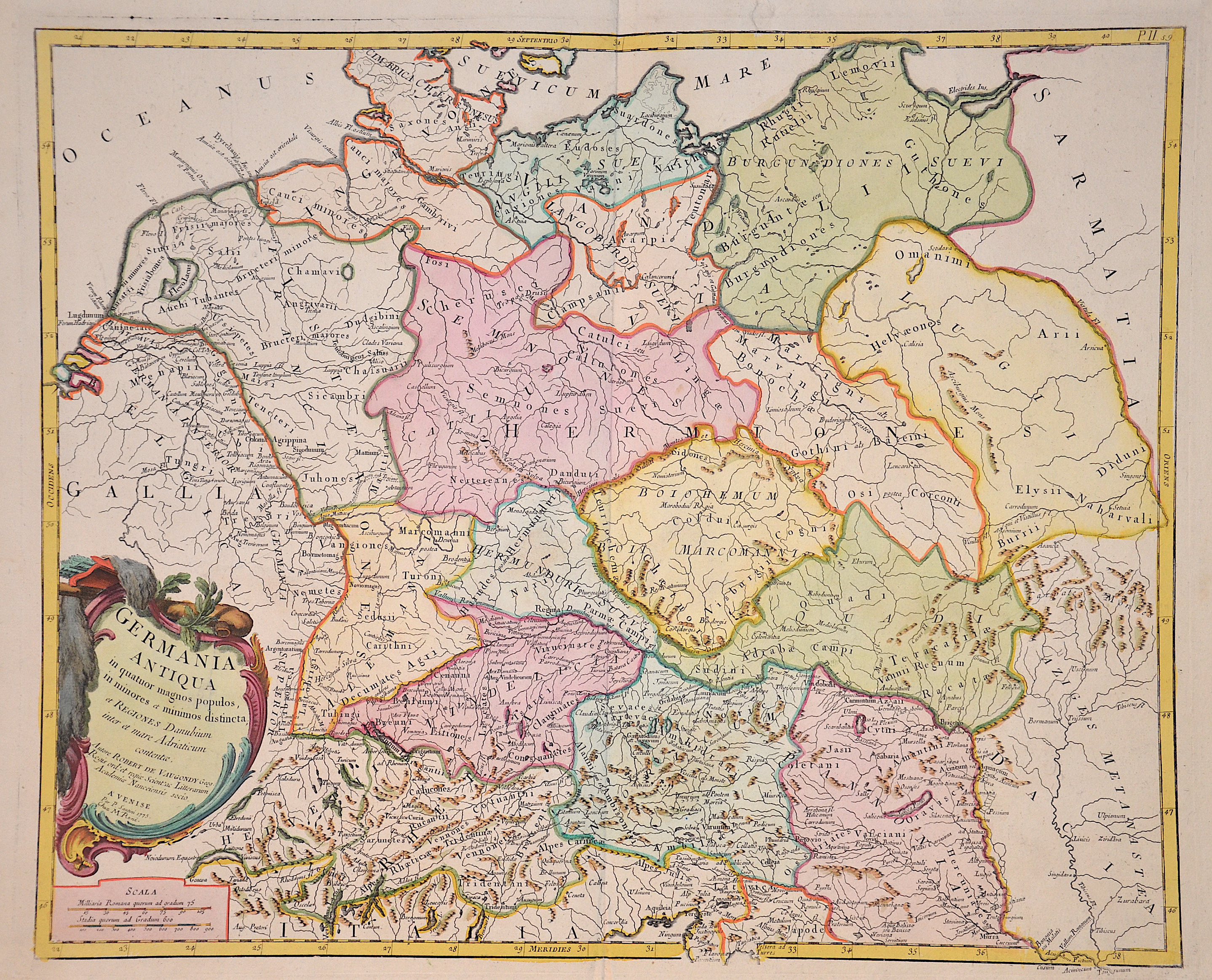
Germania Antiqua in quatuor magnos populos, in minores et minimos distincta, et Regiones Danubium inter et mare Adriaticum contentae.

| Article ID | EUD5195 |
Title | Germania Antiqua in quatuor magnos populos, in minores et minimos distincta, et Regiones Danubium inter et mare Adriaticum contentae. |
Description | Map shows the whole of Germany with Poland, the Czech Republic, Moravia, Austria, a title cartouche and a mileage scale. Author Robert de Vaugondy, edited by P. Santini. |
| Year | c. 1775 |
Artist | Santini |
Francois (Francesco) Santini was an Italian cartographer and map publisher with his brother Paolo and based in Venice. He re-issued the works of Robert de Vaugondy, Homann’s Heirs and De L’Isle. At this time, cartography in Italy was commercialy very slow, so Santini, essentially a publisher rather than a map-maker modelled his work on two of the leading practitioners of cartography in Europe, the French map-makers Gilles and Didier Robert de Vaugondy. Their “Atlas Universel” was first published in 1758, and was much re-issued there after. The atlas was a commercial and cartographic success, with widespread influence on map-makers throughout Europe, most notably on Santini, who commissioned a new set of plates, published in 1776, being almost exact copies of the original French maps. | |
Historical Description | The concept of Germany as a distinct region in central Europe can be traced to Roman commander Julius Caesar, who referred to the unconquered area east of the Rhine as Germania, thus distinguishing it from Gaul (France), which he had conquered. In the High Middle Ages, the regional dukes, princes and bishops gained power at the expense of the emperors. Martin Luther led the Protestant Reformationagainst the Catholic Church after 1517, as the northern states became Protestant, while the southern states remained Catholic. The two parts of the Holy Roman Empire clashed in the Thirty Years' War (1618–1648). 1648 marked the effective end of the Holy Roman Empire and the beginning of the modern nation-state system, with Germany divided into numerous independent states, such as Prussia, Bavaria and Saxony. |
| Place of Publication | Venice |
| Dimensions (cm) | 48 x 58 cm |
| Condition | Tear on upper margin perfectly restored |
| Coloring | original colored |
| Technique | Copper print |