

Adina Sommer
Antique and Contemporary Art
Winzerer Str. 154
80797 München
telephone
+49 89 304714
business hours:
by appointment
Email
![]()


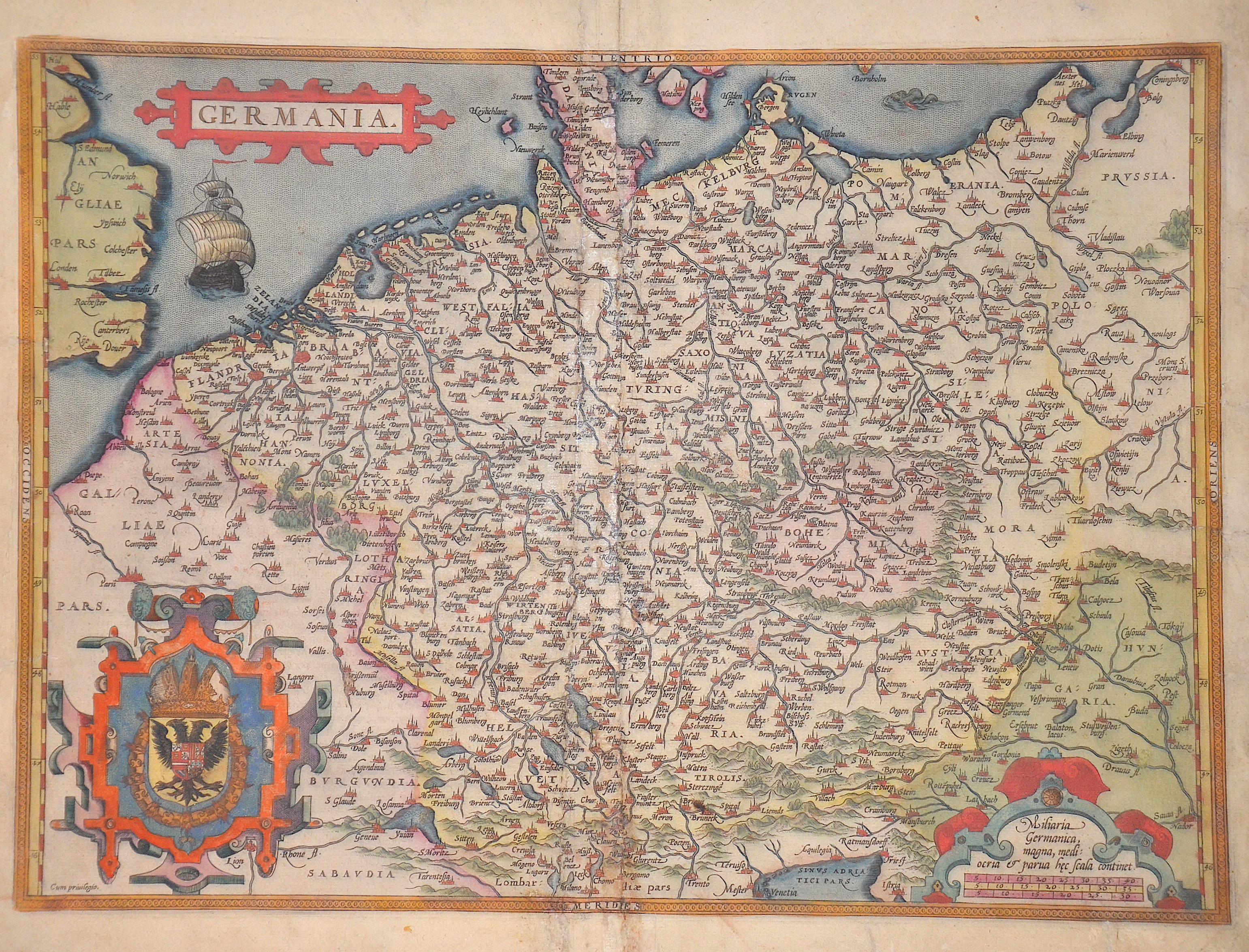
Germania.

| Article ID | EUD5155 |
Title | Germania. |
Description | Map shows total Germany with three scrollwork cartouches and the Habsburg double-headed eagle coat of arms. |
| Year | ca. 1595 |
Artist | Ortelius (1527-1598) |
Abraham Ortelius (1527–1598) was a Flemish cartographer and publisher from Antwerp. Originally a map colorist, he became a major figure in cartography through his Theatrum Orbis Terrarum (1570), considered the first modern atlas—a uniform collection of reliable maps in book form. Influenced by Gerardus Mercator, Ortelius published several maps before compiling the Theatrum, which clearly showed America as a separate continent. The work was published in 42 editions and 7 languages by 1612. Unlike many of his peers, Ortelius cited his sources, and his atlas became a milestone in mapmaking and geographic knowledge. | |
Historical Description | The concept of Germany as a distinct region in central Europe can be traced to Roman commander Julius Caesar, who referred to the unconquered area east of the Rhine as Germania, thus distinguishing it from Gaul (France), which he had conquered. In the High Middle Ages, the regional dukes, princes and bishops gained power at the expense of the emperors. Martin Luther led the Protestant Reformationagainst the Catholic Church after 1517, as the northern states became Protestant, while the southern states remained Catholic. The two parts of the Holy Roman Empire clashed in the Thirty Years' War (1618–1648). 1648 marked the effective end of the Holy Roman Empire and the beginning of the modern nation-state system, with Germany divided into numerous independent states, such as Prussia, Bavaria and Saxony. |
| Place of Publication | Antwerp |
| Dimensions (cm) | 36,5 x 50,5 cm |
| Condition | Restoration at centerfold and corner |
| Coloring | original colored |
| Technique | Copper print |