

Adina Sommer
Antique and Contemporary Art
Winzerer Str. 154
80797 München
telephone
+49 89 304714
business hours:
by appointment
Email
![]()


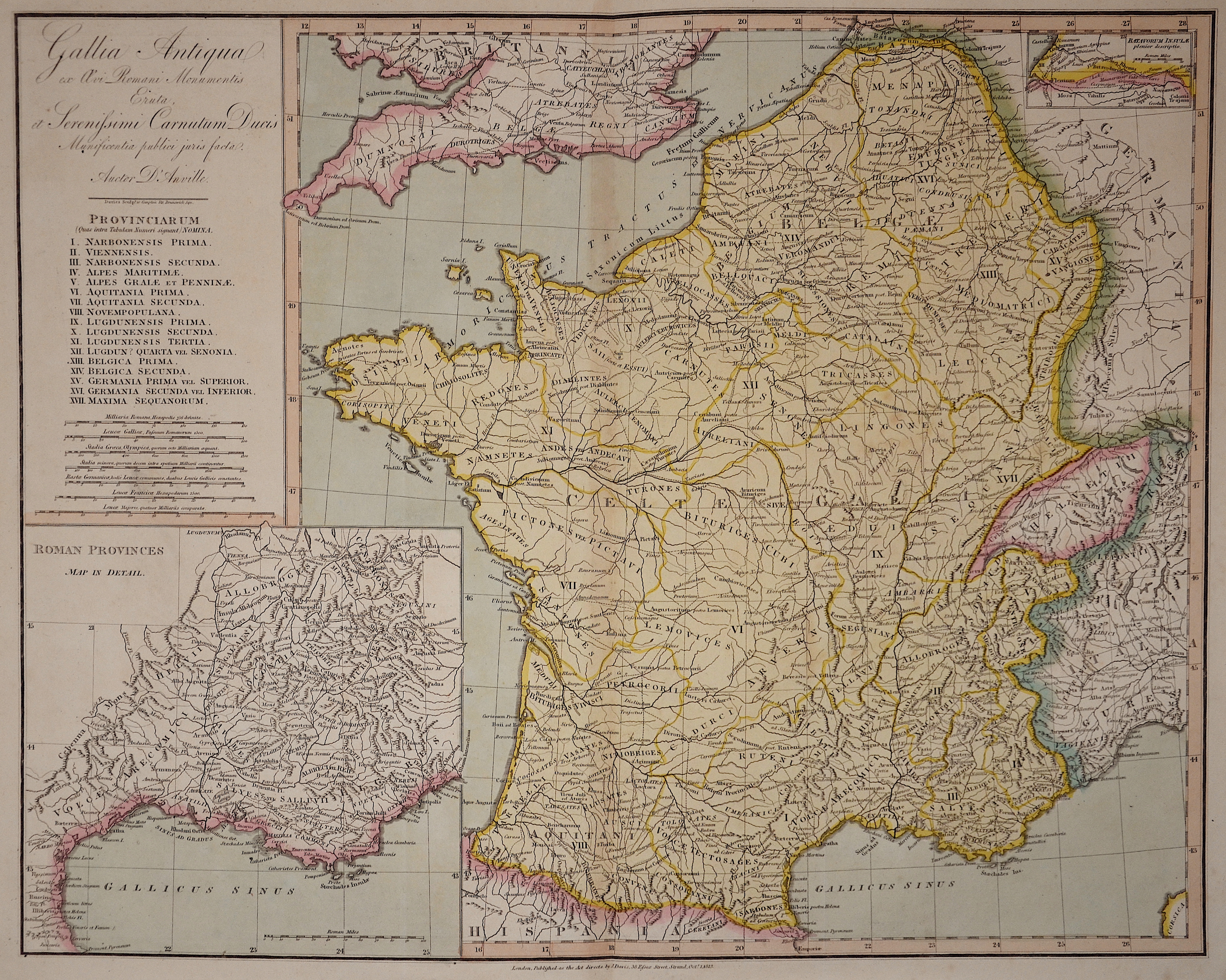
Gallia Antiqua

| Article ID | EUF3801 |
Title | Gallia Antiqua |
Description | Map shows total France with its 17 provinces and two inset maps with parts of France. |
| Year | ca. 1813 |
Artist | Anville´d (1697-1782) |
Jean Baptiste Bourguignon d'Anville (1697 -1782), was a French geographer and the reformer of old and new cartography. Bourguignon d'Anville devoted himself early to geographical studies, already in the age of 21 became a royal geographer.With this appointment he later rose as a private secretary of Louis, Duke of Orléans. He published 211 maps and became a member of the Académie des sciences in 1773. His valuable map collection, consisting of 10,500 numbers, was purchased for the Royal Library of Paris, now the Bibliothèque Nationale de France. Jean Baptiste Bourguignon d'Anville, was a geographer and cartographer who greatly improved the standards of map making. Particularly valuable are his maps of ancient geography, which are characterized by careful, accurate work and are largely based on original research. He left unknown areas of continents blank and noted dubious information as such; compared to the elaborate maps of his predecessors, his maps seemed empty. His first serious map, that of ancient Greece, was published when he was fifteen years old. At the age of twenty-two he was appointed one of the king's geographers and began to attract the attention of the first authorities. D'Anville's studies included everything geographical in the world's literature as far as he could find it: To this end, he searched not only ancient and modern historians, travelers, and storytellers of every kind, but also poets, orators, and philosophers. One of his favorite themes was to reform geography by putting an end to blind copying of older maps, by testing the generally accepted positions of places by a rigorous examination of all descriptive authority, and by excluding from cartography any name that was inadequately supported. | |
Historical Description | It is estimated that today's France was settled about 48,000 years ago. Important rock paintings from the Paleolithic period have been preserved in the Lascaux cave From 600 BC Chr. Phoenician and Greek traders founded bases on the Mediterranean coast, while Celts settled from the northwest the country that was later called by the Romans as Gaul. The French Middle Ages were marked by the rise of kingship in the constant struggle against the independence of the nobility and the secular violence of the monasteries and religious orders. Starting from today's Île-de-France, the Capetinians enforced the idea of a unitary state, which was underpinned by participation in various crusades. The Normans invaded Normandy repeatedly, hence its name; in 1066 they conquered England. A long series of armed conflicts with England began under Louis VII after Ludwig's divorced wife Eleonore von Poitou and Aquitaine married Heinrich Plantagenet in 1152 and thus about half of France's territory fell to England. Philip II August, together with the Hohenstaufen family, largely displaced England from France until 1299; the English king Henry III Ludwig IX. recognize as suzerain. From 1226 France became an inheritance monarchy; in 1250 Ludwig IX was one of the most powerful rulers in the West. In the 17th and 18th centuries, France held European leadership and supremacy. The political and cultural charisma was significant: The court of Louis XIV became the model for absolutist states throughout Europe and the French Revolution with the declaration of human and civil rights, together with occupations by Napoleon Bonaparte, started in many countries the time and again Setbacks interrupted development towards democracy. |
| Place of Publication | London |
| Dimensions (cm) | 45,5 x 57,5 |
| Condition | Perfect condition |
| Coloring | original colored |
| Technique | Steel engraving |