

Adina Sommer
Antique and Contemporary Art
Winzerer Str. 154
80797 München
telephone
+49 89 304714
business hours:
by appointment
Email
![]()


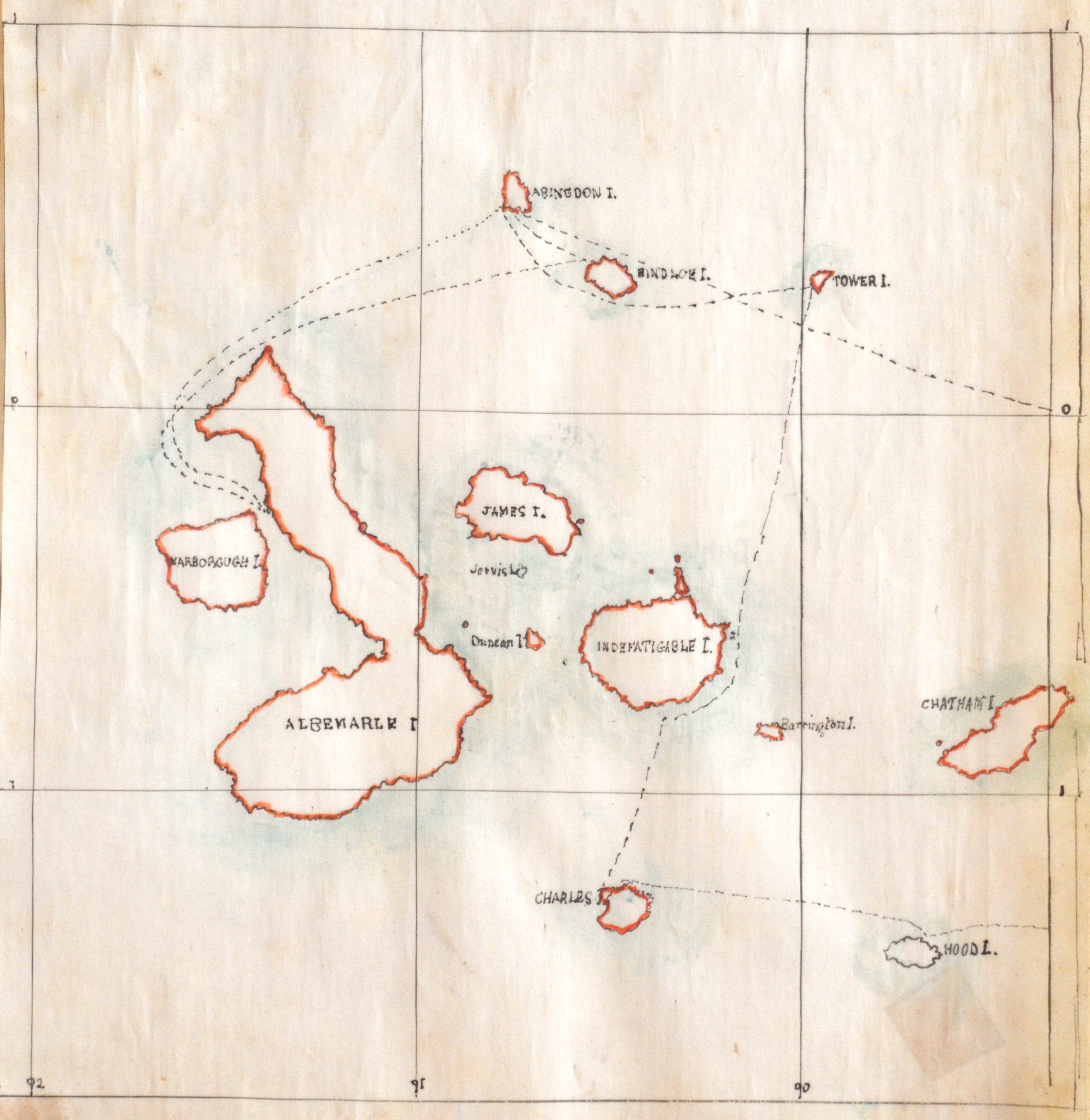
Galapagos Islands.

| Article ID | AMS1162 |
Title | Galapagos Islands. |
Description | Hand colored an drawn manuscriped map of the Galapalos Islands in the Pacific ocean. |
| Year | ca. 1800 |
Artist | Anonymus |
Historical Description | The Galapagos Islands are an archipelago in the eastern Pacific Ocean. They are located on the equator and belong to Ecuador. The extraordinary and unique flora and fauna of the archipelago are a UNESCO World Heritage Site. The European discovery of the Galápagos Islands took place when the Spaniard Tomás de Berlanga, then Bishop of Panama, sailed to Peru to settle a dispute between Francisco Pizarro. De Berlanga's ship went off course and his crew reached the islands on 1535, stranding on one of the volcanic islands. The archipelago was initially known as the Islas Encantadas 'Enchanted Islands', as no one would have expected to find islands this far out in the ocean and strong currents between and around the islands could easily give sailors the impression that the islands themselves were constantly changing position. The first English captain to visit the Galápagos Islands was Richard Hawkins in 1593. From the 17th century until the early 19th century, the islands were a hiding place and refuge for mostly English pirates - including John Cook and William Cowley - who mostly raided Spanish gold ships from Mexico and South America. In 1832, General José de Villamil took possession of the islands for Ecuador. He named the islands Archipiélago del Ecuador. The first permanent settlement of the islands began. Prior to this, the islands were owned by the Spanish, who showed no interest in them. In the 19th century, the islands were renamed Islas Galápagos after the giant tortoises found there. |
| Dimensions (cm) | 21 x 19 |
| Condition | Mounted |
| Coloring | painted |
| Technique | Manuscript |