

Adina Sommer
Antique and Contemporary Art
Winzerer Str. 154
80797 München
telephone
+49 89 304714
business hours:
by appointment
Email
![]()


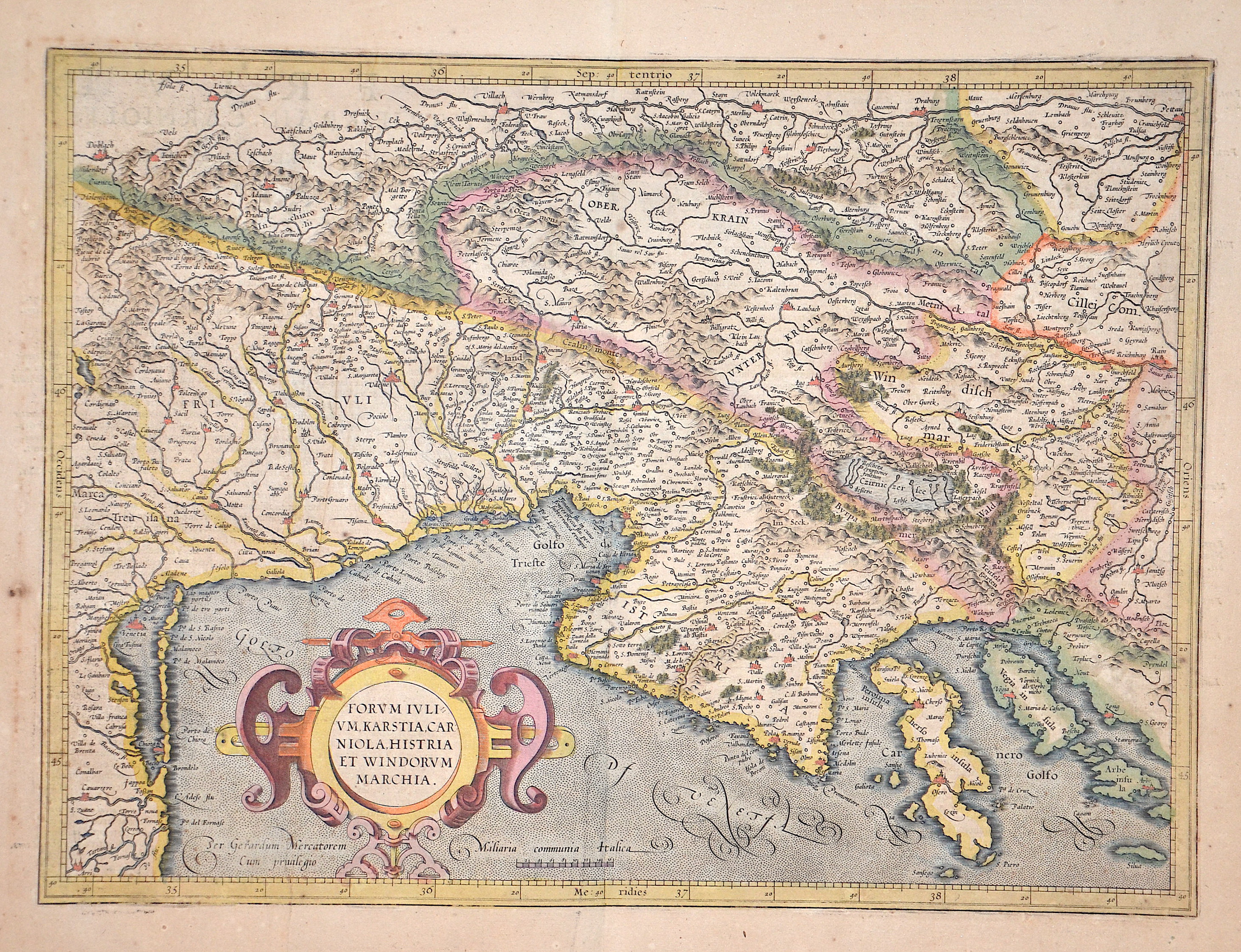
Forum ivlium Karstia Carniola Histria et Windorum Marchia.

| Article ID | EUY1718 |
Title | Forum ivlium Karstia Carniola Histria et Windorum Marchia. |
Description | Map shows the northern part of Croatia with Istria and partly Slovenia, Italy, Austria and a title cartouche. Original colored at the time. |
| Year | ca. 1630 |
Artist | Mercator (1512-1594) |
Gerardus Mercator (1512 - 1594). He was a cartographer, philosopher and mathematician. He is best known for his work in cartography, in particular the world map of 1569 based on a new projection which represented sailing courses of constant bearing as straight lines. He is renowned to the present day as the cartographer who created a world map based on a new projection which represented sailing courses of constant bearing as straight lines. In his own day he was the world's most famous geographer but in addition he had interests in theology, philosophy, history, mathematics and magnetism as well as being an accomplished engraver, calligrapher and maker of globes and scientific instruments. He wrote few books but much of his knowledge is to be found in the copious legends on his wall maps and the prefaces that he composed for his atlas ,the first in which the term "atlas" appears and the sections within it. | |
Historical Description | Following the decisive Ottoman victories, Croatia was split into civilian and military territories, with the partition formed in 1538. The military territories would become known as the Croatian Military Frontier and were under direct Imperial control. Ottoman advances in the Croatian territory continued until the 1593 Battle of Sisak, the first decisive Ottoman defeat, and stabilisation of borders. The Ottoman wars instigated great demographic changes. Croats migrated towards Austria and the present-day Burgenland Croats are direct descendants of these settlers. o replace the fleeing population, the Habsburgs encouraged the Christian populations of Bosnia and Serbia to provide military service in the Croatian Military Frontier. Serb migration into this region peaked during the Great Serb Migrations of 1690 and 1737–39. Between 1797 and 1809 the First French Empire gradually occupied the entire eastern Adriatic coastline and a substantial part of its hinterland, ending the Venetian and the Ragusan republics, establishing the Illyrian Provinces. |
| Place of Publication | Antwerp |
| Dimensions (cm) | 35 x 47 cm |
| Condition | Some browning |
| Coloring | original colored |
| Technique | Copper print |