

Adina Sommer
Antique and Contemporary Art
Winzerer Str. 154
80797 München
telephone
+49 89 304714
business hours:
by appointment
Email
![]()


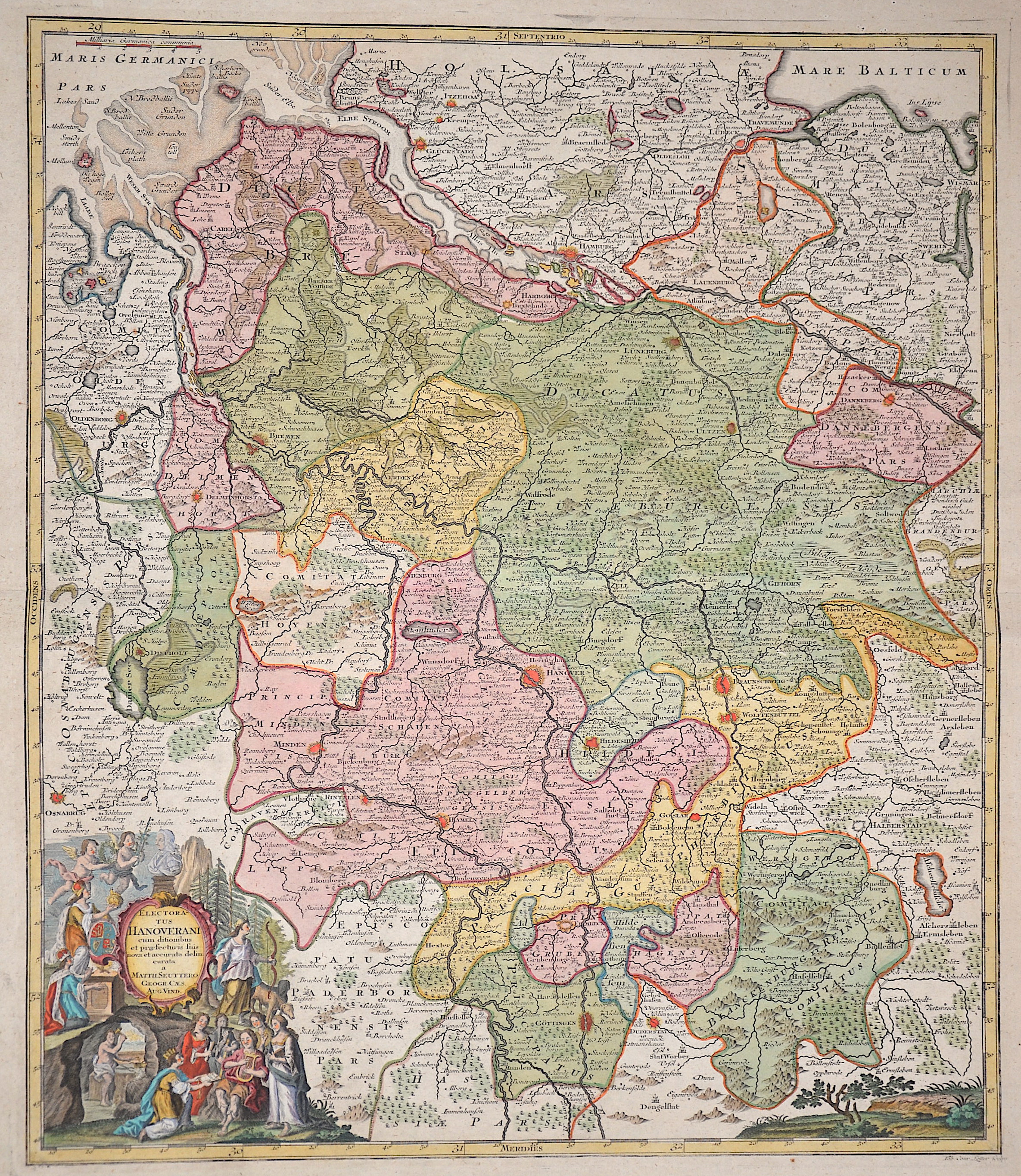
Electoratus Hanoverani cum ditionibus et praefecturis suis nova et accurata delincurata

| Article ID | EUD4829 |
Title | Electoratus Hanoverani cum ditionibus et praefecturis suis nova et accurata delincurata |
Description | Map shows the Electorate of Hanover. On the lower left decorative title cartouche surrounded by Diana hunting, Vulcan in the forge, Apollo with the muses, putti, a bust and much more. The map was published on the occasion of the foundation of the Georg August University in Göttingen in 1737. |
| Year | ca. 1737 |
Artist | Lotter/ Seutter (1717-1777) |
Tobias Conrad Lotter ( 1717- 1777) was a carthographer and publisher in Augsburg. He married the elder daughter of Matthäus Seutters and worked in the company of his father in la was map maker. He produced under the „ eye“ of M. Seutter his first „ Asia minor“ atlas between 1740 and 1744. The Asia minor altas of Lotter, Praecipua orbis terrarum imperia, regna et provincias, Germania potissimum tabelli 80 exactae delineatis sistens usui militiae ducum ac peregrinantium maxime accommodatus opera contains 63 maps, mosly Lotters work and other maps from Seutter where he put his name in the lower margin. | |
Historical Description | The name Saxony is derived from that of the Germanic confederation of tribes called Saxons. Before the late Middle Ages there was a single duchy of Saxony. The term "Lower Saxony" was used after the dissolution of the original duchy in the late 13th century to distinguish the parts of the former duchy that were ruled by the House of Welfare, on the one hand from the electorate of Saxony and from the duchy of Westphalia on the other. The name and coat of arms of today's state go back to the Germanic tribe of the Saxons. During the migration period, some of the Saxon peoples left their homeland in Holstein around the 3rd century and advanced south across the Elbe, where they expanded into the sparsely populated regions in the rest of the lowlands in today's northwestern Germany and the northeastern part of today's Netherlands. From the 7th century onwards, the Saxons occupied a settlement area that roughly corresponds to today's federal state of Lower Saxony, Westphalia and a number of areas in the east, for example in today's west and north Saxony-Anhalt. From the 14th century onwards it referred to the Duchy of Saxony-Lauenburg (as opposed to Saxony-Wittenberg). When the imperial districts were created in 1500, a distinction was made between a district in Lower Saxony and a district in Lower Rhine-Westphalia. The latter comprised the following areas, which today belong wholly or partially to the state of Lower Saxony: the Diocese of Osnabrück, the Diocese of Münster, the County of Bentheim, the County of Hoya, the Principality of East Friesland, the Principality of Verden, the district of Diepholz, the district of Oldenburg, the district of Schaumburg and the district of Spiegelberg .The close historical links between the domains of the Lower Saxon Circle now in modern Lower Saxony survived for centuries especially from a dynastic point of view. The majority of historic territories whose land now lies within Lower Saxony were sub-principalities of the medieval, Welf estates of the Duchy of Brunswick-Lüneburg. All the Welf princes called themselves dukes "of Brunswick and Lüneburg" despite often ruling parts of a duchy that was forever being divided and reunited as various Welf lines multiplied or died out. |
| Place of Publication | Augsburg |
| Dimensions (cm) | 57 x 49 cm |
| Condition | Perfect condition |
| Coloring | original colored |
| Technique | Copper print |