

Adina Sommer
Antique and Contemporary Art
Winzerer Str. 154
80797 München
telephone
+49 89 304714
business hours:
by appointment
Email
![]()


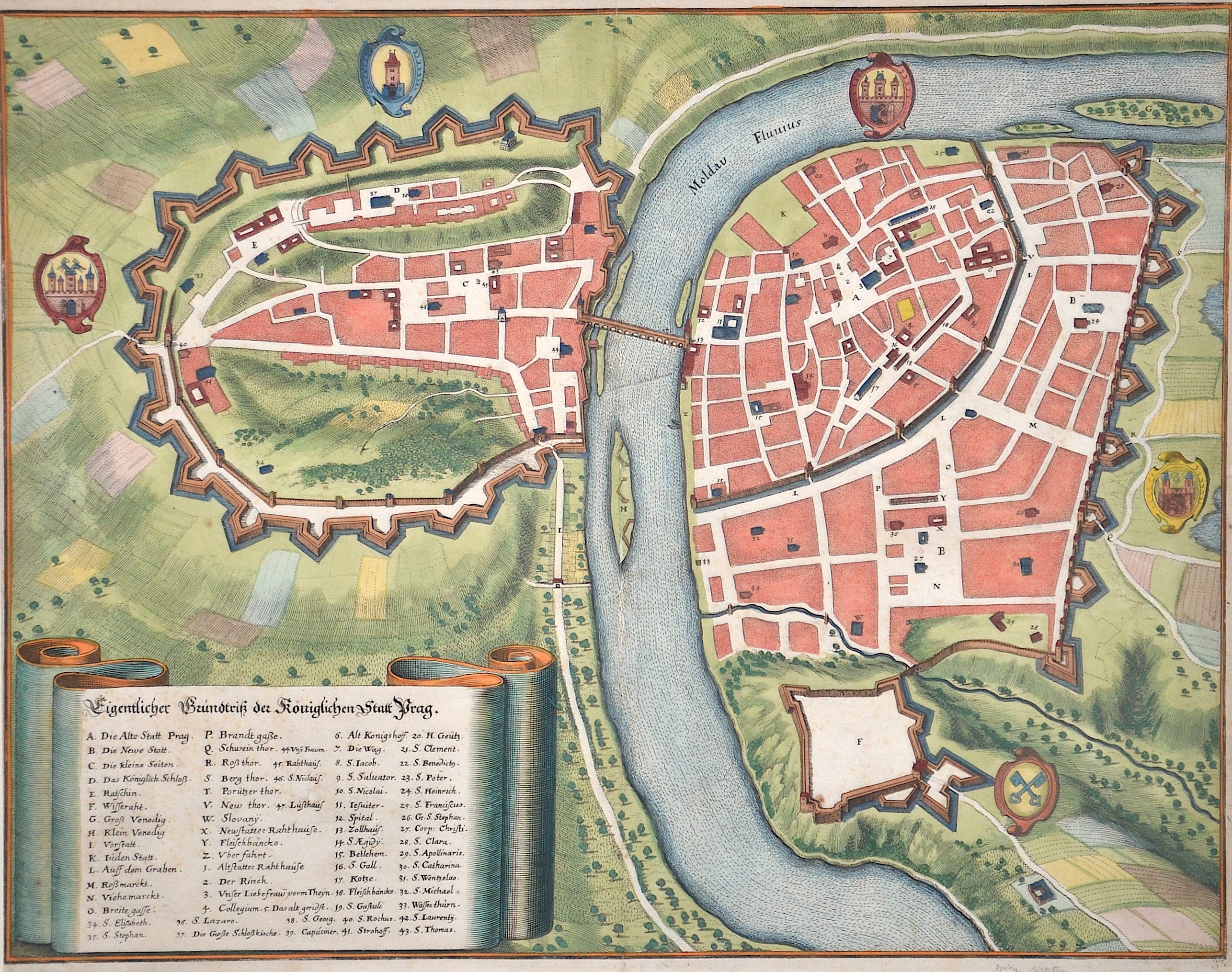
Eigentlicher Grundriß der Königlichen Stadt Prag

| Article ID | EUT1906 |
Title | Eigentlicher Grundriß der Königlichen Stadt Prag |
Description | Map shows the city map of Prague. |
| Year | ca. 1650 |
Artist | Merian (1593-1650) |
Matthäus Merian (1593 – 1650) , born in Basel, learned the art of copperplate engraving in Zurich and subsequently worked and studied in Strasbourg, Nancy, and Paris, before returning to Basel in 1615. The following year he moved to Frankfurt, Germany where he worked for the publisher Johann Theodor de Bry. He married his daughter, Maria Magdalena 1617. In 1620 they moved back to Basel, only to return three years later to Frankfurt, where Merian took over the publishing house of his father-in-law after de Bry's death in 1623. In 1626 he became a citizen of Frankfurt and could henceforth work as an independent publisher. He is the father of Maria Sibylla Merian, who later published her the famous and wellknown studies of flowers, insects and butterflies. | |
Historical Description | Prague has been a political, cultural and economic centre of central Europe complete with a rich history. Founded during the Romanesqueand flourishing by the Gothic, Renaissance and Baroque eras, Prague was the capital of the Kingdom of Bohemia and the main residence of several Holy Roman Emperors, most notably of Charles IV (1346–1378).It was an important city to the Habsburg Monarchy and its Austro-Hungarian Empire. The city played major roles in the Bohemian and Protestant Reformation, the Thirty Years' War and in 20th-century history as the capital of Czechoslovakia, during both World Wars and the post-war Communist era. During the thousand years of its existence, the city grew from a settlement stretching from Prague Castle in the north to the fort of Vyšehradin the south, becoming the capital of a modern European country, the Czech Republic. |
| Place of Publication | Frankfurt on Main |
| Dimensions (cm) | 29 x 37,5 cm |
| Condition | Restored tear at the center |
| Coloring | original colored |
| Technique | Copper print |