

Adina Sommer
Antique and Contemporary Art
Winzerer Str. 154
80797 München
telephone
+49 89 304714
business hours:
by appointment
Email
![]()


Egyptenladt
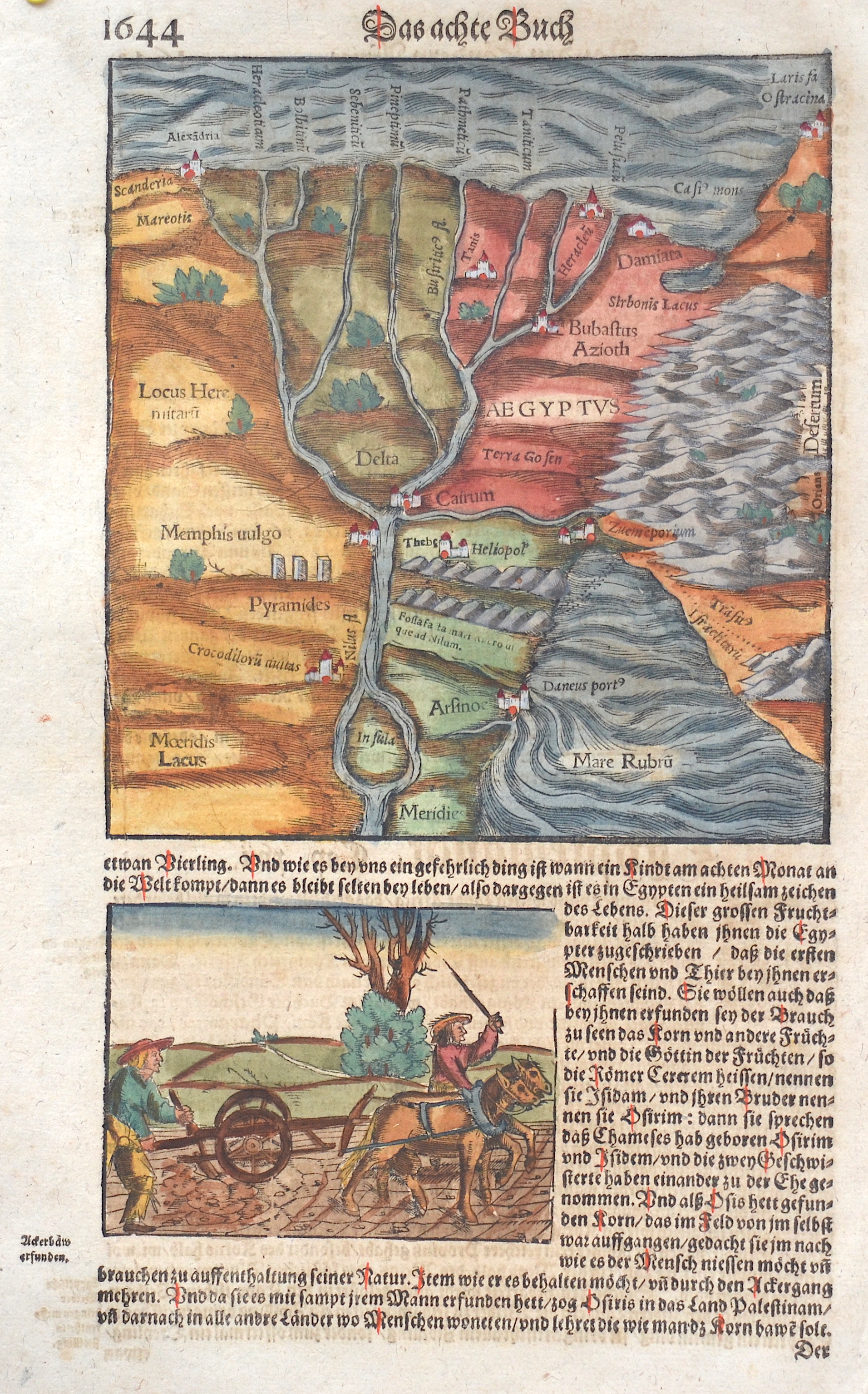

| Article ID | AF088 |
Title | Egyptenladt |
Description | Map shows the north part of Egypt and the Red Sea. Kairo-The immense debt resulting from Isma'il's projects provided a pretext for increasing European control, which culminated with the British invasion in 1882.The city's economic centre quickly moved west toward the Nile, away from the historic Islamic Cairo section and toward the contemporary, European-style areas built by Isma'il.Europeans accounted for five percent of Cairo's population at the end of the 19th century, by which point they held most top governmental positions. |
| Year | ca. 1550 |
Artist | Münster (1489-1552) |
Sebastian Münster (1489–1552) was a leading Renaissance cosmographer. His most famous work, the Cosmographia (1544), was a comprehensive description of the world with 24 maps, based on research dating back to 1528. Continuously revised, the 1550 edition already included many new maps. It was the first scientific yet accessible world description published in German, illustrated with numerous woodcuts by artists such as Hans Holbein the Younger. Between 1544 and 1650, the Cosmographia appeared in 46 editions (27 in German) and was translated into several languages. Münster’s work combined the knowledge of scholars, artists, and travelers and remained influential long after his death. | |
Historical Description | Egypt: The ancient Egyptian country name Kemet means "Black Land" and refers to the fertile soil of the Nile Valley in contrast to the "Red Land" of the neighboring deserts. The European terms Egypt, engl. Egypt comes from the Latin Aegyptus and thus ultimately from the ancient Greek Aigypto. The Copts claim to be the direct descendants of the ancient Egyptian pharaohs. From their name came the Greek Aigyptos, which became Egypt in German. Islamic Arabs conquered the Nile valley around 640; From now on Egypt was dominated by changing power centers - Damascus, Baghdad, Cairo. Under the Umayyads (661–750), Arab tribes settled in the fertile plains and from then on determined the cultural appearance of Egypt. With the coming to power of Saladin, the founder of the Ayyubid dynasty (1171–1249), Cairo became the center of Muslim resistance to the Christian crusades. Around 1250 the palace guard, which was made up of Mamluks, originally mostly Turkish military slaves, rose and took over. At the end of the 13th century, the Mamluks destroyed the last Crusader states on Asian soil. Even after Egypt was conquered by the Ottoman Empire in 1517, administration remained in their hands. The economic decline resulting from the discovery of the sea route to India (1498) made Egypt one of the poorest provinces of the Ottoman Empire. It was not until the landing of the French expeditionary force under Napoleon Bonaparte in 1798 that the Ottoman rule ended. When the French had to abandon their Oriental campaign after the British Admiral Nelson won at Abukir in the same year, the Albanian officer Muhammad Ali Pasha used the situation to seize power (1805–1849). He and his successors were able to achieve a certain independence under Ottoman rule, pursued an expansionary policy and initiated the history of modern Egypt. |
| Place of Publication | Basle |
| Dimensions (cm) | 29,5 x 18 cm |
| Condition | Perfect condition |
| Coloring | original colored |
| Technique | Woodcut |