

Adina Sommer
Antique and Contemporary Art
Winzerer Str. 154
80797 München
telephone
+49 89 304714
business hours:
by appointment
Email
![]()


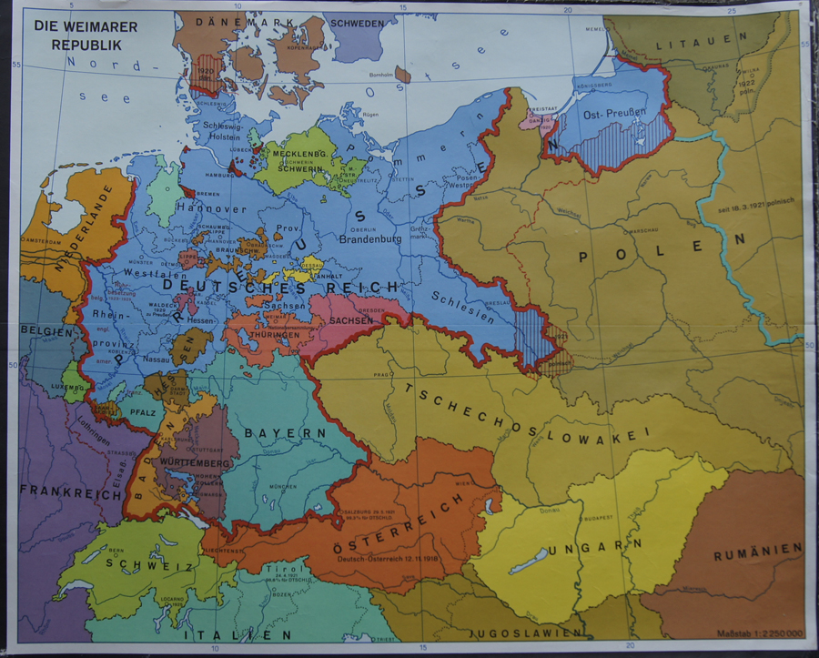
Die Weimarer Republik

| Article ID | EUP3564 |
Title | Die Weimarer Republik |
Description | Map of the Weimarer Republik with Silesia, Prussia and East Prissia), Poland, Lithuania, Czech, Austria, Hungary, Switzerland, Netherlands etc. Weimar Republic is an unofficial historical designation for the German state between 1919 and 1933. The name derives from the city of Weimar, where its constitutional assembly first took place. The official name of the state was still Deutsches Reich; it remained unchanged since 1871. In English the country was usually known simply as Germany. |
| Year | ca. 1950 |
Artist | Anonymus |
Historical Description | Poland is bordered by the Baltic Sea, Russia's Kaliningrad Oblast and Lithuania to the north, Belarus and Ukraine to the east, Slovakia and Czech Republic, to the south, and Germany to the west. The establishment of the Polish state can be traced back to AD 966, when Mieszko I ruler of the realm coextensive with the territory of present-day Poland, converted to Christianity. The Kingdom of Poland was founded in 1025, and in 1569 it cemented its longstanding political association with the Grand Duchy of Lithuania. This union formed the Polish–Lithuanian Commonwealth, one of the largest at the end of the 18th century. Poland regained its independence in 1918 with the Treaty of Versailles. It was one of the most populous countries of 16th- and 17th-century Europe, with a uniquely liberal political system, which adopted Europe's first written national constitution, the Constitution of 1791. |
| Dimensions (cm) | 53 x 65,5 cm |
| Condition | Mounted on linen |
| Coloring | colored |
| Technique | Chromo Lithography |