

Adina Sommer
Antique and Contemporary Art
Winzerer Str. 154
80797 München
telephone
+49 89 304714
business hours:
by appointment
Email
![]()


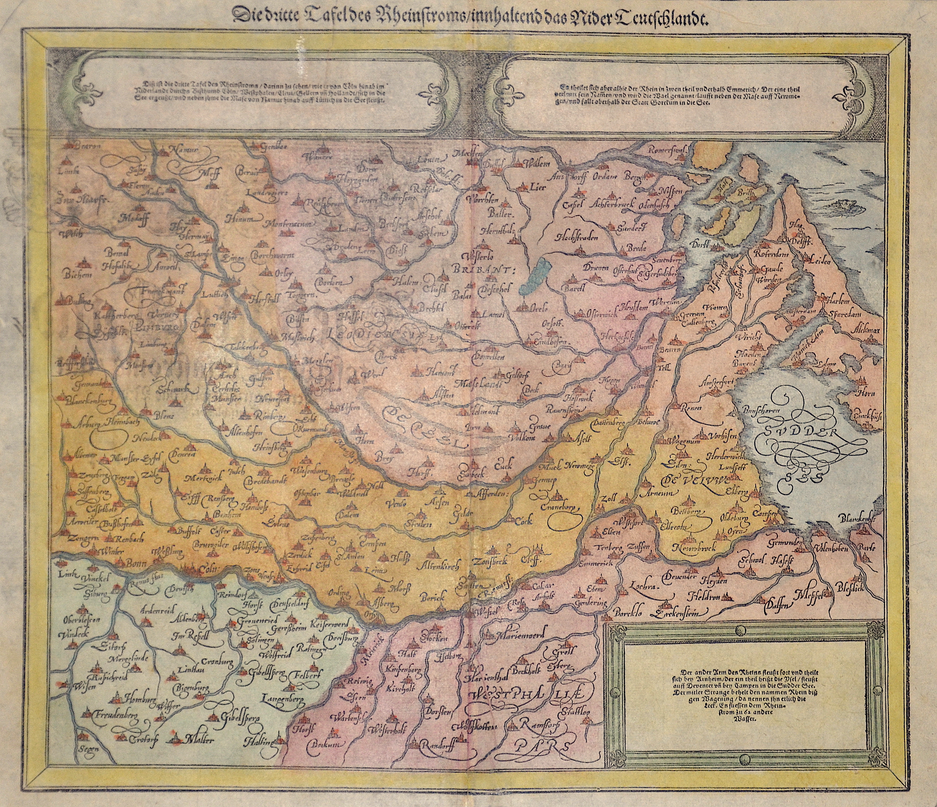
Die ander Tafel des Rheinstroms/ begreiffend die Pfaltz/Ostereich/Eyfel/ Die dritte Tafel des Rheinsroms/enthaltend das nider Deutschlandt

| Article ID | EUD2150 |
Title | Die ander Tafel des Rheinstroms/ begreiffend die Pfaltz/Ostereich/Eyfel/ Die dritte Tafel des Rheinsroms/enthaltend das nider Deutschlandt |
Description | Map shows the Lower Rhine and Delta Rhine from Cologne (Germany) to the North Sea (Netherlands). It shows the cities of Utrecht, Amsterdam, Maastricht, Falkenburg, Rotterdam, The Hague, Leiden, Liège, Breda, Limburg, Kleve and three cartouches with descriptions. The map is oriented to the west and the reverse shows a title cartouche. |
| Year | ca. 1574 |
Artist | Münster (1489-1552) |
Sebastian Münster (1489–1552) was a leading Renaissance cosmographer. His most famous work, the Cosmographia (1544), was a comprehensive description of the world with 24 maps, based on research dating back to 1528. Continuously revised, the 1550 edition already included many new maps. It was the first scientific yet accessible world description published in German, illustrated with numerous woodcuts by artists such as Hans Holbein the Younger. Between 1544 and 1650, the Cosmographia appeared in 46 editions (27 in German) and was translated into several languages. Münster’s work combined the knowledge of scholars, artists, and travelers and remained influential long after his death. | |
Historical Description | The Rhine is one of the most important rivers in Europe and has played a significant role in the history and development of the region. It connects several countries, including Switzerland, Germany, France, and the Netherlands. In ancient Europe, the Rhine was an important border, separating the Roman Empire from the Germanic tribes to the north. The Romans used the Rhine as a trade and transport route and built several fortresses along the river to secure their border, including the well-known Limes (border fortifications). The Rhine played a central role in the spread of Roman culture and civilization in the areas along the river. In the Middle Ages, the Rhine was not only an important trade route but also a strategic political point. Cities like Cologne, Mainz, and Speyer along the Rhine developed into important commercial centers. The river was a central part of the Holy Roman Empire and played a key role in the political power dynamics of the region. In the late 18th and early 19th centuries, the Rhine underwent profound changes. During the French Revolution and the Napoleonic Wars, the Rhineland came under French control, and after Napoleon's downfall, it was controlled by Prussia and other German states, becoming an important part of the newly formed German Confederation. In the 19th century, the Rhine experienced significant economic transformation. With the expansion of the railway network and industrialization, the river became an important trade route for raw materials such as coal and iron. Cities like Düsseldorf, Leverkusen, and Mannheim experienced enormous growth and became industrial centers that directly benefited from access to the Rhine. Thus, the course of the Rhine has not only geographical significance but also a profound political, cultural, and economic impact that spans thousands of years. It has shaped both conflict and cooperation and remains a key resource for the countries through which it flows. |
| Place of Publication | Basle |
| Dimensions (cm) | 32 x 69,5 cm |
| Condition | Some restoration at centerfold |
| Coloring | original colored |
| Technique | Woodcut |