

Adina Sommer
Antique and Contemporary Art
Winzerer Str. 154
80797 München
telephone
+49 89 304714
business hours:
by appointment
Email
![]()


Description, situation u. Vue de la Ville de Mexique, des deux lacs sur lesquels elle est batie, du grand Temple de cette Ville,…

| Article ID | AMZ1045 |
Title | Description, situation u. Vue de la Ville de Mexique, des deux lacs sur lesquels elle est batie, du grand Temple de cette Ville,… |
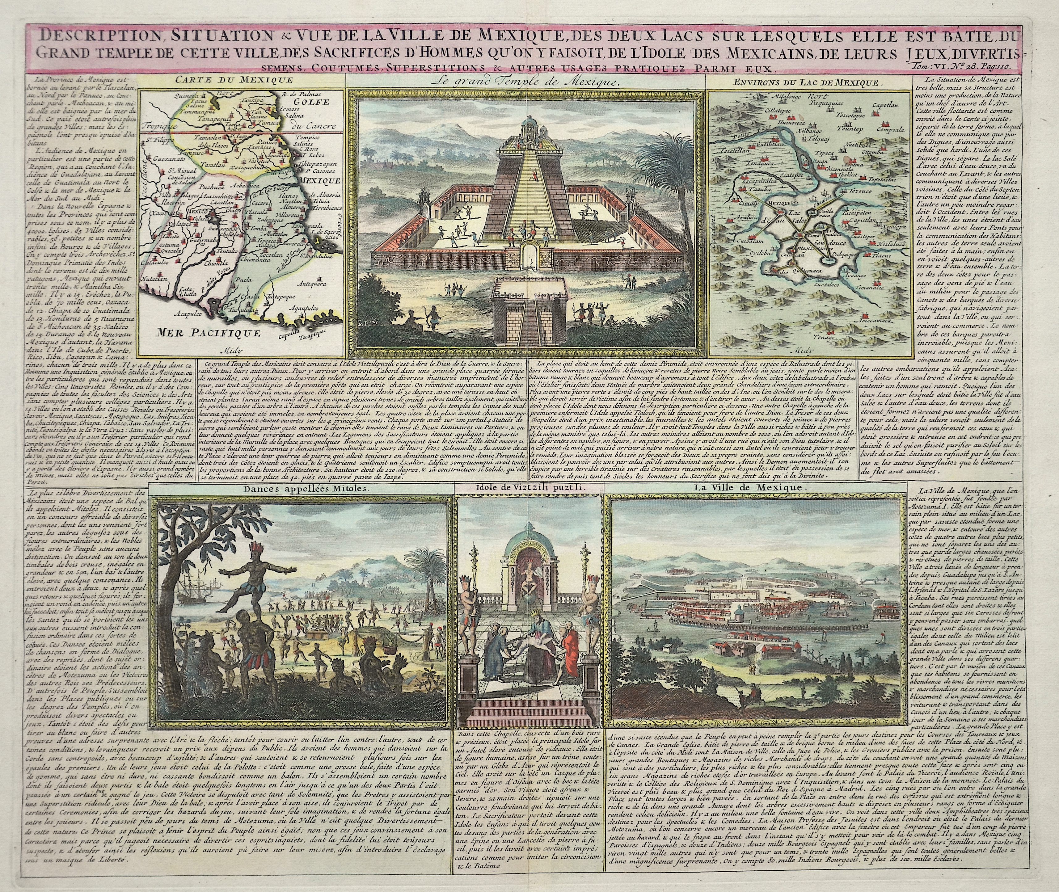
Description | 2 maps and 4 views of Mexico, on one sheet. One city map and one map of the country. The views are showing the Maya temple, one total view of Mexico city an natives. |
| Year | ca. 1720 |
Artist | Chatelain (1684-1743) |
Henri Abraham Chatelain (1684 - 1743) was a Huguenot pastor of Parisian origins. He lived consecutively in Paris, St. Martins, London (c. 1710), The Hague (c. 1721) and Amsterdam (c. 1728). He is best known as a Dutch cartographer and more specifically for his cartographic contribution in the seminal seven volume Atlas Historique, published in Amsterdam between 1705 and 1720. Innovative for its time, the Atlas Historique combined fine engraving and artwork with scholarly studies of geography, history, ethnology, heraldry, and cosmography. Some scholarship suggests that the Atlas Historique was not exclusively compiled by Henri Chatelain, as is commonly believed, but rather was a family enterprise involving Henri, his father Zacharie and his brother, also Zacharie. | |
Historical Description | The Spanish first learned of Mexico during the Juan de Grijalva expedition of 1518. The Spanish conquest of the Aztec Empire began in February 1519 when Hernán Cortés arrived at the port in Veracruz with ca. 500 conquistadores. After taking control of that city, he moved on to the Aztec capital. In his search for gold and other riches, Cortés decided to invade and conquer the Aztec empire. When the Spaniards arrived, the ruler of the Aztec empire was Moctezuma II, who was later killed. His successor and brother Cuitláhuac took control of the Aztec empire, but was among the first to fall from the first smallpox epidemic in the area a short time later. The capture of Tenochtitlan and refounding of Mexico City in 1521 was the beginning of a 300-year-long colonial era during which Mexico was known as Nueva España (New Spain). The Kingdom of New Spain was created from the remnants of the Aztec hegemonic empire. Subsequent enlargements, such as the conquest of the Tarascan state, resulted in the creation of the Viceroyalty of New Spain in 1535. The Viceroyalty at its greatest extent included the territories of modern Mexico, Central America as far south as Costa Rica, and the western United States. The Viceregal capital Mexico City also administrated the Spanish West Indies (the Caribbean), the Spanish East Indies (the Philippines), and Spanish Florida. |
| Place of Publication | Amsterdam |
| Dimensions (cm) | 36 x 43 |
| Condition | Restoration at centerfold |
| Coloring | colored |
| Technique | Copper print |