

Adina Sommer
Antique and Contemporary Art
Winzerer Str. 154
80797 München
telephone
+49 89 304714
business hours:
by appointment
Email
![]()


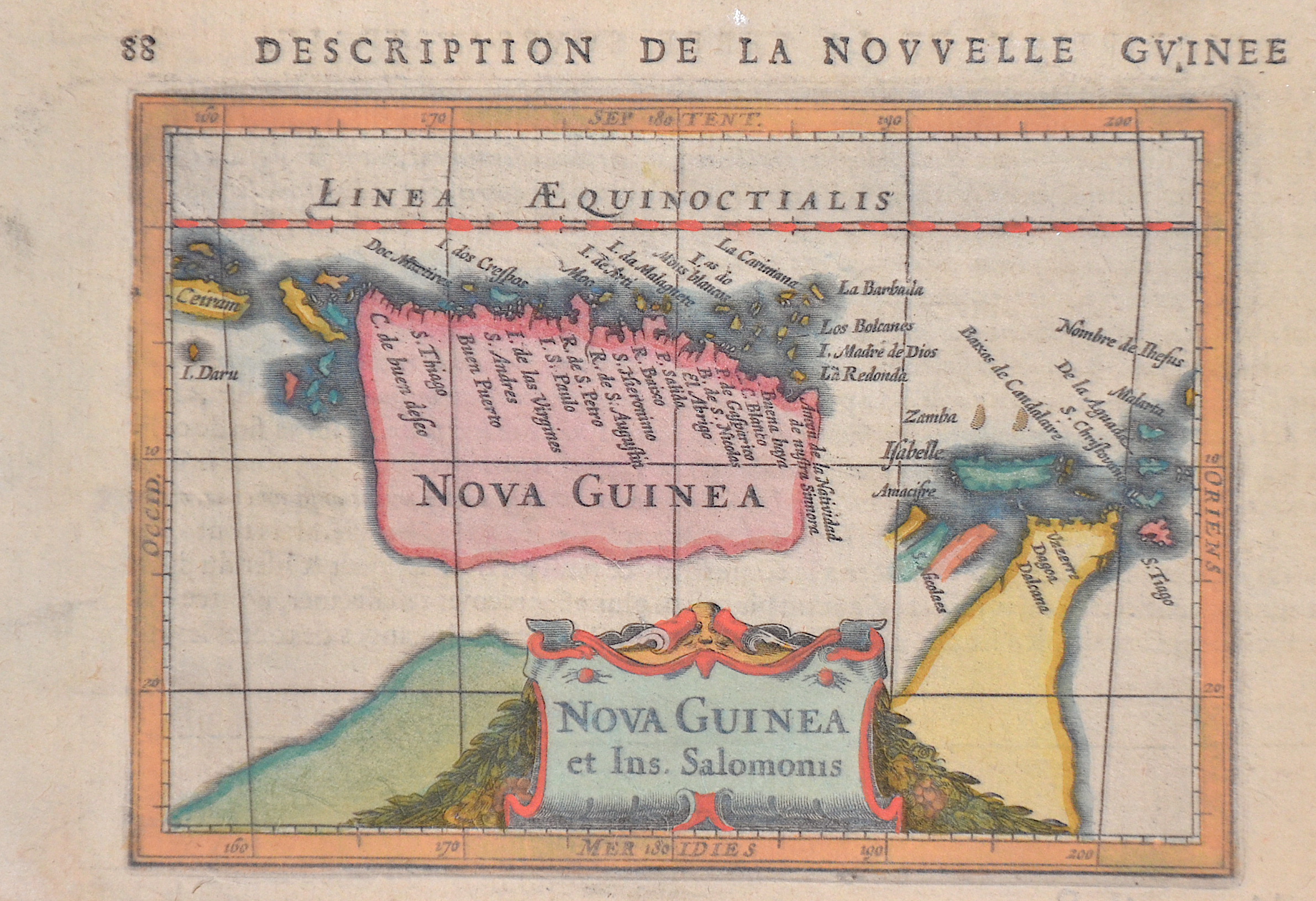
Description de la Nouvelle Guinee 88

| Article ID | OZ0527 |
Title | Description de la Nouvelle Guinee 88 |
Description | Map shows New Guinea with some neighbouring islands, the Torres Strait north of Australia and a title cartouche. |
| Year | ca. 1620 |
Artist | Bertius (1565-1629) |
Petrus Bertius (1565 -1629) was a Flemish theologian, historian, geographer and cartographer, He grew up in Beveren (Flanders). In 1593 he was appointed mathematics professor and librarian of the University of Leyden. His main cartographic work includes a miniature world atlas of 1600, a pocket atlas of the German Empire of 1616 with 26 engraved maps and 101 city views, a version of the Geographia of Ptolemy with 28 maps by Mercator and 14 maps from the Parergon of Ortelius of 1618, but he is known today as a cartographer with his edition of the Geographia of Ptolemy (based on Mercator's edition of 1578) and for his atlas. | |
Historical Description | Independent State of Papua New Guinea, is an oceanic country that occupies the eastern half of the island of New Guinea and its offshore islands in Melanesia, a region of the southwestern Pacific Ocean north of Australia. The Portuguese Jorge de Meneses, who explored the north coast and offshore islands in 1526/27, is considered the island's European explorer. In 1545 the Spaniard Íñigo Ortiz de Retez landed and named the island "New Guinea" because the coast reminded him of that of the African Guinea, which he had previously passed. In 1623 Jan Carstenszoon mapped large parts of the coast on behalf of the Dutch East India Company. Since then, the Dutch East India Company has maintained business and political contacts with the region and the Sultanate of Tidore. |
| Place of Publication | Amsterdam |
| Dimensions (cm) | 10 x 13,2 cm |
| Condition | Perfect condition |
| Coloring | colored |
| Technique | Copper print |