

Adina Sommer
Antique and Contemporary Art
Winzerer Str. 154
80797 München
telephone
+49 89 304714
business hours:
by appointment
Email
![]()


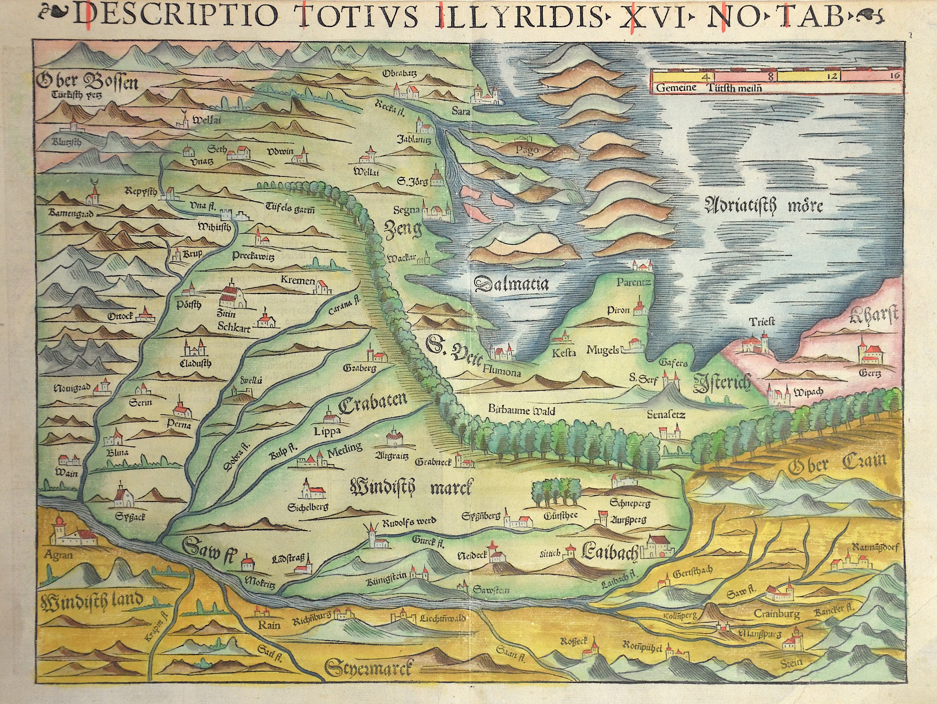
Descriptio totius Illyrides XVI no tab

| Article ID | EUY1303 |
Title | Descriptio totius Illyrides XVI no tab |
Description | Map shows total Croatia with Slovenia, on reverse beautiful representaions as titelpage |
| Year | ca. 1550 |
Artist | Ptolemy/Münster Sebastian (1489-1552) |
Sebastian Münster (1489–1552) was a prominent Renaissance cosmographer. His Cosmographia, published in 1544 with 24 double-page maps based on research from around 1528, was continuously expanded. It was the first widely accessible scientific description of the world in German, combining knowledge from history, geography, astronomy, and natural sciences. The work remained popular for a long time and was published in many editions and languages until 1650. Claudius Ptolemy (c. 100–160 AD) was a Greek mathematician, geographer, and astronomer. His works on astronomy, geography, and astrology were long considered standard references. He described the Earth as the center of the universe (Centrum Mundi) and established the basis for latitude measurement. His Geographia included the known world and the hypothesis of Terra Australis. Ptolemy provided written instructions for mapmaking but made only rough sketches himself; later maps were created under his name. | |
Historical Description | Following the decisive Ottoman victories, Croatia was split into civilian and military territories, with the partition formed in 1538. The military territories would become known as the Croatian Military Frontier and were under direct Imperial control. Ottoman advances in the Croatian territory continued until the 1593 Battle of Sisak, the first decisive Ottoman defeat, and stabilisation of borders. The Ottoman wars instigated great demographic changes. Croats migrated towards Austria and the present-day Burgenland Croats are direct descendants of these settlers. o replace the fleeing population, the Habsburgs encouraged the Christian populations of Bosnia and Serbia to provide military service in the Croatian Military Frontier. Serb migration into this region peaked during the Great Serb Migrations of 1690 and 1737–39. Between 1797 and 1809 the First French Empire gradually occupied the entire eastern Adriatic coastline and a substantial part of its hinterland, ending the Venetian and the Ragusan republics, establishing the Illyrian Provinces. |
| Place of Publication | Basle |
| Dimensions (cm) | 27 x 34 |
| Condition | Right lower corner ,tear perfectly restored |
| Coloring | original colored |
| Technique | Woodcut |