

Adina Sommer
Antique and Contemporary Art
Winzerer Str. 154
80797 München
telephone
+49 89 304714
business hours:
by appointment
Email
![]()


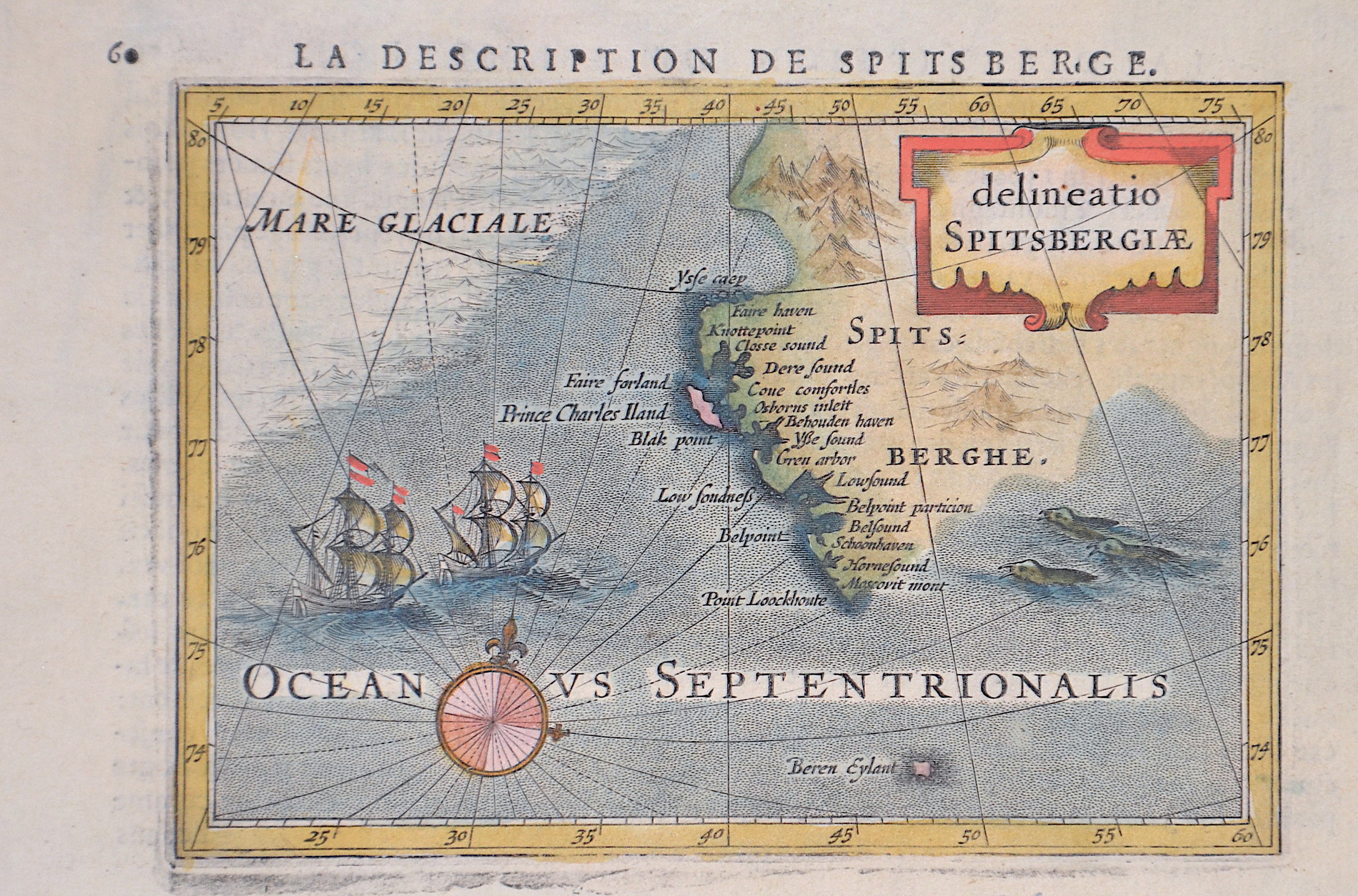
Descriptio Spitsbergiae. Delineatio Spitsbergiae

| Article ID | EUO3433 |
Title | Descriptio Spitsbergiae. Delineatio Spitsbergiae |
Description | Map shows the island Spitzbergen ( Svalbard) with decorative sealions and ofshore ships. |
| Year | ca. 1618 |
Artist | Bertius (1565-1629) |
Petrus Bertius (1565 -1629) was a Flemish theologian, historian, geographer and cartographer, He grew up in Beveren (Flanders). In 1593 he was appointed mathematics professor and librarian of the University of Leyden. His main cartographic work includes a miniature world atlas of 1600, a pocket atlas of the German Empire of 1616 with 26 engraved maps and 101 city views, a version of the Geographia of Ptolemy with 28 maps by Mercator and 14 maps from the Parergon of Ortelius of 1618, but he is known today as a cartographer with his edition of the Geographia of Ptolemy (based on Mercator's edition of 1578) and for his atlas. | |
Historical Description | Norsemen possibly discovered Svalbard as early as the 12th century. The Dutchman Willem Barentsz made the first discovery of the archipelago in 1596, when he sighted its coast while searching for the Northern Sea Route. The name Spitsbergen originated with Barentsz, who described the "pointed mountains" he saw on the west coast of the main island, Spitsbergen although his 1599 map of the Arctic labels the island as Het Nieuwe Land ("The New Land"). Barentsz did not recognize that he had discovered an archipelago, and consequently the name Spitsbergen long remained in use both for the main island and for the archipelago as a whole. |
| Place of Publication | Amsterdam |
| Dimensions (cm) | 10 x 13 cm |
| Condition | Some folds |
| Coloring | colored |
| Technique | Copper print |