

Adina Sommer
Antique and Contemporary Art
Winzerer Str. 154
80797 München
telephone
+49 89 304714
business hours:
by appointment
Email
![]()


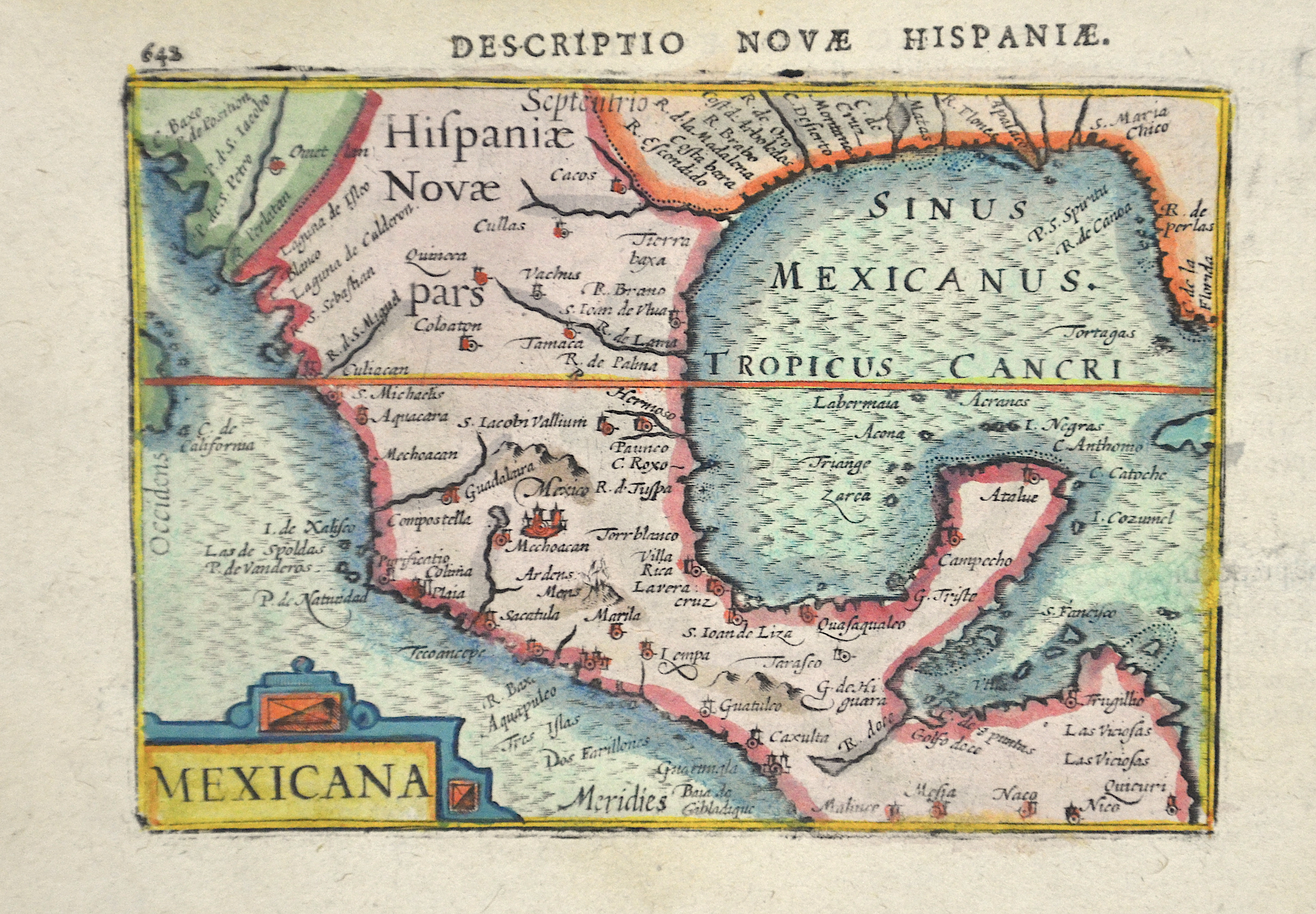
Descriptio novae Hispaniae. Mexicana

| Article ID | AMZ0514 |
Title | Descriptio novae Hispaniae. Mexicana |
Description | Map shows total Mexico with Jucatan and Guatemala and partly Florida |
| Year | ca. 1620 |
Artist | Bertius (1565-1629) |
Petrus Bertius (1565 -1629) was a Flemish theologian, historian, geographer and cartographer, He grew up in Beveren (Flanders). In 1593 he was appointed mathematics professor and librarian of the University of Leyden. His main cartographic work includes a miniature world atlas of 1600, a pocket atlas of the German Empire of 1616 with 26 engraved maps and 101 city views, a version of the Geographia of Ptolemy with 28 maps by Mercator and 14 maps from the Parergon of Ortelius of 1618, but he is known today as a cartographer with his edition of the Geographia of Ptolemy (based on Mercator's edition of 1578) and for his atlas. | |
Historical Description | The Spanish first learned of Mexico during the Juan de Grijalva expedition of 1518. The Spanish conquest of the Aztec Empire began in February 1519 when Hernán Cortés arrived at the port in Veracruz with ca. 500 conquistadores. After taking control of that city, he moved on to the Aztec capital. In his search for gold and other riches, Cortés decided to invade and conquer the Aztec empire. When the Spaniards arrived, the ruler of the Aztec empire was Moctezuma II, who was later killed. His successor and brother Cuitláhuac took control of the Aztec empire, but was among the first to fall from the first smallpox epidemic in the area a short time later. The capture of Tenochtitlan and refounding of Mexico City in 1521 was the beginning of a 300-year-long colonial era during which Mexico was known as Nueva España (New Spain). The Kingdom of New Spain was created from the remnants of the Aztec hegemonic empire. Subsequent enlargements, such as the conquest of the Tarascan state, resulted in the creation of the Viceroyalty of New Spain in 1535. The Viceroyalty at its greatest extent included the territories of modern Mexico, Central America as far south as Costa Rica, and the western United States. The Viceregal capital Mexico City also administrated the Spanish West Indies (the Caribbean), the Spanish East Indies (the Philippines), and Spanish Florida. |
| Dimensions (cm) | 9 x 12 |
| Condition | Very good |
| Coloring | original colored |
| Technique | Copper print |