

Adina Sommer
Antique and Contemporary Art
Winzerer Str. 154
80797 München
telephone
+49 89 304714
business hours:
by appointment
Email
![]()


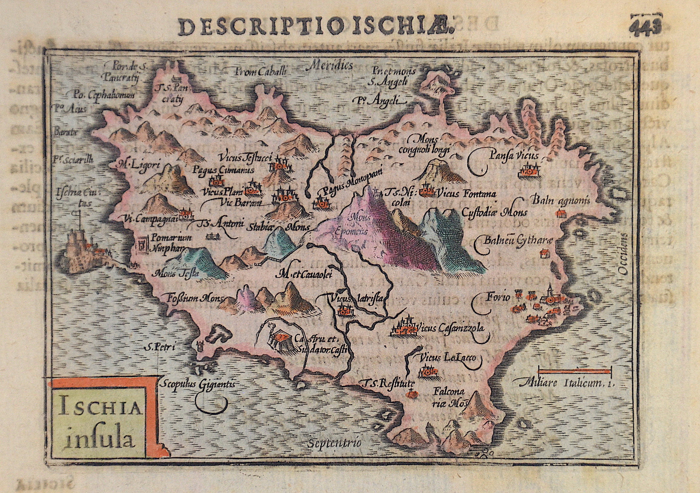
Descriptio Ischiae. 443 / Ischia insula

| Article ID | EUI4907 |
Title | Descriptio Ischiae. 443 / Ischia insula |
Description | Map shows the island of Ischia with the fortress Castello Aragonese. Ischa is a volcanic island in the Gulf of Naples, Italy. |
| Year | ca. 1607 |
Artist | Bertius (1565-1629) |
Petrus Bertius (1565 -1629) was a Flemish theologian, historian, geographer and cartographer, He grew up in Beveren (Flanders). In 1593 he was appointed mathematics professor and librarian of the University of Leyden. His main cartographic work includes a miniature world atlas of 1600, a pocket atlas of the German Empire of 1616 with 26 engraved maps and 101 city views, a version of the Geographia of Ptolemy with 28 maps by Mercator and 14 maps from the Parergon of Ortelius of 1618, but he is known today as a cartographer with his edition of the Geographia of Ptolemy (based on Mercator's edition of 1578) and for his atlas. | |
Historical Description | Ischia was settled in the second quarter of the 8th century BC by Greek colonists from Chalcis and Eretria. Ischia Porto is the economic center of the island, as it also handles the main ferry traffic between the island and the mainland, and Forio is the cultural center. In the 19th century Ischia was a favorite destination of the European nobility. Ischia developed into a well-known artists' colony at the beginning of the 20th century. Writers and painters from all over the world were attracted. Eduard Bargheer, Hans Purrmann and Arrigo Wittler lived on the island. Rudolf Levy, Werner Gilles, Max Peiffer Watenphul with Kurt Craemer and Vincent Weber stayed in the fishing village of Sant'Angelo on the southern tip of the island just before the outbreak of World War II. |
| Place of Publication | Amsterdam |
| Dimensions (cm) | 9,5 x 12,5 cm |
| Condition | Perfect condition |
| Coloring | original colored |
| Technique | Copper print |
Reproduction:
45.00 €
( A reproduction can be ordered individually on request. )