

Adina Sommer
Antique and Contemporary Art
Winzerer Str. 154
80797 München
telephone
+49 89 304714
business hours:
by appointment
Email
![]()


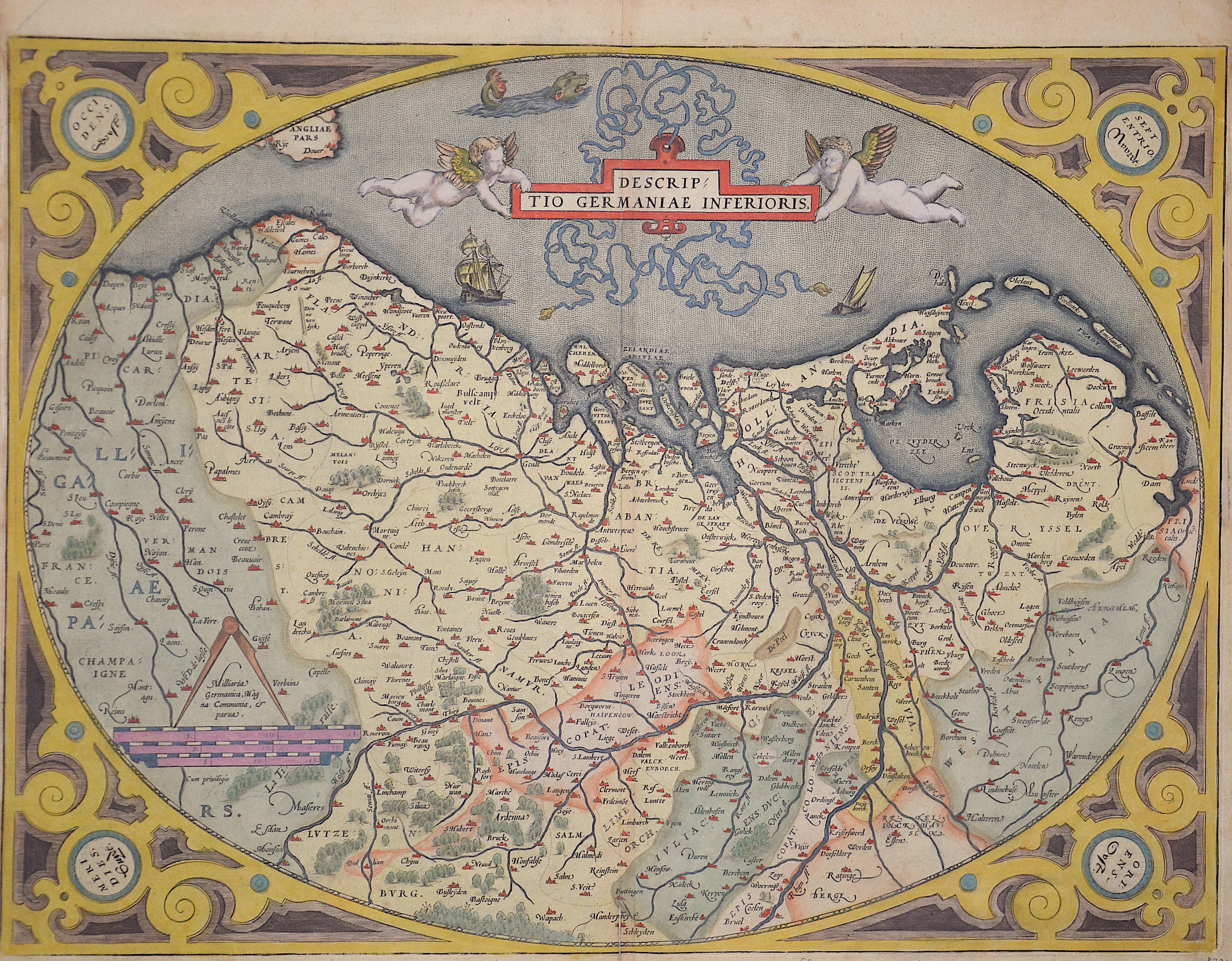
Descriptio Germaniae Inferioris

| Article ID | EUB1875 |
Title | Descriptio Germaniae Inferioris |
Description | Map shows entire Benelux, a title cartouche held by two putti, mileage indicator and a magnificent scrollwork bordure. |
| Year | ca. 1595 |
Artist | Ortelius (1527-1598) |
Abraham Ortelius (1527–1598) was a Flemish cartographer and publisher from Antwerp. Originally a map colorist, he became a major figure in cartography through his Theatrum Orbis Terrarum (1570), considered the first modern atlas—a uniform collection of reliable maps in book form. Influenced by Gerardus Mercator, Ortelius published several maps before compiling the Theatrum, which clearly showed America as a separate continent. The work was published in 42 editions and 7 languages by 1612. Unlike many of his peers, Ortelius cited his sources, and his atlas became a milestone in mapmaking and geographic knowledge. | |
Historical Description | The area, which later includes the Benelux area, is called de Lage Landen in Dutch, Low Countries in English, consisting of Belgium, the Netherlands (Nederland) and Luxembourg. In the 19th century, three countries were united under the crown of the Dutch king from 1815 to 1830, until Belgium became independent. The forerunners of the Benelux Treaty were the economic union concluded between Luxembourg and Belgium on July 25, 1921. |
| Dimensions (cm) | 38 x 50,5 cm |
| Condition | Very good |
| Coloring | original colored |
| Technique | Copper print |