

Adina Sommer
Antique and Contemporary Art
Winzerer Str. 154
80797 München
telephone
+49 89 304714
business hours:
by appointment
Email
![]()


der Werlt Blat XXXIII

| Article ID | ASP0910 |
Title | der Werlt Blat XXXIII |
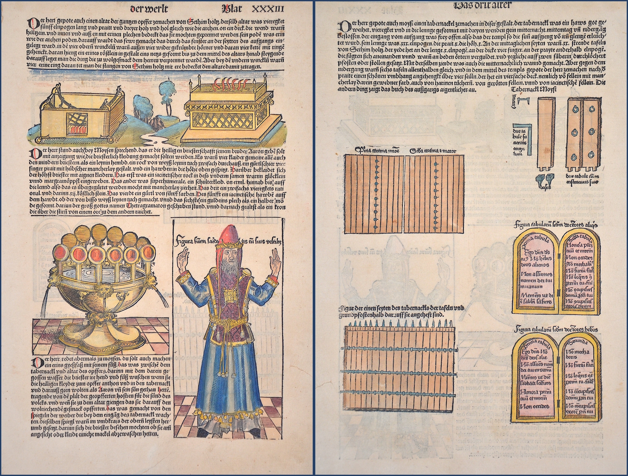
Description | Woodcut depicts a sacrifice lord´s table, a ritual water dispender an a jewish priest. |
| Year | ca. 1493 |
Artist | Schedel (1440-1515) |
Hartmann Schedel (1440–1515) from Nuremberg is best known for the 1493 publication of the Schedel’s World Chronicle (Liber chronicarum), a universal history featuring 1,809 woodcuts—making it the most richly illustrated book of early printing. The chronicle, written in Latin by Schedel for merchants Sebald Schreyer and Sebastian Kammermeister, was translated into German by Georg Alt and printed by Anton Koberger. The illustrations came from the workshop of Michael Wolgemut and Wilhelm Pleydenwurff. The work covers world history up to 1492/93, divided into eight ages of the world, and draws on numerous sources, including Jacobus Foresta and Enea Silvio Piccolomini. Notably, it features highly accurate city views, many depicted in detail for the first time. Pleydenwurff introduced a new perspective by portraying cities from a fixed viewpoint, emphasizing their unique architectural and landscape features. The project was funded in part by the patron Sebald Schreyer. | |
Historical Description | The first archaeologically proven traces of an early or proto-Israelite settlement in the Mashrek region go back to the period between the 12th and 11th centuries BC. BC back. According to biblical tradition, Jerusalem was founded around 1000 BC. Conquered by David from the Jebusites and chosen as the capital of his great empire. The country subsequently became part of the Persian Empire, then the Empire of Alexander the Great, and finally the Empire of the Seleucids. The Maccabees revolt in 165 BC BC brought Israel once more state independence for about 100 years. 63 BC The time of Roman supremacy began. The Romans divided the area into two provinces: Syria in the north, Judea in the south. In the course of the Islamic expansion, the area came under Arab rule in 636. Since then, Palestine has been predominantly inhabited by Arabs. The crusaders ruled from 1099 to 1291 what they called the "Latin Kingdom of Jerusalem". This was followed by the Mamluks from 1291 to 1517 and then the Ottoman rule from 1517 to 1918. None of these authorities had planned their own administration for Palestine or viewed the area as an independent geographical unit. The region was also part of Syria for the Ottomans, probably going back to the Roman name Syria. |
| Place of Publication | Nuremberg |
| Dimensions (cm) | 38,5 x 22,5 cm |
| Condition | Tear external margin perfectly restored |
| Coloring | original colored |
| Technique | Woodcut |