

Adina Sommer
Antique and Contemporary Art
Winzerer Str. 154
80797 München
telephone
+49 89 304714
business hours:
by appointment
Email
![]()


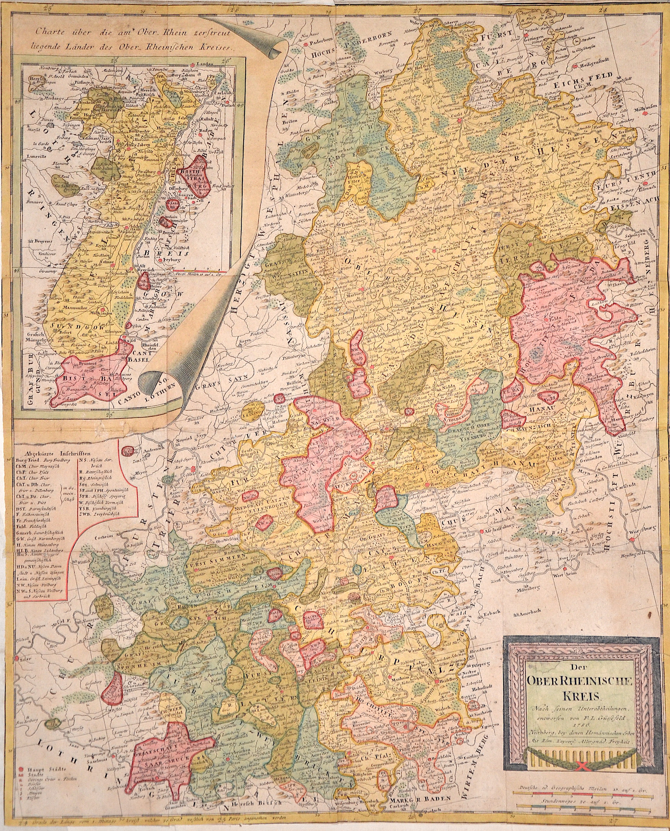
Der Ober Rheinische Kreis. Nach seinen Unterabtheilungen, entworfen von F. L. Güssefeld.
| Article ID | EUD837 |
Title | Der Ober Rheinische Kreis. Nach seinen Unterabtheilungen, entworfen von F. L. Güssefeld. |
Map shows the whole of Hesse with the Rhine from Koblenz to Speyer, with a partial map of Alsace, an index and a title cartouche. | |
| Year | dated 1786 |
Artist | Homann Erben |
| Place of Publication | Nuremberg |
| Dimensions (cm) | 57 x 47 cm |
| Condition | Map is printed on 12 sheets printed, joined together |
| Coloring | colored |
| Technique | Copper print |
:
39.00 €
( A reproduction can be ordered individually on request. )