

Adina Sommer
Antique and Contemporary Art
Winzerer Str. 154
80797 München
telephone
+49 89 304714
business hours:
by appointment
Email
![]()


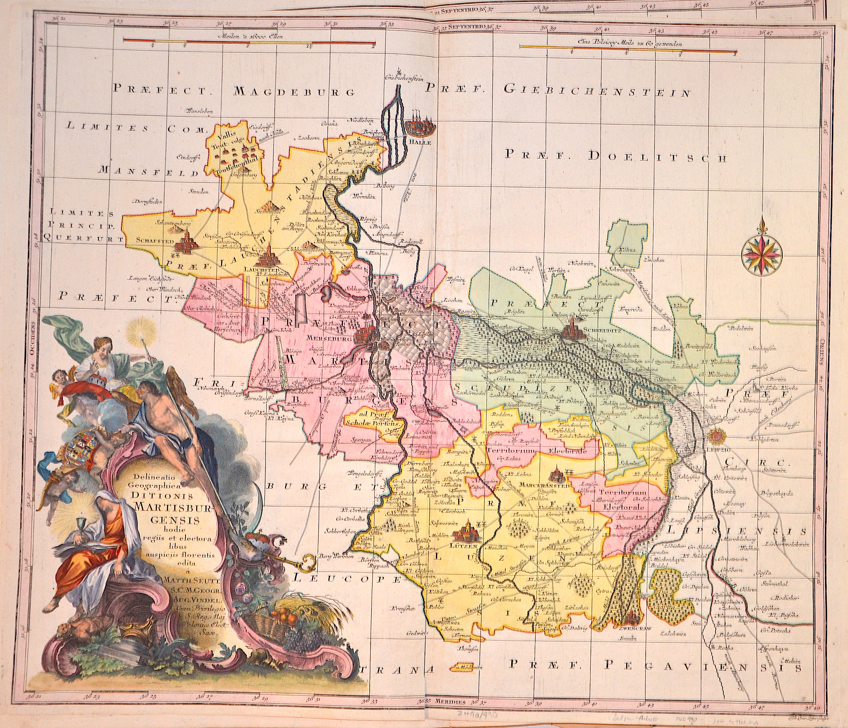
Delineatio Geographica Ditionis Martisburgensis hodie regiis et electoralibus auspiciis florentis edita…

| Article ID | EUD990 |
Title | Delineatio Geographica Ditionis Martisburgensis hodie regiis et electoralibus auspiciis florentis edita… |
Description | The map shows the area around the city of Halle with a magnificent cartouche, a compass rose and two mileage scales. |
| Year | ca. 1760 |
Artist | Lotter (1717-1777) |
Tobias Conrad Lotter ( 1717- 1777) was a carthographer and publisher in Augsburg. He married the elder daughter of Matthäus Seutters and worked in the company of his father in la was map maker. He produced under the „ eye“ of M. Seutter his first „ Asia minor“ atlas between 1740 and 1744. The Asia minor altas of Lotter, Praecipua orbis terrarum imperia, regna et provincias, Germania potissimum tabelli 80 exactae delineatis sistens usui militiae ducum ac peregrinantium maxime accommodatus opera contains 63 maps, mosly Lotters work and other maps from Seutter where he put his name in the lower margin. | |
Historical Description | The area of today's state of Saxony-Anhalt was one of the cultural focal points in the German-speaking area in the early Middle Ages. Today's state capital Magdeburg was at that time one of the political centers in the Holy Roman Empire of the German Nation. The well-preserved architectural monuments from the Romanesque and Gothic periods, such as the cathedrals in Magdeburg and Halberstadt, the old town of Quedlinburg and many castles and churches, testify to the earlier importance of the entire region. The state was created in July 1947 through the unification of the Free State of Anhalt with the Prussian provinces of Magdeburg and Halle-Merseburg, which the Free State of Prussia had created in April 1944 by dividing its province of Saxony. |
| Place of Publication | Augsburg |
| Dimensions (cm) | 48 x 57 cm |
| Condition | Perfect condition |
| Coloring | original colored |
| Technique | Copper print |